Fremantle (suburb)
Fremantle is a Western Australian port city located at the mouth of the Swan River, and is situated 18 km from the capital Perth. Fremantle was one of the original townships of the Swan River Colony established in 1829.
| Fremantle Perth, Western Australia | |||||||||||||||
|---|---|---|---|---|---|---|---|---|---|---|---|---|---|---|---|
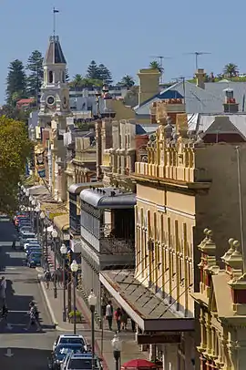 High Street, Fremantle | |||||||||||||||
 Fremantle | |||||||||||||||
| Coordinates | 32.0569°S 115.7439°E | ||||||||||||||
| Population | 8,211 (2016 census)[1] | ||||||||||||||
| • Density | 1,493/km2 (3,870/sq mi) | ||||||||||||||
| Established | 1829 | ||||||||||||||
| Postcode(s) | 6160 | ||||||||||||||
| Area | 5.5 km2 (2.1 sq mi) | ||||||||||||||
| Location | 18 km (11 mi) SW of the Perth CBD | ||||||||||||||
| LGA(s) | City of Fremantle | ||||||||||||||
| State electorate(s) | Bicton / Fremantle | ||||||||||||||
| Federal Division(s) | Fremantle | ||||||||||||||
| |||||||||||||||
Geography
Fremantle is bounded by the Swan River to the north and north-west, the Indian Ocean to the west, South Street to the south, and the suburbs of East Fremantle and White Gum Valley to the east. The central part of the suburb extends eastwards to include Royal Fremantle Golf Club and a suburban area south of Marmion Street and west of Carrington Street.[2]
Population
According to the 2016 census of Population, there were 8,211 people in Fremantle.
- Aboriginal and Torres Strait Islander people made up 1.5% of the population.
- 56.0% of people were born in Australia. The most common countries of birth were England 10.4%, New Zealand 2.7%, Italy 2.7% and Ireland 1.2%.
- 75.3% of people spoke only English at home. Other languages spoken at home included Italian at 4.1%.
- The most common responses for religion were No Religion 45.1% and Catholic 19.9%.[1]
Transport
Fremantle contains the Fremantle railway station, which serves as both the terminus of the Fremantle railway line and a bus station serving the surrounding region. All services are operated by Swan Transit and Transdev WA as part of the Transperth network.
Schools
Fremantle is home to University of Notre Dame Australia's main campus, two annexes of the Challenger Institute of Technology (formerly Challenger TAFE), a public high school, John Curtin College of the Arts, and a private high school, CBC Fremantle. Other schools in the suburb are the historic Fremantle Primary School (known until the 1990s as South Terrace Primary) and East Fremantle Primary School.
References
- Australian Bureau of Statistics (27 June 2017). "Fremantle (State Suburb)". 2016 Census QuickStats. Retrieved 4 July 2018.

- Department of Land Information. StreetSmart Perth Street Directory (54th ed.). West Australian Newspapers Ltd. pp. Map 430-431. ISBN 978-0-909439-67-5.