Ellerton, East Riding of Yorkshire
Ellerton is a village and civil parish in the East Riding of Yorkshire, England. It is situated approximately 8 miles (13 km) north-west of the market town of Howden and 8 miles south-west of the market town of Pocklington. It lies west of the B1228 road and east of the River Derwent. According to the 2011 UK census, the parish had a population of 388,[1] an increase on the 2001 UK census figure of 355.[2] and covers an area of 1,824.551 hectares (4,508.56 acres).[3]
| Ellerton | |
|---|---|
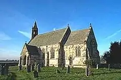 St Mary's Church, Ellerton, 2004 | |
 | |
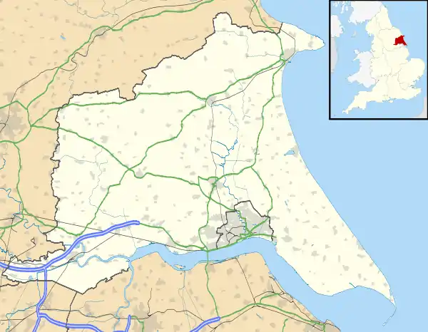 Ellerton Location within the East Riding of Yorkshire | |
| Population | 388 (2011 census)[1] |
| OS grid reference | SE704398 |
| • London | 165 mi (266 km) S |
| Civil parish |
|
| Unitary authority | |
| Ceremonial county | |
| Region | |
| Country | England |
| Sovereign state | United Kingdom |
| Post town | YORK |
| Postcode district | YO42 |
| Dialling code | 01757 |
| Police | Humberside |
| Fire | Humberside |
| Ambulance | Yorkshire |
| UK Parliament | |
Civil parish
The parish includes Aughton. In 1935 the civil parishes of Ellerton Priory and Aughton were abolished and merged into Ellerton.[4] Although the civil parish is called "Ellerton"[5] its parish council is called "Ellerton & Aughton Parish Council".[6]
History
A priory of canons of the Gilbertine Order existed at Ellerton, which was known as Ellerton Priory. The priory was founded before 1212, and relinquished on 11 December 1536 under the Suppression of the Monasteries. The site of the priory is now a scheduled ancient monument.[7]
In 1823 Ellerton, was in the Wapentake of Harthill, and contained a Methodist chapel and a chapel dedicated to St Mary. The village had a population of 318, with occupations including ten farmers, a corn miller, a tailor, and a shopkeeper. A shoemaker was also a licensed victualler of The Board public house. Also directory-listed was a school master, a gentleman and a vicar. Once a week a carrier operated between the village and York.[8]
The parish church of St Mary, by architect John Loughborough Pearson, was designated a Grade II listed building in December 1966 and is now recorded in the National Heritage List for England, maintained by Historic England.[9]
References
- UK Census (2011). "Local Area Report – Ellerton Parish (1170211173)". Nomis. Office for National Statistics. Retrieved 17 February 2018.
- UK Census (2001). "Local Area Report – Ellerton Parish (1543504219)". Nomis. Office for National Statistics. Retrieved 12 March 2008.
- "2001 Census Area Profile" (PDF). East Riding of Yorkshire Council. 2004. Archived (PDF) from the original on 18 March 2012. Retrieved 8 February 2013.
- Great Britain Historical GIS / University of Portsmouth, Ellerton CP. Retrieved 28 April 2020.
- "Ellerton". Ordnance Survey. Retrieved 4 February 2021.
- "Ellerton & Aughton Parish Council". Ellerton & Aughton Parish Council. Retrieved 4 February 2021.
- Historic England. "Site of Ellerton Priory (1005225)". National Heritage List for England. Retrieved 22 October 2017.
- Baines, Edward (1823): History, Directory and Gazetteer of the County of York, p. 201
- Historic England. "Church of St Mary (1083208)". National Heritage List for England. Retrieved 21 March 2015.
- Gazetteer — A–Z of Towns Villages and Hamlets. East Riding of Yorkshire Council. 2006. p. 5.
- "The Ellerton One-Place Study". Retrieved 29 April 2013.
Provides the history of the parish
External links
 Media related to Ellerton at Wikimedia Commons
- Ellerton in the Domesday Book