Grade II* listed buildings in the East Riding of Yorkshire
There are over 20,000 Grade II* listed buildings in England. This page is a list of the 183 of these buildings in the ceremonial county of the East Riding of Yorkshire.
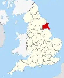
East Riding of Yorkshire shown in England
City of Kingston upon Hull
| Name | Location | Type | Completed [note 1] | Date designated | Grid ref.[note 2] Geo-coordinates |
Entry number [note 3] | Image |
|---|---|---|---|---|---|---|---|
| 100 Ton Steam Crane at Alexandra Dock | City of Kingston upon Hull | Steam Crane | 1886 | 16 May 1989 | TA1279128992 53°44′42″N 0°17′28″W |
1283082 |  100 Ton Steam Crane at Alexandra Dock |
| Blaydes House | City of Kingston upon Hull | House | Earlier | 13 October 1952 | TA1026128998 53°44′45″N 0°19′46″W |
1209566 | |
| Church of St Mary | City of Kingston upon Hull | Wall | Mid 19th century | 13 October 1952 | TA1008328776 53°44′37″N 0°19′56″W |
1217998 | |
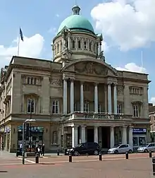
| City Hall | City of Kingston upon Hull | Town Hall | 1903–09 | 12 November 1973 | 53°44′37″N 0°20′26″W | 1197685 | |
| Former National Westminster Bank | City of Kingston upon Hull | Bank (financial) | 1873 | 9 April 1990 | TA0997128689 53°44′35″N 0°20′03″W |
1219232 |  Former National Westminster Bank |
| Guildhall | City of Kingston upon Hull | Civic Centre | 1906–14 | 12 November 1973 | TA1002928862 53°44′40″N 0°19′59″W |
1279708 | |
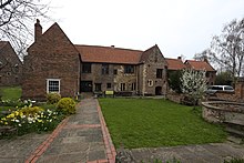
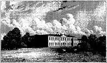
| Haworth Hall and Attached Outbuildings Garden Wall and Summerhouse | City of Kingston upon Hull | Country House | c. 1755 | 13 October 1952 | TA0883133557 53°47′13″N 0°20′59″W |
1197620 | 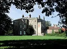 Haworth Hall and Attached Outbuildings Garden Wall and Summerhouse |
| Hull Maritime Museum and Adjoining Railings | City of Kingston upon Hull | Gate | 1867–71 | 7 January 1970 | TA0967928776 53°44′38″N 0°20′18″W |
1219019 | |
| Humberside University | City of Kingston upon Hull | Art School | 1904 | 12 November 1973 | TA0919828719 53°44′36″N 0°20′45″W |
1197653 |  |
| Masters House at Hull Charterhouse and Attached Boundary Wall | City of Kingston upon Hull | Teachers House | Late 17th century | 13 October 1952 | TA1004429317 53°44′55″N 0°19′58″W |
1293252 | 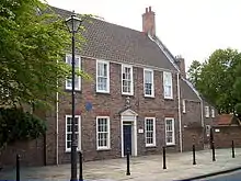 Masters House at Hull Charterhouse and Attached Boundary Wall |
| Minerva Lodge of Freemasons Number 250 | City of Kingston upon Hull | Freemasons Hall | 1802 | 12 November 1973 | TA0978128556 53°44′31″N 0°20′13″W |
1293046 | .jpg.webp) Minerva Lodge of Freemasons Number 250 |
| Old Grammar School Museum | City of Kingston upon Hull | Exchange | 1583 | 13 October 1952 | TA0988028526 53°44′30″N 0°20′08″W |
1197660 | 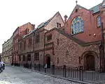 Old Grammar School Museum |
| Paragon Station & Station Hotel | City of Kingston upon Hull | Booking Office | 1849 | 13 October 1952 | TA0917728803 53°44′39″N 0°20′46″W |
1218434 | |
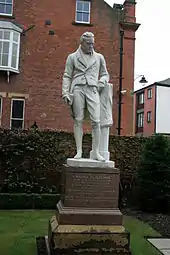
| Statue of William Wilberforce in Garden of Wilberforce House | City of Kingston upon Hull | Statue | 1883 | 21 January 1994 | TA1022828834 53°44′39″N 0°19′48″W |
1197754 | |
| The Old White Hart Inn | City of Kingston upon Hull | House | c. 1660 | 13 October 1952 | 53°44′35″N 0°20′01″W | 1197696 |  The Old White Hart Inn |
| 10–15, Whitefriargate | City of Kingston upon Hull | House | 1795 | 13 October 1952 | TA0984428664 53°44′34″N 0°20′09″W |
1197675 |  10–15, Whitefriargate |


East Riding of Yorkshire
| Name | Location | Type | Completed [note 1] | Date designated | Grid ref.[note 2] Geo-coordinates |
Entry number [note 3] | Image |
|---|---|---|---|---|---|---|---|
| Church of Saint Bartholomew | Aldbrough, East Riding of Yorkshire | Statue | 12th century | 16 December 1966 | TA2442238718 53°49′47″N 0°06′40″W |
1083529 |  Church of Saint Bartholomew |
| Knedlington Old Hall | Knedlington, East Riding of Yorkshire | House | Early–mid 17th century | 16 December 1966 | SE7311728094 53°44′39″N 0°53′34″W |
1083235 | 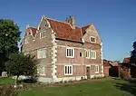 Knedlington Old Hall |
| Church of St. Catherine | Barmby Moor, East Riding of Yorkshire | Church | 15th century | 26 January 1967 | SE7764648942 53°55′51″N 0°49′08″W |
1083879 | 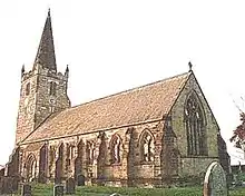 Church of St. Catherine |
| The Manor House | Barmby Moor, East Riding of Yorkshire | House | 1597 | 26 January 1967 | SE7777948919 53°55′50″N 0°49′01″W |
1309940 | |
| Old Hall | Barmston, East Riding of Yorkshire | House | Late 17th century | 11 January 1952 | TA1556758794 54°00′44″N 0°14′16″W |
1204832 | |
| Church of St Leonard | Beeford, East Riding of Yorkshire | Church | Earlier | 20 September 1966 | TA1290454379 53°58′23″N 0°16′49″W |
1083372 |  Church of St Leonard |
| Buckton Hall | Buckton, East Riding of Yorkshire | Country House | 1744 | 11 January 1952 | TA1697973740 54°08′46″N 0°12′38″W |
1083409 |  Buckton Hall |
| Church of St Michael | Bempton, East Riding of Yorkshire | Church | Early 13th century | 30 June 1966 | TA1910972099 54°07′51″N 0°10′43″W |
1161842 |  Church of St Michael |
| Beswick Hall | Beswick, East Riding of Yorkshire | House | c. 1590 | 7 February 1968 | TA0115048123 53°55′10″N 0°27′41″W |
1103484 |  Beswick Hall |
| Church of All Saints | Kilnwick, East Riding of Yorkshire | Church | 12th century or Earlier | 7 February 1968 | SE9970749517 53°55′56″N 0°28′58″W |
1346968 |  Church of All Saints |
| Ash Close | Beverley, East Riding of Yorkshire | House | c. 1732 | 1 March 1950 | TA0285240083 53°50′49″N 0°26′17″W |
1163343 | |
| Cross Keys Hotel | Beverley, East Riding of Yorkshire | Hotel | Mid 18th century | 1 March 1950 | TA0316039654 53°50′34″N 0°26′01″W |
1161728 |  Cross Keys Hotel |
| Foresters Hall or Ann Rouths House | Beverley, East Riding of Yorkshire | House | c. 1703 | 1 March 1950 | TA0348239540 53°50′31″N 0°25′43″W |
1346399 |  Foresters Hall or Ann Rouths House |
| Foster and Plumpton Chemist White Horse Hotel | Beverley, East Riding of Yorkshire | Jettied House | Mediaeval | 1 March 1950 | TA0328239840 53°50′40″N 0°25′54″W |
1346350 | 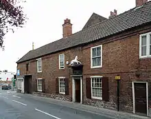 Foster and Plumpton Chemist White Horse Hotel |
| Highgate House | Beverley, East Riding of Yorkshire | House | mid–late 18th century | 1 March 1950 | TA0361239442 53°50′27″N 0°25′36″W |
1083923 | |
| Keldgate House | Beverley, East Riding of Yorkshire | House | Early 18th century | 1 March 1950 | TA0352239071 53°50′15″N 0°25′42″W |
1084035 |  Keldgate House |
| Lord Nelson | Beverley, East Riding of Yorkshire | Timber Framed House | Late 17th century | 2 October 1980 | TA0387839269 53°50′21″N 0°25′22″W |
1346325 |  Lord Nelson |
| Monks Walk Public House | Beverley, East Riding of Yorkshire | House | pre 18th century | 1 March 1950 | TA0368639389 53°50′25″N 0°25′33″W |
1161054 |  Monks Walk Public House |
| St Marys Court | Beverley, East Riding of Yorkshire | End Gabled House | 15th century | 1 March 1950 | TA0304039814 53°50′40″N 0°26′07″W |
1084008 |  St Marys Court |
| Beverley Friary | Beverley, East Riding of Yorkshire | House | 16th century | 1 March 1950 | TA0386039348 53°50′24″N 0°25′23″W |
1084062 | |
| The Old Grammar School | Beverley, East Riding of Yorkshire | Grammar School | c. 1696 | 1 March 1950 | TA0349639096 53°50′16″N 0°25′43″W |
1084045 |  The Old Grammar School |
| The Sessions House | Beverley, East Riding of Yorkshire | Magistrates Court | 1804–14 | 1 March 1950 | TA0265640173 53°50′52″N 0°26′28″W |
1162300 | |
| 35 North Bar Within | Beverley, East Riding of Yorkshire | House | c. 1740 | 1 March 1950 | TA0307639777 53°50′38″N 0°26′05″W |
1084007 | |
| 29 North Bar Without | Beverley, East Riding of Yorkshire | House | c. 1730 | 2 July 1969 | TA0287639946 53°50′44″N 0°26′16″W |
1083977 |  29 North Bar Without |
| 44 Toll Gavel | Beverley, East Riding of Yorkshire | House | First half of the 18th century | 1 March 1950 | TA0342139522 53°50′30″N 0°25′47″W |
1083947 | |
| 58 Flemingate | Beverley, East Riding of Yorkshire | House | mid–late 17th century | 1 March 1950 | TA0417639192 53°50′19″N 0°25′06″W |
1084060 |  58 Flemingate |
| 26, 28 Eastgate | Beverley, East Riding of Yorkshire | House | c. 1750 | 1 March 1950 | TA0373139399 53°50′26″N 0°25′30″W |
1084089 |  26, 28 Eastgate |
| 54, 56 Toll Gavel | Beverley, East Riding of Yorkshire | House | Late 17th century | 2 July 1969 | TA0348539519 53°50′30″N 0°25′43″W |
1083948 |  54, 56 Toll Gavel |
| 56 Flemingate | Beverley, East Riding of Yorkshire | House | mid–late 17th century | 1 March 1950 | TA0417039191 53°50′19″N 0°25′06″W |
1084059 | 56 Flemingate |
| 18, 20 North Bar Within | Beverley, East Riding of Yorkshire | House | c. 1700 | 1 March 1950 | TA0316539750 53°50′38″N 0°26′01″W |
1162666 |  18, 20 North Bar Within |
| 6–14 Butcher Row | Beverley, East Riding of Yorkshire | House | Late 17th century | 30 June 1987 | TA0352739515 53°50′30″N 0°25′41″W |
1160246 | |
| 7 Hengate | Beverley, East Riding of Yorkshire | Town House | c. 1709 | 1 March 1950 | TA0323839842 53°50′40″N 0°25′56″W |
1310370 |  7 Hengate |
| 45, 46 Saturday Market | Beverley, East Riding of Yorkshire | House | Mid 18th century | 2 July 1969 | TA0327439581 53°50′32″N 0°25′55″W |
1346394 | |
| 22 North Bar Within | Beverley, East Riding of Yorkshire | House | Early 18th century | 1 March 1950 | TA0315839761 53°50′38″N 0°26′01″W |
1346358 |  22 North Bar Within |
| 56 North Bar Without | Beverley, East Riding of Yorkshire | House | 1765 | 1 March 1950 | TA0288540044 53°50′47″N 0°26′16″W |
1083989 |  56 North Bar Without |
| 19 North Bar Within | Beverley, East Riding of Yorkshire | House | Mid 18th century | 2 July 1969 | TA0312739734 53°50′37″N 0°26′03″W |
1084006 |  19 North Bar Within |
| 14, 16 Newbigin | Beverley, East Riding of Yorkshire | House | Late 17th century | 1 March 1950 | TA0307839583 53°50′32″N 0°26′06″W |
1162157 | |
| 48 North Bar Without | Beverley, East Riding of Yorkshire | House | 1726–34 | 1 March 1950 | TA0289340011 53°50′46″N 0°26′15″W |
1346385 |  48 North Bar Without |
| 11 Saturday Market | Beverley, East Riding of Yorkshire | House | 18th century | 2 July 1969 | TA0322739723 53°50′37″N 0°25′57″W |
1346373 | |
| 5 Ladygate | Beverley, East Riding of Yorkshire | House | Late 17th century | 1 March 1950 | TA0319339787 53°50′39″N 0°25′59″W |
1084046 |  5 Ladygate |
| Church of St Giles | Bielby, East Riding of Yorkshire | Church | Late 12th century | 26 January 1967 | SE7886443722 53°50′38″N 0°25′51″W |
1084123 | 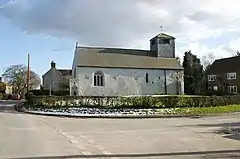 Church of St Giles |
| Church of All Saints | Bishop Burton, East Riding of Yorkshire | Church | Early 13th century | 7 February 1968 | SE9905039731 53°50′40″N 0°29′46″W |
1103429 |  Church of All Saints |
| Garden House at Boynton Hall | Boynton, East Riding of Yorkshire | Garden House | 16th century | 30 June 1966 | TA1376167729 54°05′34″N 0°15′44″W |
1346640 | |
| Church of All Saints | Brantingham, East Riding of Yorkshire | Church | 12th century | 7 February 1968 | SE9437830085 53°45′31″N 0°34′12″W |
1103351 |  Church of All Saints |
| Church of St John the Evangelist | Sewerby, East Riding of Yorkshire | Church | 1846–1848 | 9 January 1976 | TA2011169074 54°06′13″N 0°09′52″W |
1083693 | 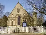 Church of St John the Evangelist |
| Church of St Magnus | Bessingby, East Riding of Yorkshire | Church | 1893–1894 | 9 January 1976 | TA1590065948 54°04′35″N 0°13′48″W |
1083689 | 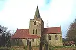 Church of St Magnus |
| Conservatory to East of Sewerby House | Sewerby, East Riding of Yorkshire | Conservatory | Mid 19th century | 7 September 1951 | TA2037069067 54°06′12″N 0°09′38″W |
1346514 | |
| Courtyard Archway to North West of Sewerby House | Sewerby, East Riding of Yorkshire | Courtyard | Mid 19th century | 7 September 1951 | TA2031669066 54°06′12″N 0°09′41″W |
1054767 | |
| Craven House | Bridlington, East Riding of Yorkshire | House | Late 17th century | 7 September 1951 | TA1746367859 54°05′36″N 0°12′20″W |
1346541 |  Craven House |
| Dominican Convent School of Mercy | Bridlington, East Riding of Yorkshire | Convent School | 18th century | 7 September 1951 | TA1744167858 54°05′36″N 0°12′21″W |
1345558 |  Dominican Convent School of Mercy |
| Gate House, Comprising Archway and Lodges (numbers 2 and 4) to Sewerby House Attached Forecourt Walls and Gatepiers to West | Sewerby, East Riding of Yorkshire | Gate Pier | Mid 19th century | 9 January 1976 | TA2014668932 54°06′08″N 0°09′51″W |
1346515 | |
| Hebblethwaite House | Bridlington, East Riding of Yorkshire | House | c. 1670 | 7 September 1951 | TA1715067869 54°05′36″N 0°12′37″W |
1083599 |  Hebblethwaite House |
| Marton Hall School | Marton, Bridlington, East Riding of Yorkshire | School | 1672 | 7 September 1951 | TA2012469687 54°06′33″N 0°09′51″W |
1083696 |  Marton Hall School |
| Stable Block to North West of Sewerby House | Sewerby, East Riding of Yorkshire | Cafe | c. 1825 | 7 September 1951 | TA2028469077 54°06′13″N 0°09′43″W |
1083691 | |
| Terrace Balustrade and Attached Garden Wall and Archway to Sewerby House | Sewerby, East Riding of Yorkshire | Balustrade | c. 1850 | 7 September 1951 | TA2035069025 54°06′11″N 0°09′39″W |
1083690 | |
| The Avenue Hospital | Bridlington, East Riding of Yorkshire | House | 1714 | 7 September 1951 | TA1702267875 54°05′37″N 0°12′44″W |
1083603 | 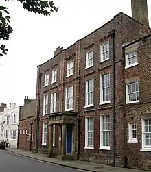 The Avenue Hospital |
| The Old Laundry, Sewerby House | Sewerby, East Riding of Yorkshire | Laundry | 18th century | 7 September 1951 | TA2032069082 54°06′13″N 0°09′41″W |
1055861 | |
| The Toft | Bridlington, East Riding of Yorkshire | House | 1673 | 7 September 1951 | TA1736367836 54°05′35″N 0°12′25″W |
1083660 | 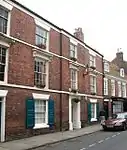 The Toft |
| 70 High Street | Bridlington, East Riding of Yorkshire | House | Early 18th century | 7 September 1951 | TA1726567879 54°05′36″N 0°12′31″W |
1083679 |  70 High Street |
| 67 High Street | Bridlington, East Riding of Yorkshire | House | Early 19th century | 7 September 1951 | TA1729367854 54°05′36″N 0°12′29″W |
1083664 |  67 High Street |
| 42 and 44 High Street | Bridlington, East Riding of Yorkshire | House | Late 17th century or Early 18th century | 7 September 1951 | TA1736467854 54°05′36″N 0°12′25″W |
1083673 |  42 and 44 High Street |
| 51 & 53 High Street | Bridlington, East Riding of Yorkshire | House | Early 18th century | 7 September 1951 | TA1733167846 54°05′35″N 0°12′27″W |
1083662 |  51 & 53 High Street |
| 45 High Street | Bridlington, East Riding of Yorkshire | House | Late 17th century | 7 September 1951 | TA1735167840 54°05′35″N 0°12′26″W |
1346536 |  45 High Street |
| 46, 46A, 48, 50 and 50A High Street | Bridlington, East Riding of Yorkshire | House | 18th century | 7 September 1951 | TA1735067856 54°05′36″N 0°12′26″W |
1039110 | 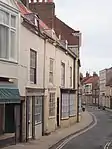 46, 46A, 48, 50 and 50A High Street |
| Low Hall | Bugthorpe, East Riding of Yorkshire | House | Late Medieval | 26 January 1967 | SE7713658120 54°00′48″N 0°49′28″W |
1083872 | |
| The Menagerie Approximately 45 Metres to West of Burton Constable Hall | Burton Constable Park, Burton Constable, East Riding of Yorkshire | House | Late C20 | 16 December 1966 | TA1835236676 53°48′46″N 0°12′14″W |
1083447 | |
| The Orangery Approximately 10 Metres to South-west of Burton Constable Hall | Burton Constable Park, Burton Constable, East Riding of Yorkshire | Orangery | 1788–1789 | 16 December 1966 | TA1884136687 53°48′46″N 0°11′48″W |
1083445 | |
| Church of St Cuthbert | Burton Fleming, East Riding of Yorkshire | Sundial | 12th century | 30 June 1966 | TA0834872368 54°08′09″N 0°20′35″W |
1083394 | .JPG.webp) Church of St Cuthbert |
| Church of St John the Baptist | Carnaby, East Riding of Yorkshire | Church | Late C13–early 14th century | 30 June 1966 | TA1446665591 54°04′25″N 0°15′08″W |
1083821 |  Church of St John the Baptist |
| Kexby Old Bridge | Catton, East Riding of Yorkshire | Bridge | 1650 | 17 November 1966 | SE7050151115 53°57′05″N 0°55′38″W |
1316288 |  Kexby Old Bridge |
| Church of St Michael | Catwick, East Riding of Yorkshire | Church | 15th century | 16 December 1966 | TA1309245387 53°53′32″N 0°16′50″W |
1249378 | 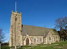 Church of St Michael |
| Downs Hall, the Lawns | Cottingham, East Riding of Yorkshire | Hall of Residence | 1963–7 | 30 March 1993 | TA0371033601 53°47′18″N 0°25′38″W |
1103346 | |
| Grant Hall, the Lawns | Cottingham, East Riding of Yorkshire | Hall of Residence | 1963–7 | 30 March 1993 | TA0368933644 53°47′20″N 0°25′39″W |
1103345 | |
| Lambert Hall, the Lawns | Cottingham, East Riding of Yorkshire | Hall of Residence | 1963–7 | 30 March 1993 | TA0379633419 53°47′12″N 0°25′34″W |
1232675 | |
| Morgan Hall, the Lawns | Cottingham, East Riding of Yorkshire | Hall of Residence | 1963–7 | 30 March 1993 | TA0380733541 53°47′16″N 0°25′33″W |
1103344 | |
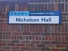
| Nicholson Hall, the Lawns | Cottingham, East Riding of Yorkshire | Hall of Residence | 1963–7 | 30 March 1993 | TA0379933475 53°47′14″N 0°25′33″W |
1276987 | |
| Reckitt Hall, the Lawns | Cottingham, East Riding of Yorkshire | Hall of Residence | 1963–7 | 30 March 1993 | TA0367233588 53°47′18″N 0°25′40″W |
1103343 | |
| Southwood Hall | Cottingham, East Riding of Yorkshire | House | Before 1661 | 3 December 1951 | TA0383632224 53°46′34″N 0°25′33″W |
1310021 |  Southwood Hall |
| Zion United Reformed Church | Cottingham, East Riding of Yorkshire | Presbyterian Chapel | 1819 | 31 January 1967 | TA0438132873 53°46′54″N 0°25′02″W |
1103393 | 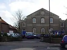 Zion United Reformed Church |
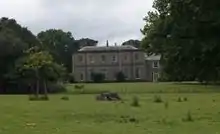
| Dalton Hall | Dalton Holme, East Riding of Yorkshire | House | Before 1737 | 6 May 1952 | SE9558445076 53°53′35″N 0°32′49″W |
1161304 |  Dalton Hall |
| Church of St Mary | Little Driffield, East Riding of Yorkshire | Cross | Late C9–10 | 25 January 1985 | TA0098857798 54°00′23″N 0°27′38″W |
1083376 |  Church of St Mary |
| Tithe Barn | Easington, East Riding of Yorkshire | Horse Engine House | 19th century | 27 February 1987 | TA3983719124 53°39′00″N 0°06′51″E |
1083473 |  Tithe Barn |
| Blue Hall | Garton, East Riding of Yorkshire | House | c. 1600 | 16 December 1966 | TA2617335593 53°48′05″N 0°05′08″W |
1346612 |  Blue Hall |
| Stable Block at Grimston Garth | Grimston, East Riding of Yorkshire | Gate Pier | c1781–6 | 16 December 1966 | TA2829435189 53°47′50″N 0°03′13″W |
1083500 | |
| Church of St Mary | Elloughton, East Riding of Yorkshire | Church | 15th century | 7 February 1968 | SE9443328243 53°44′31″N 0°34′11″W |
1203258 | 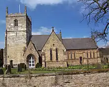 Church of St Mary |
| Church of St Mary | Etton, East Riding of Yorkshire | Church | 12th century | 7 February 1968 | SE9814043579 53°52′45″N 0°30′31″W |
1103443 | .jpg.webp) Church of St Mary |
| Church of Saint Everilda | Everingham, East Riding of Yorkshire | Church | Early 13th century | 26 January 1967 | SE8040442313 53°52′15″N 0°46′43″W |
1310669 | 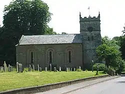 Church of Saint Everilda |
| Church of St Martin | Fangfoss, East Riding of Yorkshire | Church | 12th century | 26 January 1967 | SE7668853346 53°58′14″N 0°49′57″W |
1083833 | 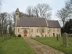 Church of St Martin |
| Fangfoss Hall | Fangfoss, East Riding of Yorkshire | House | Late 18th century | 26 January 1967 | SE7673053378 53°58′15″N 0°49′54″W |
1346460 | |
| Church of St Oswald | Flamborough, East Riding of Yorkshire | Sculpture | c. 1100 | 30 June 1966 | TA2261570155 54°06′46″N 0°07′33″W |
1162230 |  Church of St Oswald |
| The Old Lighthouse | Flamborough, East Riding of Yorkshire | Lighthouse | 1674 | 11 January 1952 | TA2496670810 54°07′05″N 0°05′23″W |
1083400 | _-_geograph.org.uk_-_1047.jpg.webp) The Old Lighthouse |
| Church of St Andrew | Foston, East Riding of Yorkshire | Church | 12th century | 20 September 1966 | TA1006455819 53°59′12″N 0°19′22″W |
1346653 | 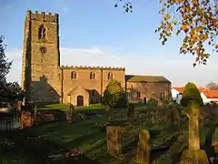 Church of St Andrew |
| Elmswell Old Hall | Elmswell, East Riding of Yorkshire | House | 1634 | 20 September 1966 | SE9979658140 54°00′35″N 0°28′43″W |
1083792 |  Elmswell Old Hall |
| Hall Garth | Goodmanham, East Riding of Yorkshire | House | 1823–4 | 26 January 1967 | SE8902743006 53°52′32″N 0°38′50″W |
1160374 | |
| Boat Hoist on South Side of South Dock | Goole, East Riding of Yorkshire | Boat Lift | c. 1862 | 18 April 1986 | SE7426822851 53°41′49″N 0°52′36″W |
1083214 |  Boat Hoist on South Side of South Dock |
| Lowther Hotel | Goole, East Riding of Yorkshire | Office | 1824–1826 | 29 July 1966 | SE7471923313 53°42′03″N 0°52′11″W |
1310687 | 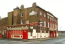 Lowther Hotel |
| Railway Swing Bridge over River Ouse | Goole, East Riding of Yorkshire | Railway Bridge | 1869 | 15 September 1987 | SE7649924707 53°42′47″N 0°50′33″W |
1346710 | 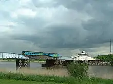 Railway Swing Bridge over River Ouse |
| Goole Hall | Goole Fields, East Riding of Yorkshire | House | c. 1820 | 14 February 1967 | SE7532521521 53°41′05″N 0°51′39″W |
1103307 | |
| Constable Mausoleum | Halsham, East Riding of Yorkshire | Mausoleum | 1792–1802 | 4 March 1952 | TA2705427866 53°43′54″N 0°04′32″W |
1346604 | 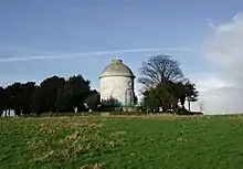 Constable Mausoleum |
| Church of Saint Nicholas | Ruston Parva, East Riding of Yorkshire | Church | 1832 | 20 September 1966 | TA0646361610 54°02′22″N 0°22′33″W |
1083348 | 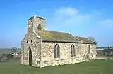 Church of Saint Nicholas |
| Church of St Martin | Lowthorpe, East Riding of Yorkshire | Cross | Pre-Conquest | 20 September 1966 | TA0790960807 54°01′55″N 0°21′14″W |
1346656 |  Church of St Martin |
| Cross Approximately One Metre East of East Wall of Church of St Martin | Lowthorpe, East Riding of Yorkshire | Cross | Medieval | 20 September 1966 | TA0792660811 54°01′55″N 0°21′13″W |
1083347 | |
| Church of Saint Giles | Burnby, East Riding of Yorkshire | Church | Late 12th century | 26 January 1967 | SE8356846379 53°54′25″N 0°43′46″W |
1084145 | 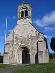 Church of Saint Giles |
| Church of St Mary and St Joseph | Hedon, East Riding of Yorkshire | Church | 1803 | 9 January 1954 | TA1904928593 53°44′24″N 0°11′47″W |
1083537 |  Church of St Mary and St Joseph |
| Hedon Town Hall | Hedon, East Riding of Yorkshire | Lock Up | 1693 | 9 January 1954 | TA1890428616 53°44′25″N 0°11′55″W |
1083554 |  Hedon Town Hall |
| Ravenspurn Cross in the Grounds of Holyrood House | Hedon, East Riding of Yorkshire | Cross | Early 15th century | 20 December 1991 | TA1903128731 53°44′29″N 0°11′48″W |
1240953 |  Ravenspurn Cross in the Grounds of Holyrood House |
| The New Hall | Hedon, East Riding of Yorkshire | House | Mid 18th century | 9 January 1954 | TA1892728497 53°44′21″N 0°11′54″W |
1083574 |  The New Hall |
| The Old Hall | Hedon, East Riding of Yorkshire | House | Early 18th century | 9 January 1954 | TA1909828519 53°44′22″N 0°11′45″W |
1083575 |  The Old Hall |
| Holme Hall | Holme upon Spalding Moor, East Riding of Yorkshire | House | Post 1766 | 16 December 1966 | SE8158838503 53°50′11″N 0°45′42″W |
1083338 | |
| Church of St Mary | Hook, East Riding of Yorkshire | Church | 14th century | 14 February 1967 | SE7590825500 53°43′13″N 0°51′04″W |
1160360 |  Church of St Mary |
| The White House | Hornsea, East Riding of Yorkshire | House | c. 1674 | 26 November 1985 | TA2018147340 53°54′30″N 0°10′19″W |
1249390 |  The White House |
| Church of St Oswald | Hotham, East Riding of Yorkshire | Church | Early 12th century | 16 December 1966 | SE8944034580 53°47′59″N 0°38′37″W |
1083305 |  Church of St Oswald |
| Howden Hall | Howden, East Riding of Yorkshire | House | Late 17th century | 17 March 1952 | SE7509828532 53°44′52″N 0°51′46″W |
1160523 |  Howden Hall |
| The Bishop's Manor | Bishop's Manor Park, Howden, East Riding of Yorkshire | Hall House | Earlier than 1388 | 17 March 1952 | SE7488028183 53°44′41″N 0°51′58″W |
1083181 |  The Bishop's Manor |
| The Langley Archway | Bishop's Manor Park, Howden, East Riding of Yorkshire | Arch | Early 15th century | 16 December 1966 | SE7482828176 53°44′41″N 0°52′01″W |
1083182 | |
| Church of St Peter | Hutton, Hutton Cranswick, East Riding of Yorkshire | Church | 12th century | 20 September 1966 | TA0241453355 53°57′58″N 0°26′25″W |
1161006 |  Church of St Peter |
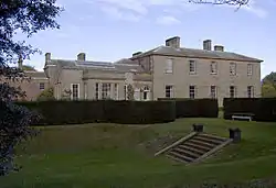
| Saltmarshe Hall | Saltmarshe, East Riding of Yorkshire | Country House | 1825 | 17 March 1952 | SE7820423965 53°42′23″N 0°49′00″W |
1203298 | |
| Holy Trinity Church | Leven, East Riding of Yorkshire | Church | Pre-conquest 1066 | 7 February 1968 | TA1065745232 53°53′29″N 0°19′04″W |
1103456 |  Holy Trinity Church |
| Gate Piers | Londesborough Park, Londesborough, East Riding of Yorkshire | Gate Pier | Early 18th century | 26 January 1967 | SE8691545398 53°53′51″N 0°40′44″W |
1160419 | |
| Church of All Saints | Lund, East Riding of Yorkshire | Church | 15th century | 7 February 1968 | SE9701748145 53°55′13″N 0°31′27″W |
1103410 |  Church of All Saints |
| Church of All Saints | Mappleton, East Riding of Yorkshire | Church | 14th century | 16 December 1966 | TA2255143864 53°52′35″N 0°08′14″W |
1083417 |  Church of All Saints |
| Church of St. Andrew | Middleton, East Riding of Yorkshire | Church | Early 13th century | 20 September 1966 | SE9466749571 53°56′01″N 0°33′34″W |
1084151 |  Church of St. Andrew |
| Church of Saint Ethelburgh | Great Givendale, East Riding of Yorkshire | Church | 1849 | 26 January 1967 | SE8133253879 53°58′29″N 0°45′41″W |
1346278 |  Church of Saint Ethelburgh |
| Hotham Hall | North Cave, East Riding of Yorkshire | House | 1871 | 16 December 1966 | SE8964133707 53°47′31″N 0°38′27″W |
1203450 |  Hotham Hall |
| Stable Block at Hotham Hall | North Cave, East Riding of Yorkshire | Garage | Early C20 | 16 December 1966 | SE8959033734 53°47′32″N 0°38′29″W |
1346681 | |
| Church of All Saints | North Dalton, East Riding of Yorkshire | Church | 12th century | 20 September 1966 | SE9346952200 53°57′27″N 0°34′37″W |
1161951 |  Church of All Saints |
| Ferriby House | North Ferriby, East Riding of Yorkshire | House | c1760–1770 | 6 May 1952 | SE9877226148 53°43′21″N 0°30′16″W |
1347005 |  Ferriby House |
| Church of St Elgin | Church End, North Frodingham, East Riding of Yorkshire | Cross | 10th century | 20 September 1966 | TA0897953416 53°57′55″N 0°20′25″W |
1083362 | 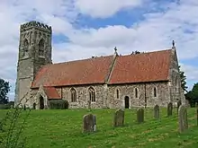 Church of St Elgin |
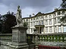
| Kilnwick Percy Hall | Kilnwick Percy, East Riding of Yorkshire | Country House | c. 1845 | 26 January 1967 | SE8257949861 53°56′18″N 0°44′37″W |
1309858 | 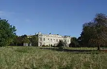 Kilnwick Percy Hall |
| The White Hall | Winestead, East Riding of Yorkshire | Country House | 1814–15 | 16 December 1966 | TA2930823829 53°41′42″N 0°02′35″W |
1310373 | |
| Rise Hall | Rise, East Riding of Yorkshire | Country House | 1815–1820 | 16 December 1966 | TA1535241942 53°51′39″N 0°14′51″W |
1161753 | |
| Church of St Margaret | Long Riston, East Riding of Yorkshire | Church | 13th century | 16 December 1966 | TA1233042725 53°52′07″N 0°17′35″W |
1083422 | 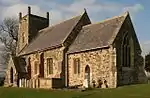 Church of St Margaret |
| Church of All Saints | Routh, East Riding of Yorkshire | Church | 14th century | 7 February 1968 | TA0911042505 53°52′02″N 0°20′32″W |
1160744 |  Church of All Saints |
| Church of Saint Peter | Rowley, East Riding of Yorkshire | Church | 12th century | 7 February 1968 | SE9764732619 53°46′51″N 0°31′11″W |
1347015 |  Church of Saint Peter |
| Thorpe Hall | Rudston, East Riding of Yorkshire | Country House | Mid 17th century | 11 January 1952 | TA1092967675 54°05′35″N 0°18′19″W |
1346645 | |
| Church of All Saints | Sancton, East Riding of Yorkshire | Church | 15th century | 26 January 1967 | SE8997439467 53°50′37″N 0°38′02″W |
1084105 |  Church of All Saints |
| Wassand Hall | Wassand Park, Wassand, East Riding of Yorkshire | Country House | 1813–1819 | 4 March 1952 | TA1740746037 53°53′50″N 0°12′53″W |
1249398 | |
| Church of St Lawrence | Sigglesthorne, East Riding of Yorkshire | Sundial | 1616 | 16 December 1966 | TA1544045666 53°53′40″N 0°14′41″W |
1249769 | 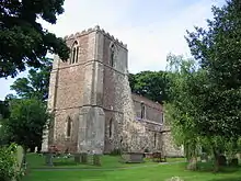 Church of St Lawrence |
| Church of St Mary the Virgin | Wansford, East Riding of Yorkshire | Church | 1868 | 20 September 1966 | TA0621656654 53°59′42″N 0°22′53″W |
1162211 | 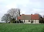 Church of St Mary the Virgin |
| Church of Saint Michael | Skidby, East Riding of Yorkshire | Church | 12th century | 7 February 1968 | TA0150833658 53°47′22″N 0°27′38″W |
1103341 |  Church of Saint Michael |
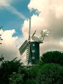
| Skidby Mill and Attached Mill Buildings | Skidby, East Riding of Yorkshire | Corn Mill | 1821 | 6 May 1952 | TA0204833313 53°47′10″N 0°27′09″W |
1103339 | |
| Church of Saint Mary | Skirpenbeck, East Riding of Yorkshire | Church | 12th century | 26 January 1967 | SE7498357221 54°00′20″N 0°51′27″W |
1161856 |  Church of Saint Mary |
| Bloodstock Stables and Farmery with Walls and Gate Piers | Sledmere, East Riding of Yorkshire | Gate Pier | 1830 | 20 September 1966 | SE9304364854 54°04′16″N 0°34′47″W |
1083807 |  Bloodstock Stables and Farmery with Walls and Gate Piers |
| Church of St Mary | Sledmere, East Riding of Yorkshire | Church | Medieval | 20 September 1966 | SE9300364553 54°04′07″N 0°34′49″W |
1310183 | 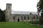 Church of St Mary |
| Stables and Carriage House to Sledmere House | Sledmere, East Riding of Yorkshire | Garage | Late 18th century | 20 September 1966 | SE9300064750 54°04′13″N 0°34′49″W |
1161302 | |
| Church of All Saints | South Cave, East Riding of Yorkshire | Church | Mid 13th century | 7 February 1968 | SE9161431008 53°46′03″N 0°36′42″W |
1103317 | 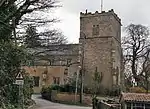 Church of All Saints |
| Bridge over River Derwent | Stamford Bridge, East Riding of Yorkshire | Road Bridge | 1727 | 18 January 1952 | SE7114655578 53°59′29″N 0°54′59″W |
1346426 |  Bridge over River Derwent |
| Stamford Bridge Railway Viaduct (that Part in East Yorkshire District) | Stamford Bridge, East Riding of Yorkshire | Railway Viaduct | 1847 | 26 January 1967 | SE7087255407 53°59′23″N 0°55′14″W |
1083841 |  Stamford Bridge Railway Viaduct (that Part in East Yorkshire District) |
| Sutton Bridge (that Part in Sutton on Derwent Parish) | Sutton upon Derwent, East Riding of Yorkshire | Bridge | Late 14th century | 18 January 1952 | SE7048647663 53°55′13″N 0°55′42″W |
1346432 |  Sutton Bridge (that Part in Sutton on Derwent Parish) |
| Church of St Michael | Thornton, East Riding of Yorkshire | Bell Tower | 12th century | 26 January 1967 | SE7598445200 53°53′51″N 0°50′43″W |
1346434 | 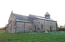 Church of St Michael |
| The Old Farmhouse, Glebe Farm | Octon, East Riding of Yorkshire | Farmhouse | Late 17th century | 2 January 1985 | TA0322569885 54°06′52″N 0°25′21″W |
1309563 | |
| Eske Manor | Eske, East Riding of Yorkshire | House | Mid 17th century | 9 February 1987 | TA0573743236 53°52′28″N 0°23′36″W |
1346994 | |
| Stone Building Approximately 25 Metres South of Church House | Adlingfleet, East Riding of Yorkshire | Outbuilding | Medieval | 14 February 1967 | SE8438120944 53°40′41″N 0°43′27″W |
1346748 |  Stone Building Approximately 25 Metres South of Church House |
| Whitgift Hall Including Attached Walls to North Outbuildings and Screen Wall to South East | Whitgift, East Riding of Yorkshire | Country House | Early 18th century | 14 February 1967 | SE8166222808 53°41′43″N 0°45′53″W |
1083149 | |
| Church of All Hallows | Walkington, East Riding of Yorkshire | Church | 12th century | 26 March 1987 | SE9984936824 53°49′05″N 0°29′05″W |
1161425 |  Church of All Hallows |
| Outbuildings to Watton Abbey | Watton, East Riding of Yorkshire | Wall | c. 1150 | 7 September 1987 | TA0232649907 53°56′07″N 0°26′34″W |
1083773 |  Outbuildings to Watton Abbey |
| Church of St Helen | Welton, East Riding of Yorkshire | Church | Pre 16th century | 7 February 1968 | SE9589627305 53°44′00″N 0°32′52″W |
1347029 | 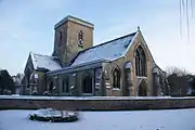 Church of St Helen |
| Welton Grange | Welton, East Riding of Yorkshire | House | c. 1741 | 6 May 1952 | SE9565827193 53°43′57″N 0°33′05″W |
1347030 | 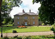 Welton Grange |
| Church of St Nicholas | Wetwang, East Riding of Yorkshire | Church | 12th century | 20 August 1966 | SE9328759050 54°01′09″N 0°34′40″W |
1083774 | 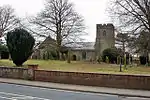 Church of St Nicholas |
| Church Bridge | Wilberfoss, East Riding of Yorkshire | Bridge | Late Medieval | 26 January 1967 | SE7322250967 53°56′59″N 0°53′09″W |
1083860 |  Church Bridge |
| Haltemprice Priory Farm | Willerby, East Riding of Yorkshire | House | Late C15/early 16th century | 3 December 1951 | TA0419830965 53°45′53″N 0°25′15″W |
1103364 | |
| Church of St Nicholas | Withernsea, East Riding of Yorkshire | Parish Church | Mid 15th century | 27 February 1987 | TA3424927666 53°43′41″N 0°02′00″E |
1366257 | 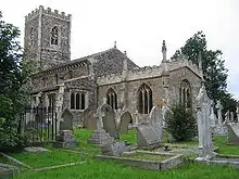 Church of St Nicholas |
| Church of All Saints | Wold Newton, East Riding of Yorkshire | Church | 12th century | 30 June 1966 | TA0457873130 54°08′36″N 0°24′02″W |
1346665 |  Church of All Saints |
| Church of St James | Fordon, East Riding of Yorkshire | Church | 12th century | 30 June 1966 | TA0497275113 54°09′40″N 0°23′38″W |
1162675 |  Church of St James |
| Lantern Turret in Garden of No 4 King Street | Woodmansey, East Riding of Yorkshire | Church | c. 1400 | 26 March 1987 | TA0555137980 53°49′39″N 0°23′52″W |
1161446 | |
| The Bakehouse at Wressle Castle Approximately 30 Metres North of Ruins of Wressle Castle | Wressle, East Riding of Yorkshire | Bakehouse | c. 1380 | 16 December 1966 | SE7066631577 53°46′33″N 0°55′45″W |
1160652 | |
| Church of Saint Martin | Yapham, East Riding of Yorkshire | Church | 13th century | 26 January 1967 | SE7888551961 53°57′28″N 0°47′57″W |
1161970 |  Church of Saint Martin |


_-_geograph.org.uk_-_1374997.jpg.webp)

See also
- Category:Grade II* listed buildings in the East Riding of Yorkshire
Notes
- The date given is the date used by Historic England as significant for the initial building or that of an important part in the structure's description.
- Sometimes known as OSGB36, the grid reference is based on the British national grid reference system used by the Ordnance Survey.
- The "List Entry Number" is a unique number assigned to each listed building and scheduled monument by Historic England.
References
| Wikimedia Commons has media related to Grade II* listed buildings in the East Riding of Yorkshire. |
This article is issued from Wikipedia. The text is licensed under Creative Commons - Attribution - Sharealike. Additional terms may apply for the media files.