Etah district
Etah district is one of the districts of Uttar Pradesh, India, since 1854. Etah town is the district headquarters. Etah district is a part of Aligarh Division. Etah district is a part of Aligarh Division.
Etah district | |
|---|---|
District of Uttar Pradesh | |
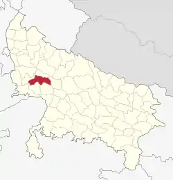 Location of Etah district in Uttar Pradesh | |
| Country | India |
| State | Uttar Pradesh |
| Division | Aligarh |
| Headquarters | Etah |
| Tehsils | Sadar Etah, Aliganj, Jalesar |
| Government | |
| • Lok Sabha constituencies | Etah |
| Area | |
| • Total | 2,651 km2 (1,024 sq mi) |
| Population (2011) | |
| • Total | 1,774,480 |
| • Density | 670/km2 (1,700/sq mi) |
| Demographics | |
| • Literacy | 75.27% |
| Time zone | UTC+05:30 (IST) |
| Vehicle registration | UP 82 |
| Major highways | NH 91,SH 31,33,85 |
| Website | http://etah.nic.in/ |
According to the 2011 census Etah district has a population of 1,761,152. This gives it a ranking of 272nd in India (out of a total of 640 Districts). The district has a population density of 717 inhabitants per square kilometre (1,860 /sq mi) . Its population growth rate over the decade 2001-2011 was 12.77%. Etah has a sex ratio of 863 females for every 1000 males, and a literacy rate of 73.27%.
History
It is the midpoint on the Kanpur-Delhi Highway. Historically, it is also known for being a centre of the Revolt of 1857. In ancient times, Etah was called “Aintha” which means ‘to respond aggressively’ because of the people of the yadav community, who are very aggressive. It was when the king of Awagarh went hunting in the forest along with his 2 dogs. The dogs saw a fox and started barking and chasing it. The fox kept on running away trying to protect itself from the king's dogs but when it reached Etah, the fox responded very aggressively to the king's dogs. The King was surprised by the behavioural change in the fox. So, he thought that this place must have something which made the fleeing fox change attitude.
Therefore, the place was called Aintha, which later was mispronounced as Etah. Another story found in Vidya Bharti's book states the old name of Etah as ‘Einta’ due to a person lost here. In search of water, he dug into the land and his shoe struck a brick (eint)which leads to the name Einta and later this word changed to Etah. Etah also is very famous for its Yagyashala which is located in the Gurukul Vidyalaya and is considered to be world's second largest Yagyashala. There is a historical fort which was built by the king of Awagarh. Awagarh is a place which is 24 km from Etah. Etah also has a historical mandir named as Kailash Mandir dedicated to Lord Shiva. Amir Khusro was born in Patiyali, Etah and is considered as one of the best poets of Urdu.
It is of Uttar Pradesh, one of the 34 economically distressed districts and is receiving funds from the Backward Regions Grant Fund Program. Etah District is part of the Aligarh Division. The majority population are Lodhi Rajputs. The Origin of most of the Kulshreshtha Families (Kayastha community) is in district Etah. Like Lala Shanti Swroop (Patwari at Sirsa Tippu Village), Advocate Ratendra Pal Kulshreshtha (In the naming committee of Shringar Nagar), Dr. Rajeev Kulshreshtha (have many awards at national level) are the big names. NH 91 passes through this district. Etah's nearest district and surrounded by Budaun, Aligarh, Khair, Farrukhabad, Mainpuri, Firozabad, Mahamaya Nagar and Kasganj. Previously Kasganj was a part of the Etah District. Kasganj was established on 15 April 2008 by partitioning Kasganj, Patiali and Sahawar Tehsils from the Etah District. There are 8 blocks: Jaithara, Marehara, Nidhauli Kalan, Sakit, SheetalPur, Awagarh, Aliganj and Jalesar. Raja Ka Rampur is also a major town.
Geography
Eta is located at 27.63 ° N 78.67 ° E. [4] It has an average elevation of 170 m (557 ft). The Eisen River flows behind the village Ghazipur Pahor. Etah is a district in the Aligarh division of Uttar Pradesh province, India. It is bounded by Kasganj in the north, Mainpuri and Firozabad in the south, Farrakhabad in the east and Aligarh, Hathras, Mathura and Agra districts in the west. Which come in Uttar Pradesh. The district does not have a border with any other state.
Festival and events
This is a land of west UP festivals. So here are celebrating all festivals like Holi, Diwali, dashara.
Demographics
According to the 2011 census Etah district has a population of 1,774,480. This gives it a ranking of 272nd in India (out of a total of 640). The district has a population density of 717 inhabitants per square kilometre (1,860/sq mi) . Its population growth rate over the decade 2001-2011 was 12.77%. Etah has a sex ratio of 863 females for every 1000 males, and a literacy rate of 73.27%.
At the time of the 2011 Census of India, 99.25% of the population in the district spoke Hindi and 0.71% Urdu as their first language.[1]
| Year | Pop. | ±% p.a. |
|---|---|---|
| 1901 | 467,166 | — |
| 1911 | 471,233 | +0.09% |
| 1921 | 448,730 | −0.49% |
| 1931 | 465,371 | +0.36% |
| 1941 | 532,585 | +1.36% |
| 1951 | 608,080 | +1.33% |
| 1961 | 696,873 | +1.37% |
| 1971 | 853,095 | +2.04% |
| 1981 | 1,011,479 | +1.72% |
| 1991 | 1,229,949 | +1.97% |
| 2001 | 1,531,645 | +2.22% |
| 2011 | 1,774,480 | +1.48% |
| source:[2] | ||
Language
Hindi is most spoken language here.
Civic administration
Etah is one of the 75 administrative Districts of Uttar Pradesh with its headquarters located at Etah. As in the case of all other Districts of the country, the Collector and District Magistrate is the administrative head of Etah District. As per provisional population figures of 2011 Census: Area: 4,446 km2
No. of municipal bodies: 9
No. of Nyay Panchayats: 72
No. of Tehsils: 4
No. of Parliamentary Constituency: 3
Division: ALIGARH Division
Jalesar, Awagarh Come Under Agra Division
No. of Blocks: 8
No. of Gram Panchayats: 576
No. of Villages: 892
No. of Assembly: 4.
No. of Police station: 18.
Transport
District has 8 Railway Station/Halt. Length of Railway Line in the district is 55 km. and it comes under North Central Railway zone.
Towns and villages are well equipped with a web of roads as it is the major way of transportation in the region. National Highway 91 (Delhi-Kolkata) pass from the middle of the district. Etah Bus Station is situated on National Highway 91. Uttar Pradesh State Road Transport Corporation operates buses to all cities in Uttar Pradesh.
Etah is well connected by road. It is located on National Highway 91. You can reach it easily here. Uttar Pradesh Roadways bus is directly available from here to Agra, Aligarh, Delhi, Noida, Aliganj, Farrukhabad, Awagarh, Jalesar, Kasganj, Tundla, Shikohabad, Mainpuri, Etawah, Kanpur and Lucknow.
Economy
There are no large industries here, but there are some factories here. Hindustan Unilever Ltd. Brass casting work is going on at Jalesar on a large scale. Etah is an agricultural region. Farming is one of the main employments of the people of Etah. The land of Etah is very fertile Economy of Etah District is agrarian in character. The geography and the climate are favourable for production of crops like paddy, sugarcane, sunflower, oilseeds, etc. This town behaves as a nodal point for accumulation and marketing of such products. Except a few agro palaceprocessing.
Agriculture Sector
- Livestock
- Forestry & Logging
- Fishing
Industry Sector
- Mining & Quarrying
- Manufacturing (Registered & Unregistered)
- Electricity, Gas & Water Supply
- Construction
Service Sector
- Trade
- Hotels
- Restaurants
- Railways
- Transport by other means
- Storage
- Communications
- Banking and Insurance
- Real Estates, Ownership of dwelling and Business Services
- Public Administration
- Other services
Tourist places
- Kailash Mandir
- Arsh Gurukul
- Awagarh Fort
- Atranji Khera
- Patna Bird Sanctuary
- Ram Darbaar
- Kali Mandir
- Mehta Park
Historical Places
- Ghantaghar
- Shaheed Park
Development
Work is under construction on the Jawaharpur super thermal power project ultra mega power plant here, work on the Tundla-Etah-Malawan new rail route is going on, Etah-Kasganj new track approved by the Railways in budget 2017–2018, work on Etah Medical College is underway, work on Etah Sewerage Work is underway on Etah-Aligarh bypass, most of all main roads are under construction, some of Etah roads have recently been added to the national highway. Agra-Bareilly National Highway, Etah-Farrukhabad Highway.
