Etna, Licking County, Ohio
Etna (formerly Carthage) is an unincorporated community and census-designated place (CDP) in Licking County, Ohio, United States. As of the 2010 census it had a population of 1,215.[2] It lies at an elevation of 1,069 feet (326 m) at the intersection of U.S. Route 40 and State Route 310.[4] It was listed as a census-designated place in 2010.[5]
Etna, Ohio | |
|---|---|
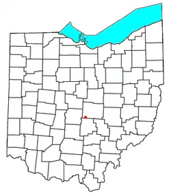 Location of Etna in Ohio | |
| Coordinates: 39°57′26″N 82°40′57″W | |
| Country | United States |
| State | Ohio |
| County | Licking |
| Township | Etna |
| Area | |
| • Total | 0.64 sq mi (1.66 km2) |
| • Land | 0.64 sq mi (1.65 km2) |
| • Water | 0.004 sq mi (0.01 km2) |
| Elevation | 1,069 ft (326 m) |
| Population | |
| • Total | 1,215 |
| • Density | 1,912/sq mi (738.4/km2) |
| Time zone | UTC-5 (Eastern (EST)) |
| • Summer (DST) | UTC-4 (EDT) |
| ZIP Code | 43062 (Pataskala) |
| FIPS code | 39-25676[1] |
| GNIS feature ID | 1040239[3] |
Geography
Etna is in southwestern Licking County, in the center of Etna Township. U.S. Route 40 forms the northern edge of the community, and Interstate 70 forms the southern edge. Access from I-70 is via Exit 118 (State Route 310). Both US 40 and I-70 lead west 18 miles (29 km) to Columbus and east 35 miles (56 km) to Zanesville. Newark, the Licking county seat, is 20 miles (32 km) to the northeast.
According to the U.S. Census Bureau, the Etna CDP has a total area of 0.7 square miles (1.7 km2), of which 0.04 square miles (0.1 km2), or 0.65%, are water.[1] Etna's surface area drains northeast to the South Fork of the Licking River, an east-flowing tributary of the Muskingum River and part of the Ohio River watershed.
History
Etna was originally called "Carthage", under which name it was laid out in 1832 when the National Road was being built to that point.[6] The present name is derived from Etna Township.[7] A post office called Etna has been in operation since 1833.[8]
References
- "U.S. Gazetteer Files: 2019: Places: Ohio". U.S. Census Bureau Geography Division. Retrieved July 17, 2020.
- "Total Population: 2010 Census DEC Summary File 1 (P1), Etna CDP, Ohio". data.census.gov. U.S. Census Bureau. Retrieved July 17, 2020.
- "Etna". Geographic Names Information System. United States Geological Survey.
- "Etna, Licking County, Ohio". ACME Mapper. U.S. Geological Survey 7-1/2 minute topographic map series. Retrieved July 17, 2020.
- "Etna Census Designated Place". Geographic Names Information System. United States Geological Survey.
- Brister, Edwin M. P. (1909). Centennial History of the City of Newark and Licking County, Ohio. S.J. Clarke Publishing Company. p. 351.
- Overman, William Daniel (1958). Ohio Town Names. Akron, OH: Atlantic Press. p. 43.
- "Licking County". Jim Forte Postal History. Archived from the original on 4 March 2016. Retrieved 6 December 2015.
Municipalities and communities of Licking County, Ohio, United States | ||
|---|---|---|
| Cities | 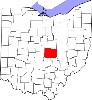 Map of Ohio highlighting Licking County | |
| Villages | ||
| Townships | ||
| CDPs | ||
| Unincorporated communities | ||
| Ghost towns | ||
| Footnotes | ‡This populated place also has portions in an adjacent county or counties | |
| ||