Marne, Ohio
Marne is an unincorporated community and census-designated place (CDP) in Licking County, Ohio, United States. As of the 2010 census it had a population of 783.[2]
Marne, Ohio | |
|---|---|
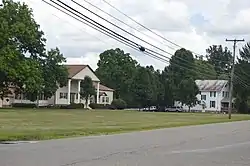 Houses on Marne Road | |
 Marne  Marne | |
| Coordinates: 40°04′16″N 82°18′34″W | |
| Country | United States |
| State | Ohio |
| County | Licking |
| Township | Madison |
| Area | |
| • Total | 0.88 sq mi (2.27 km2) |
| • Land | 0.88 sq mi (2.27 km2) |
| • Water | 0.0 sq mi (0.0 km2) |
| Elevation | 1,069 ft (326 m) |
| Population | |
| • Total | 783 |
| • Density | 893/sq mi (344.8/km2) |
| Time zone | UTC-5 (Eastern (EST)) |
| • Summer (DST) | UTC-4 (EDT) |
| FIPS code | 39-47950[1] |
| GNIS feature ID | 1061379[3] |
Geography
Marne is in eastern Licking County, in the eastern part of Madison Township. Ohio State Route 16 forms the southern edge of the community, leading west 5 miles (8 km) to Newark, the Licking county seat, and northeast 32 miles (51 km) to Coshocton.
According to the U.S. Census Bureau, the Marne CDP has a total area of 0.9 square miles (2.3 km2), of which 0.9 acres (3,568 m2), or 0.16%, are water.[1] Marne is in the valley of the Licking River, which passes to the south of State Route 16. The Licking is an east-flowing tributary of the Muskingum River and part of the Ohio River watershed.
Demographics
As of the census[4] of 2010, there were 783 people, 289 households, and 228 families living in the CDP. There were 301 housing units. The racial makeup of the CDP was 96.42% White, 0.64% African American, 0.13% Native American, 0.13% Asian, and 2.68% from two or more races. Hispanic or Latino of any race were 2.17% of the population.
There were 289 households, out of which 32.9% had children under the age of 18 living with them, 56.4% were married couples living together, 15.2% had a female householder with no husband present, and 21.1% were non-families. 15.9% of all households were made up of individuals, and 7.6% had someone living alone who was 65 years of age or older. The average household size was 2.71 and the average family size was 2.99.
References
- "U.S. Gazetteer Files: 2019: Places: Ohio". U.S. Census Bureau Geography Division. Retrieved July 20, 2020.
- "Total Population: 2010 Census DEC Summary File 1 (P1), Marne CDP, Ohio". data.census.gov. U.S. Census Bureau. Retrieved July 20, 2020.
- "Marne". Geographic Names Information System. United States Geological Survey.
- "U.S. Census website". United States Census Bureau. Retrieved 2011-05-14.
Municipalities and communities of Licking County, Ohio, United States | ||
|---|---|---|
| Cities | 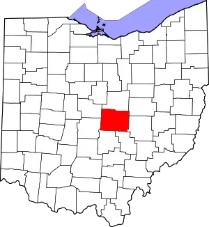 Map of Ohio highlighting Licking County | |
| Villages | ||
| Townships | ||
| CDPs | ||
| Unincorporated communities | ||
| Ghost towns | ||
| Footnotes | ‡This populated place also has portions in an adjacent county or counties | |
| ||