Everson, Washington
Everson is a city in Whatcom County, Washington, United States. The population was 2,481 at the 2010 census.
Everson, Washington | |
|---|---|
 Bethany Chapel in Everson | |
 Location of Everson, Washington | |
| Coordinates: 48°55′3″N 122°20′56″W | |
| Country | United States |
| State | Washington |
| County | Whatcom |
| Area | |
| • Total | 1.38 sq mi (3.56 km2) |
| • Land | 1.35 sq mi (3.49 km2) |
| • Water | 0.03 sq mi (0.08 km2) |
| Elevation | 85 ft (26 m) |
| Population | |
| • Total | 2,481 |
| • Estimate (2019)[3] | 2,841 |
| • Density | 2,110.70/sq mi (814.84/km2) |
| Demonym: Eversonian | |
| Time zone | UTC-8 (Pacific (PST)) |
| • Summer (DST) | UTC-7 (PDT) |
| ZIP codes | 98247, 98276 |
| Area code | 360 |
| FIPS code | 53-22745 |
| GNIS feature ID | 1504794[4] |
| Website | www.ci.everson.wa.us |
Everson and the nearby city of Nooksack lie near the foothills of the Cascade mountains in Northwest Washington. Located on the banks of the Nooksack River, the businesses support the surrounding farms and logging industries. The valley is heavily influenced by Dutch settlers who established dairy farms on the fertile flood prone land. Fruit orchards and berry fields also play an important part of the town's economy.
The town's small business district provides all the basic services. There are restaurants, a pharmacy and groceries, auto-repair, and agricultural supply stores. The City Park is located a 1/2 block south off the W. Main St. and Riverside Park is on the banks of the Nooksack River featuring picnic tables and ball fields.
Throughout the year, the area hosts small festivals in town or in the surrounding area, including a summer festival and harvest festival.
History
Everson was named for a local pioneer, Ever Everson.[5] Everson was officially incorporated on May 4, 1929.
In February 2009 there was talk of merging Everson and Nooksack into a single city with a combined population of 3,819 (2010 census). The Bellingham Herald compared the merger to that of the four towns that formed Bellingham in 1903.[6] Names for the proposed new city include "Nooksack Valley".[7]
Geography
Everson is located at 48°55′3″N 122°20′56″W (48.917421, -122.348779).[8]
According to the United States Census Bureau, the city has a total area of 1.26 square miles (3.26 km2), of which, 1.24 square miles (3.21 km2) is land and 0.02 square miles (0.05 km2) is water.[9]
Demographics
| Historical population | |||
|---|---|---|---|
| Census | Pop. | %± | |
| 1930 | 295 | — | |
| 1940 | 292 | −1.0% | |
| 1950 | 345 | 18.2% | |
| 1960 | 431 | 24.9% | |
| 1970 | 633 | 46.9% | |
| 1980 | 898 | 41.9% | |
| 1990 | 1,490 | 65.9% | |
| 2000 | 2,035 | 36.6% | |
| 2010 | 2,481 | 21.9% | |
| 2019 (est.) | 2,841 | [3] | 14.5% |
| U.S. Decennial Census[10] | |||
2010 census
As of the census[2] of 2010, there were 2,481 people, 819 households, and 619 families residing in the city. The population density was 2,000.8 inhabitants per square mile (772.5/km2). There were 864 housing units at an average density of 696.8 per square mile (269.0/km2). The racial makeup of the city was 75.3% White, 0.3% African American, 2.5% Native American, 0.7% Asian, 16.6% from other races, and 4.5% from two or more races. Hispanic or Latino of any race were 28.9% of the population.
There were 819 households, of which 45.8% had children under the age of 18 living with them, 56.7% were married couples living together, 12.0% had a female householder with no husband present, 7.0% had a male householder with no wife present, and 24.4% were non-families. 19.9% of all households were made up of individuals, and 8.1% had someone living alone who was 65 years of age or older. The average household size was 3.03 and the average family size was 3.46.
The median age in the city was 29.8 years. 32.2% of residents were under the age of 18; 10.6% were between the ages of 18 and 24; 28.9% were from 25 to 44; 20.1% were from 45 to 64; and 8.1% were 65 years of age or older. The gender makeup of the city was 48.8% male and 51.2% female.
2000 census
As of the census of 2000, there were 2,035 people, 684 households, and 525 families residing in the city. The population density was 1,661.6 people per square mile (644.0/km2). There were 727 housing units at an average density of 593.6 per square mile (230.1/km2). The racial makeup of the city was 85.06% White, 0.54% African American, 2.16% Native American, 0.98% Asian, 8.01% from other races, and 3.24% from two or more races. Hispanic or Latino of any race were 18.33% of the population.
There were 684 households, out of which 46.5% had children under the age of 18 living with them, 59.9% were married couples living together, 12.0% had a female householder with no husband present, and 23.2% were non-families. 18.6% of all households were made up of individuals, and 7.0% had someone living alone who was 65 years of age or older. The average household size was 2.97 and the average family size was 3.40.
In the city, the age distribution of the population shows 34.6% under the age of 18, 8.8% from 18 to 24, 31.2% from 25 to 44, 16.6% from 45 to 64, and 8.7% who were 65 years of age or older. The median age was 30 years. For every 100 females, there were 93.3 males. For every 100 females age 18 and over, there were 90.0 males.
The median income for a household in the city was $35,313, and the median income for a family was $40,568. Males had a median income of $33,942 versus $20,547 for females. The per capita income for the city was $13,700. About 14.3% of families and 18.0% of the population were below the poverty line, including 21.4% of those under age 18 and 9.5% of those age 65 or over.
Education
Public education is provided by the Nooksack Valley School District. It operates one high school (Nooksack Valley High School), one middle school, and three elementary schools that serve Nooksack, Everson, and surrounding areas.
Notable people
- Gordon Adam, member of 1936 Olympic goal medal winning crew team.[11]
- George Bernard "Bernie" Worrell, Jr. (April 19, 1944 – June 24, 2016), American keyboardist and composer best known as a founding member of Parliament-Funkadelic and for his work with Talking Heads. He is a member of the Rock and Roll Hall of Fame, inducted in 1997.
References
- "2019 U.S. Gazetteer Files". United States Census Bureau. Retrieved August 7, 2020.
- "U.S. Census website". United States Census Bureau. Retrieved 2012-12-19.
- "Annual Estimates of the Resident Population for Incorporated Places in Washington: April 1, 2010 to July 1, 2019". United States Census Bureau. May 2020. Retrieved May 27, 2020.
- "US Board on Geographic Names". United States Geological Survey. 2007-10-25. Retrieved 2008-01-31.
- Meany, Edmond S. Origin of Washington geographic names. Seattle: University of Washington Press. p. 82.
- Taylor, Sam (March 4, 2009). "Everson and Nooksack residents discuss merging". The Bellingham Herald. Retrieved September 14, 2018.
- http://www.lyndentribune.com/node/4137%5B%5D
- "US Gazetteer files: 2010, 2000, and 1990". United States Census Bureau. 2011-02-12. Retrieved 2011-04-23.
- "US Gazetteer files 2010". United States Census Bureau. Archived from the original on 2012-01-25. Retrieved 2012-12-19.
- United States Census Bureau. "Census of Population and Housing". Retrieved July 31, 2013.
- Nalder, Eric (March 29, 1992). "GORDON ADAM, 76, ROWED FOR UW GOLD-MEDAL CREW IN '36". The Seattle Times. p. D4.
External links
| Wikimedia Commons has media related to Everson, Washington. |
Places adjacent to Everson, Washington | |
|---|---|
Municipalities and communities of Whatcom County, Washington, United States | ||
|---|---|---|
| Cities | 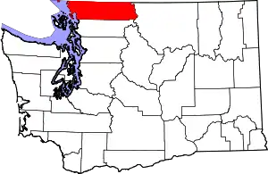 Map of Washington highlighting Whatcom County | |
| CDPs | ||
| Indian reservations | ||
| Unincorporated communities | ||
| Ghost towns | ||
| ||