Farm to Market Road 1096
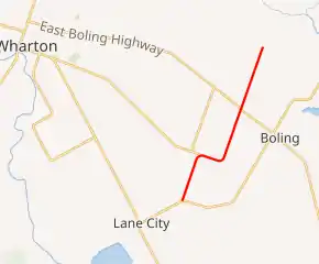
Farm to Market Road 1096 (FM 1096) is a state highway the U.S. state of Texas that stays within Wharton County. The highway starts at a junction with FM 442 to the northeast of Lane City, heads in a northeasterly direction through Boling-Iago and ends at a country road to the north-northeast.
| ||||
|---|---|---|---|---|
| ||||
| Route information | ||||
| Maintained by TxDOT | ||||
| Length | 7.272 mi[1] (11.703 km) | |||
| Existed | July 28, 1955[1]–present | |||
| Major junctions | ||||
| South end | ||||
| ||||
| North end | Barker Cutoff north of Iago | |||
| Location | ||||
| Counties | Wharton | |||
| Highway system | ||||
| ||||

Route description
FM 1096 begins as a two-lane road on FM 442 northeast of Lane City. From there, FM 1096 goes north-northeast 1.8 miles (2.9 km) to its intersection with FM 3012. It turns east-southeast for 1.0 mile (1.6 km), then curves back to the north-northeast again for 2.0 miles (3.2 km) to its intersection with FM 1301 in Iago. The road crosses Caney Creek approximately 300 yards (274 m) south of Iago. Also known as North Iago Road, the highway continues north-northeast 2.5 miles (4.0 km) to Barker Cutoff. North Iago Road extends past Barker Cutoff in the same direction to intersect with County Road 160 (CR 160) and CR 153 before coming to a dead end short of the San Bernard River.[2]
History
FM 1096 was originally designated on December 16, 1948, from State Highway 60 at Wadsworth in Matagorda County to a county road 2.5 miles (4.0 km) west. This route was canceled on October 15, 1954 as it was transferred to FM 521.[1]
On July 28, 1955, a new FM 1096 was established from FM 1301 at Iago in Wharton County southwest to FM 442. The length was about five miles (8.0 km). A new segment 2.5 miles (4.0 km) in length was added on June 28, 1963. This portion started from FM 1301 at Iago and extended about 2.5 miles (4.0 km) northeast to a road intersection.[1]
Major intersections
The entire highway is in Wharton County.
| Location | mi | km | Destinations | Notes | |
|---|---|---|---|---|---|
| | 0.0 | 0.0 | Southern terminus of FM 1096 | ||
| | 1.8 | 2.9 | Southern terminus of FM 3012 | ||
| Boling-Iago | 4.8 | 7.7 | |||
| | 7.3 | 11.7 | Barker Cutoff | Northern terminus of FM 1096 | |
| 1.000 mi = 1.609 km; 1.000 km = 0.621 mi | |||||
See also
 Texas portal
 U.S. Roads portal
References
- Transportation Planning and Programming Division (n.d.). "Farm to Market Road No. 1096". Highway Designation Files. Texas Department of Transportation. Retrieved January 5, 2013.
- Google (January 5, 2013). "Farm to Market Road 1096" (Map). Google Maps. Google. Retrieved January 5, 2013.