Farm to Market Road 177
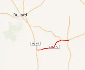
Farm to Market Road 177, or FM 177, in the eastern part of Texas (USA), runs about 4.98 miles (8.01 km) from an intersection with US 69 in Mount Selman east to Mixon at an intersection with SH 135. The road is located in far north-central Cherokee County.
| ||||
|---|---|---|---|---|
| ||||
| Route information | ||||
| Length | 4.98 mi[1] (8.02 km) | |||
| Existed | 1951[1]–present | |||
| Major junctions | ||||
| West end | ||||
| ||||
| East end | ||||
| Location | ||||
| Counties | Cherokee | |||
| Highway system | ||||
| ||||

Route description
FM 177 has no local street names. Mostly rural for all of its length, FM 177 passes by a landscape of rolling hills of trees and farmland. All of FM 177 has 2 lanes and no shoulders. The road serves just the 2 towns of Mount Selman and Mixon. The western terminus intersection connects to US 69 which goes south to Jacksonville and north to Tyler; while the eastern terminus intersection connects to TX 135 which goes northeast to Troup, and south to Jacksonville. FM 177 has intersections at county roads, besides its intersections with FM 2493 west of Mixon and FM 3052 in Mixon, and its termini at US 69 in Mount Selman and at TX 135 in Mixon.[1][2][3]
History
A previous commissioning of FM 177 came on June 11, 1945 by Minute Order for a 3 miles (4.8 km) stretch of road south of Lamesa from SH 137 to Patricia. This previous use of FM 177 was cancelled on April 30, 1947 (became a portion of SH 349). The Minute Order for the current location of FM 177 came on May 23, 1951. It is unclear exactly when any part of FM 177 was built.[1]
Major intersections
The entire route is in Cherokee County.
| Location | mi[4] | km | Destinations | Notes | |
|---|---|---|---|---|---|
| Mount Selman | 0.00 | 0.00 | Western terminus | ||
| | 4.00 | 6.44 | |||
| Mixon | 4.97 | 8.00 | |||
| 4.98 | 8.01 | Eastern terminus | |||
| 1.000 mi = 1.609 km; 1.000 km = 0.621 mi | |||||
References
- Transportation Planning and Programming Division (n.d.). "Farm to Market Road No. 177". Highway Designation Files. Texas Department of Transportation. Retrieved October 26, 2011.
- Google (October 26, 2011). "overview of Farm to Market Road 177" (Map). Google Maps. Google. Retrieved October 26, 2011.
- County Grid Map 553 (PDF) (Map). Texas Department of Transportation. 2010. Archived from the original (PDF) on June 12, 2012. Retrieved October 24, 2011.
- Cherokee County, Texas map (#1), Texas Department of Transportation, University of Texas at Austin--Texas County Maps collection, 1990/1996. Retrieved 2010-08-04.