Cherokee County, Texas
Cherokee County is a county located in the U.S. state of Texas. As of the 2010 census, its population was 50,845.[1] The county seat is Rusk.[2] The county was named for the Cherokee, who lived in the area before being expelled in 1839. Rusk, the county seat, is 130 miles southeast of Dallas and 160 miles north of Houston.
Cherokee County | |
|---|---|
 The Cherokee County Courthouse in Rusk | |
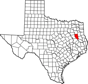 Location within the U.S. state of Texas | |
 Texas's location within the U.S. | |
| Coordinates: 31°50′N 95°10′W | |
| Country | |
| State | |
| Founded | July 13, 1846 |
| Named for | Cherokee people |
| Seat | Rusk |
| Largest city | Jacksonville |
| Area | |
| • Total | 1,062 sq mi (2,750 km2) |
| • Land | 1,053 sq mi (2,730 km2) |
| • Water | 9.3 sq mi (24 km2) 0.9%% |
| Population (2010) | |
| • Total | 50,845 |
| • Density | 48/sq mi (19/km2) |
| Time zone | UTC−6 (Central) |
| • Summer (DST) | UTC−5 (CDT) |
| Congressional district | 5th |
| Website | www |
Cherokee County comprises the Jacksonville, TX Micropolitan Statistical Area, which is also included in the Tyler-Jacksonville, TX Combined Statistical Area.
History
Native Americans
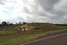
The Hasinai group of the Caddo tribe built a village in the area in around AD 800[3] [4] and continued to live in the area until the 1830s, when they migrated to the Brazos River. The federal government moved them to the Brazos Indian Reservation in 1855 and later to Oklahoma.
The Cherokee, Delaware, Shawnee, and Kickapoo Native American peoples began settling in the area around 1820. The Texas Cherokee tried unsuccessfully to gain a grant to their own land from the Mexican government.
Sam Houston, adopted son of Chief Oolooteka (John Jolly) of the Cherokee, negotiated the January 14, 1836, treaty between Chief Bowl[5] of the Cherokee and the Republic of Texas.[6][7] On December 16, 1837, the Texas Senate declared the treaty null and void,[8] and encroachment of Cherokee lands continued. On October 5, 1838, Indians massacred members of the Isaac Killough family[9][10] at their farm northwest of the site of present Jacksonville, leading to the Cherokee War of 1839 and the expulsion of some to Oklahoma. Some went to Monclova, Mexico, and some over into Rusk and Gregg counties (many had relatives among the Choctaw/Chickasaw/Creek community there). Later in 1844 President Polk issued an executive order known as "The Right to return," allowing many Cherokee to return to Texas. Some came to what is now Cherokee County.
Early exploration and settlers
Domingo Terán de los Ríos[11] and Father Damián Massanet[12] explored the area on behalf of Spain in 1691. Louis Juchereau de St. Denis[13] began trading with the Hasinais in 1705. Nuestro Padre San Francisco de los Tejas[14] was originally established in 1690, but was re-established in 1716 by Captain Domingo Ramon. It was abandoned again because of French incursions and re-established in 1721 by the Marques de San Miguel de Aguyao.
In 1826, empresario David G. Burnet received a grant from the Coahuila y Tejas legislature to settle 300 families.[15] The settlers were mostly from the southern states and brought with that lifestyle with them. By contracting how many families each grantee could settle, the government sought to have some control over colonization.
County established and growth
Cherokee County was formed from land given by Nacogdoches County in 1846.[16] It was organized the same year. The town of Rusk became the county seat.
Cherokee County voted in favor of secession from the Union, during the build-up to the Civil War.
In 1872, the International – Great Northern Railroad[17] caused Jacksonville[18] to relocate two miles east, to be near the tracks. The Kansas and Gulf Short Line Railway[19] was built north-to-south through the county between 1882 and 1885. The Texas and New Orleans Railroad[20] in 1905, and the Texas State Railroad[21] in 1910, each gave rise to new county towns along their tracks.
Geography
According to the U.S. Census Bureau, the county has a total area of 1,062 square miles (2,750 km2), of which 1,053 square miles (2,730 km2) is land and 9.3 square miles (24 km2) (0.9%) is covered by water.[22]
Major highways
 U.S. Highway 69
 U.S. Highway 79
 U.S. Highway 84
 U.S. Highway 175
 State Highway 21
 State Highway 110
 State Highway 135
 State Highway 204
 State Highway 294
Adjacent counties
- Smith County (north)
- Rusk County (northeast, east)
- Nacogdoches County (east, southeast)
- Angelina County (southeast)
- Houston County (southwest)
- Anderson County (west)
- Henderson County (northwest)
National protected area
Demographics
| Historical population | |||
|---|---|---|---|
| Census | Pop. | %± | |
| 1850 | 6,673 | — | |
| 1860 | 12,098 | 81.3% | |
| 1870 | 11,079 | −8.4% | |
| 1880 | 16,723 | 50.9% | |
| 1890 | 22,975 | 37.4% | |
| 1900 | 25,154 | 9.5% | |
| 1910 | 29,038 | 15.4% | |
| 1920 | 37,633 | 29.6% | |
| 1930 | 43,180 | 14.7% | |
| 1940 | 43,970 | 1.8% | |
| 1950 | 38,694 | −12.0% | |
| 1960 | 33,120 | −14.4% | |
| 1970 | 32,008 | −3.4% | |
| 1980 | 38,127 | 19.1% | |
| 1990 | 41,049 | 7.7% | |
| 2000 | 46,659 | 13.7% | |
| 2010 | 50,845 | 9.0% | |
| 2019 (est.) | 52,646 | [23] | 3.5% |
| U.S. Decennial Census[24] 1850–2010[25] 2010–2014[1] | |||
As of the census[26] of 2000, 46,659 people, 16,651 households, and 12,105 families resided in the county. The population density was 44 people per square mile (17/km2). The 19,173 housing units averaged 18 per square mile (7/km2). The racial makeup of the county was 74.34% White, 15.96% Black or African American, 0.47% Native American, 0.40% Asian, 0.06% Pacific Islander, 7.43% from other races, and 1.34% from two or more races. About 13.24% of the population was Hispanic or Latino of any race.
Of the 16,651 households, 33.40% had children under the age of 18 living with them, 55.70% were married couples living together, 12.80% had a female householder with no husband present, and 27.30% were not families. Around 24.20% of all households were made up of individuals, and 11.90% had someone living alone who was 65 years of age or older. The average household size was 2.63, and the average family size was 3.11.
In the county, the population was distributed as 26.30% under the age of 18, 9.30% from 18 to 24, 27.40% from 25 to 44, 21.90% from 45 to 64, and 15.10% who were 65 years of age or older. The median age was 36 years. For every 100 females, there were 101.00 males. For every 100 females age 18 and over, there were 99.00 males.
The median income for a household in the county was $29,313, and for a family was $34,750. Males had a median income of $26,410 versus $19,788 for females. The per capita income for the county was $13,980. About 13.70% of families and 17.90% of the population were below the poverty line, including 23.30% of those under age 18 and 15.10% of those age 65 or over.
Media
Cherokee County is part of the Tyler/Longview/Jacksonville DMA. Local media outlets are: KLTV, KTRE-TV, KYTX-TV, KFXK-TV, KCEB-TV, and KETK-TV.
Newspapers in the county include the Jacksonville Progress, which publishes three editions a week in Jacksonville, and the weekly Cherokeean Herald in Rusk.
Communities
Cities
- Gallatin
- Jacksonville
- New Summerfield
- Reklaw (partly in Rusk County)
- Rusk (county seat)
- Troup (mostly in Smith County)
Towns
- Alto
- Bullard (mostly in Smith County)
- Cuney
- Wells
Census-designated place
Unincorporated communities
- Afton Grove
- Atoy
- Blackjack
- Church Hill
- Concord
- Corine
- Cove Springs
- Craft
- Delmer
- Dialville
- Earle's Chapel
- Forest
- Fry's Gap
- Gould
- Ironton
- Lakeview
- Larissa
- Linwood
- Maydelle
- Mixon
- Mount Selman
- New Hope
- Oakland
- Pierces Chapel
- Pine Hill
- Ponta
- Reese
- Salem
- Shady Grove
- Tecula
- Turney
- Weeping Mary
- Woodville
Politics
| Year | Republican | Democratic | Third parties |
|---|---|---|---|
| 2020 | 77.4% 15,101 | 21.6% 4,210 | 1.0% 197 |
| 2016 | 76.9% 12,919 | 20.7% 3,469 | 2.4% 402 |
| 2012 | 75.0% 12,094 | 24.0% 3,875 | 1.0% 157 |
| 2008 | 71.2% 11,695 | 28.1% 4,610 | 0.7% 112 |
| 2004 | 71.5% 11,329 | 28.0% 4,439 | 0.5% 71 |
| 2000 | 66.0% 9,599 | 32.7% 4,755 | 1.3% 183 |
| 1996 | 51.1% 6,483 | 40.9% 5,185 | 8.1% 1,026 |
| 1992 | 41.4% 5,847 | 35.4% 5,003 | 23.3% 3,288 |
| 1988 | 57.1% 7,520 | 42.6% 5,604 | 0.3% 41 |
| 1984 | 64.4% 8,187 | 35.4% 4,494 | 0.2% 30 |
| 1980 | 49.0% 5,629 | 49.9% 5,726 | 1.1% 131 |
| 1976 | 37.5% 3,921 | 62.2% 6,509 | 0.3% 35 |
| 1972 | 69.3% 5,743 | 29.8% 2,467 | 0.9% 78 |
| 1968 | 26.8% 2,575 | 33.7% 3,242 | 39.5% 3,791 |
| 1964 | 35.6% 3,043 | 64.3% 5,485 | 0.1% 9 |
| 1960 | 41.0% 3,233 | 57.7% 4,544 | 1.3% 105 |
| 1956 | 57.8% 4,022 | 41.8% 2,912 | 0.4% 27 |
| 1952 | 49.6% 3,825 | 50.2% 3,868 | 0.2% 14 |
| 1948 | 24.0% 1,154 | 64.1% 3,079 | 11.9% 573 |
| 1944 | 11.6% 598 | 76.1% 3,918 | 12.2% 630 |
| 1940 | 13.1% 801 | 86.7% 5,293 | 0.2% 10 |
| 1936 | 7.2% 302 | 92.7% 3,908 | 0.2% 8 |
| 1932 | 5.3% 233 | 94.4% 4,125 | 0.2% 10 |
| 1928 | 49.9% 1,933 | 50.1% 1,938 | |
| 1924 | 13.1% 666 | 85.2% 4,343 | 1.8% 90 |
| 1920 | 13.4% 478 | 62.5% 2,233 | 24.1% 861 |
| 1916 | 9.7% 241 | 80.3% 2,002 | 10.0% 249 |
| 1912 | 7.7% 145 | 89.1% 1,684 | 3.2% 61 |
See also
References
- "State & County QuickFacts". United States Census Bureau. Archived from the original on February 27, 2016. Retrieved December 9, 2013.
- "Find a County". National Association of Counties. Archived from the original on 2015-05-09. Retrieved 2011-06-07.
- Long, Christopher and Standifer, Mary M: Caddoan Mounds State Historic Site from the Handbook of Texas Online. Retrieved 04 May 2010. Texas State Historical Association
- "Caddo Mounds". Texas State Historical Association. Retrieved 4 May 2010. Texas State Historical Association
- "Houston, Sam". The Sam Houston Memorial Museum. Archived from the original on 24 May 2010. Retrieved 4 May 2010. The Sam Houston Memorial Museum
- "The Texas Cherokee". R. Edward Moore and Texarch Associates. Retrieved 4 May 2010. R. Edward Moore and Texarch Associates
- "Houston, Sam". PBS. Retrieved 4 May 2010.
- Cherokee War from the Handbook of Texas Online. Retrieved 4 May 2010. Texas State Historical Association
- Long, Christopher: Killough Massacre from the Handbook of Texas Online. Retrieved 4 May 2010. Texas State Historical Association
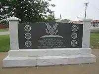
- Whitington, Mitchell. "A Monument to the Killough Massacre". Texas Escapes - Blueprints For Travel, LLC. Retrieved 4 May 2010. Texas Escapes - Blueprints For Travel, LLC.
- Blake, Robert Bruce: Terán de los Ríos, Domingo from the Handbook of Texas Online. Retrieved 4 May 2010. Texas State Historical Association
- Chipman, Donald E: Massanet, Father Damian from the Handbook of Texas Online. Retrieved 4 May 2010. Texas State Historical Association
- Chipman, Donald E and Lemee, Patricia R: St. Denis, Louis Juchereau de from the Handbook of Texas Online. Retrieved 4 May 2010. Texas State Historical Association
- Nuestro Padre San Francisco de los Tejas Mission from the Handbook of Texas Online. Retrieved 4 May 2010. Texas State Historical Association
- "Empresario Contracts in the Colonization of Texas 1825-1834". Texas A & M University. Archived from the original on 15 June 2010. Retrieved 4 May 2010. Wallace L. McKeehan,
- Alvarez, Elizabeth Cruce (Nov 8, 2011). Texas Almanac 2012–2013. Texas A&M University Press. pp. Contents. ISBN 9780876112571. Retrieved 17 November 2013.
- Werner, George C: International-Great Northern Railroad from the Handbook of Texas Online. Retrieved 04 May 2010. Texas State Historical Association
- "Jacksonville, Texas". Texas Escapes - Blueprints For Travel, LLC. Retrieved 4 May 2010. Texas Escapes - Blueprints For Travel, LLC.
- "Kansas and Gulf Short Railway". History Map.com. Retrieved 4 May 2010.
- Williams, Howard C: Texas and New Orleans Railroad from the Handbook of Texas Online. Retrieved 4 May 2010. Texas State Historical Association
- Richards, Amy: Texas State Railroad from the Handbook of Texas Online. Retrieved 04 May 2010. Texas State Historical Association
- "2010 Census Gazetteer Files". United States Census Bureau. August 22, 2012. Retrieved April 20, 2015.
- "Population and Housing Unit Estimates". United States Census Bureau. May 24, 2020. Retrieved May 27, 2020.
- "U.S. Decennial Census". United States Census Bureau. Retrieved April 20, 2015.
- "Texas Almanac: Population History of Counties from 1850–2010" (PDF). Texas Almanac. Retrieved April 20, 2015.
- "U.S. Census website". United States Census Bureau. Retrieved 2011-05-14.
- Leip, David. "Dave Leip's Atlas of U.S. Presidential Elections". uselectionatlas.org. Retrieved 2018-07-20.
External links
| Wikimedia Commons has media related to Cherokee County, Texas. |
- Cherokee County in Handbook of Texas Online at the University of Texas
- Historic Cherokee County materials, hosted by the Portal to Texas History.
- Cherokee County Sons of Confederate Veterans
Places adjacent to Cherokee County, Texas | ||||||||||
|---|---|---|---|---|---|---|---|---|---|---|
| ||||||||||
Municipalities and communities of Cherokee County, Texas, United States | ||
|---|---|---|
| Cities | Cherokee County map | |
| Towns | ||
| CDP | ||
| Other unincorporated communities | ||
| Ghost towns | ||
| Footnotes | ‡This populated place also has portions in an adjacent county or counties | |
| ||

| Authority control |
|---|