Farm to Market Road 2977
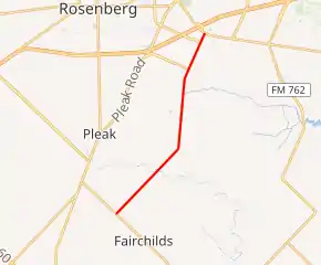
Farm to Market Road 2977 (FM 2977) is a state highway in the U.S. state of Texas that stays within Fort Bend County. The highway begins at FM 361 near Fairchilds, goes generally to the northeast and ends at FM 762 a short distance from U.S. Highway 59 (US 59) in Rosenberg. The highway is also named Minonite Road.
| ||||
|---|---|---|---|---|

| ||||
| Route information | ||||
| Maintained by TxDOT | ||||
| Length | 7.839 mi[1] (12.616 km) | |||
| Existed | June 1, 1965[1]–present | |||
| Major junctions | ||||
| South end | ||||
| Reading Road | ||||
| North end | ||||
| Location | ||||
| Counties | Fort Bend | |||
| Highway system | ||||
| ||||
Route description
FM 2977 starts as a two-lane rural road at a stop sign on FM 361 northwest of Fairchilds in Fort Bend County. From the intersection, the highway goes northeast 3.4 miles (5.5 km) to Powerline Road where it curves more toward the north. In this stretch the highway crosses Big Creek. On the east side of the road near Powerline Road is the Big Creek Oil Field. FM 2977 continues north-northeast for 2.6 miles (4.2 km) to Ricefield Road where it veers to the northeast again. FM 2977 continues straight for 1.9 miles (3.1 km) before crossing the BNSF Railway tracks and terminating at a traffic signal at FM 762 in Rosenberg. After Ricefield Road, the highway passes the Walnut Creek subdivision and the aspect becomes less rural. There is a traffic signal at Reading Road, 0.4 miles (0.64 km) southwest of FM 762. Reading Road and two other streets connect FM 2977 to a large shopping center 250 yards (229 m) to the west at FM 762 and US 59.[2]
History
FM 2977 was originally designated on June 1, 1965, to go from FM 361 to the northeast about 3.4 miles (5.5 km). The highway was extended an additional 4.4 miles (7.1 km) to FM 762 on July 11, 1968.[1]
Major intersections
The entire highway is in Fort Bend County.
| Location | mi | km | Destinations | Notes | |
|---|---|---|---|---|---|
| Fairchilds | 0.0 | 0.0 | Southern terminus of FM 2977 | ||
| | 7.4 | 11.9 | Reading Road | ||
| Rosenberg | 7.8 | 12.6 | Northern terminus of FM 2977 | ||
| 1.000 mi = 1.609 km; 1.000 km = 0.621 mi | |||||
Gallery
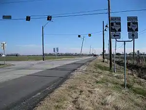
 Southwest end of FM 2977 at FM 361 near Fairchilds
 View from Powerline Road near FM 2977
 Northeast end of FM 2977 at FM 762 in Rosenberg
See also
 Texas portal
 U.S. Roads portal
References
- Transportation Planning and Programming Division (n.d.). "Farm to Market Road No. 2977". Highway Designation Files. Texas Department of Transportation. Retrieved January 5, 2013.
- Google (April 26, 2013). "Farm to Market Road 2977" (Map). Google Maps. Google. Retrieved April 26, 2013.
