Florida State Road 33
State Road 33 (SR 33) is a state highway running through Lake and Polk counties in Florida.
| ||||
|---|---|---|---|---|
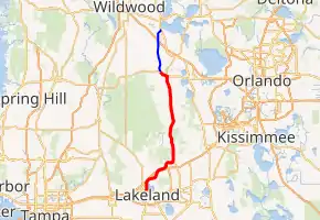
SR 33 in red, CR 33 in blue | ||||
| Route information | ||||
| Maintained by FDOT | ||||
| Length | 42.687 mi[1] (68.698 km) | |||
| Major junctions | ||||
| South end | ||||
| North end | ||||
| Location | ||||
| Counties | Lake, Polk | |||
| Highway system | ||||
| ||||

Route description
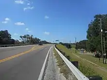
State Road 33 begins in Lakeland off U.S. Route 92 (US 92) east of the overlap with US 98 and heads north along the vicinity of the west bank of Lake Parker. North of there it curves to the northeast and has one of two interchanges with Interstate 4 (I-4). The first interchange (Exit 33) provides westbound access via North Socrum Loop Road (CR 582, and eastbound access directly to SR 33. The route turns more to the east away from I-4, until it curves north at the northern terminus of Florida State Road 569. It has an encounter at the second interchange with I-4 (Exit 38) where it actually crosses under the interstate. The road continues northeast to Polk City where it curves back towards the north at a bridge over a former Seaboard Air Line Railroad line (now the Auburndale TECO Trail and General James A. Van Fleet State Trail) just at the northwestern coast of Lake Agnes. From there, it traverses through mostly rural farmland into Lake County and Groveland. In Groveland, it intersects and begins a 3 miles (4.8 km) concurrency with SR 50, up to Mascotte. Now a county road, CR 33 continues through another 10 miles (16 km) or so of rural farmland, passes under Florida's Turnpike, and ends on US 27 in Okahumpka.
Major intersections
| County | Location | mi[1] | km | Destinations | Notes |
|---|---|---|---|---|---|
| Polk | Lakeland | 0.000 | 0.000 | ||
| 2.931 | 4.717 | ||||
| 3.572 | 5.749 | I-4 exit 33 | |||
| 6.046 | 9.730 | ||||
| 7.69 | 12.38 | I-4 exit 38 | |||
| Polk City | 13.503 | 21.731 | |||
| 13.702 | 22.051 | ||||
| Polk–Lake county line | | Bridge over Withlacoochee River | |||
| Lake | | 27.460 | 44.193 | ||
| | 29.803 | 47.963 | |||
| | 36.547 | 58.817 | |||
| Groveland | 40.216 | 64.721 | south end of SR 50 overlap; signage changes northbound from SR 33 to CR 33 | ||
| 40.541 | 65.244 | Southern terminus of SR 19 | |||
| 41.312 | 66.485 | ||||
| Mascotte | 42.687 | 68.698 | north end of SR 50 overlap and state maintenance | ||
| Leesburg | 54.1[2] | 87.1 | south end of CR 48 overlap | ||
| Okahumpka | 54.7[2] | 88.0 | north end of CR 48 overlap | ||
| | 56.049 | 90.202 | |||
1.000 mi = 1.609 km; 1.000 km = 0.621 mi
| |||||
References
- FDOT straight line diagrams Archived March 6, 2014, at the Wayback Machine, accessed February 2014
- Google Maps distance
External links
| Wikimedia Commons has media related to Florida State and County Roads 33. |