Forrestfield, Western Australia
Forrestfield is a suburb of the City of Kalamunda in Western Australia. It lies 15 kilometres to the south-east of Perth at the base of the Darling Scarp and the southern border of Perth Airport.
| Forrestfield Perth, Western Australia | |||||||||||||||
|---|---|---|---|---|---|---|---|---|---|---|---|---|---|---|---|
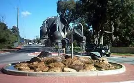 Roundabout at entrance to Hartfield Park | |||||||||||||||
 Forrestfield | |||||||||||||||
| Coordinates | 31.98°S 115.993611°E | ||||||||||||||
| Population | 12,690 (2016 census)[1] | ||||||||||||||
| Postcode(s) | 6058 | ||||||||||||||
| LGA(s) | City of Kalamunda | ||||||||||||||
| State electorate(s) | Forrestfield | ||||||||||||||
| Federal Division(s) | Hasluck | ||||||||||||||
| |||||||||||||||
The suburb is split by Roe Highway into a southern residential area and a northern industrial area. The suburb is adjacent to Wattle Grove, Cloverdale and Kalamunda.
Industrial area
Rail
The industrial area contains a major rail hub. The 241 hectare Forrestfield Marshalling Yard was built adjacent to the Kwinana railway line opening in stages between 1968 and 1973 in conjunction with the nearby Kewdale Freight Terminal as a replacement for the Perth marshalling yard and two other inner Perth yards. Within the confines of the yard, separate depots were built for locomotive, carriage and wagon maintenance.[2]
It was previously used by the Western Australian Government Railways, Westrail and Australian Railroad Group.[3][4] As at January 2018, Aurizon, SCT Logistics and Watco Australia use the yard.[5][6][7] Aurizon closed its terminal in late-2017 as part of the closure of its intermodal business.[8][9] Gemco Rail also has a facility.[10]
Bounded by Dundas Road to the east, the Tonkin Highway to the south and Perth Airport to the west, some of the land was no longer required for railway by in the late 1990s and rezoned for industrial use.[11][12] A combined 102 hectares was sold to the CBH Group, LandCorp and Specialised Container Transport.[13][14]
CBH Group's Metro Grains Centre was completed in 1998.[15][16] In mid-2005 BlueScope constructed a large warehouse on former Westrail land.[17] Kenworth DAF Trucks also relocated from Guildford to a new complex on Abernethy Road in 2005.[18]
Infrastructure
In November 2016, construction commenced on the Airport line that is scheduled to open in 2021.[19] Included will be High Wycombe station.[20]
The Western Australian Government has prompted the City of Kalamunda to investigate the possibility of business and infrastructure opportunities arising from the completion of the new link for Forrestfield and its surrounding areas.[21] The completion of the Airport Link is expected to facilitate the continuing growth of Perth Airport as a nationally integral part of employment, commerce and international trade.
Forrestfield's northern and eastern outskirts are home to the majority of the areas industrial enterprise. The area is host to a wide range of commercial business-to-business industries. Some of the most notable occupants include Grace Removals[22] Improvid[23] and the Super Retail Group.[24]
History
Settlement of the area dates from the late 1800s. Population was minimal until the early 1900s, with growth during the interwar period. Significant development did not occur until the post-war years, with rapid growth from the 1950s into the 1970s. The population has been relatively stable since the early 1990s, a result of some new dwellings being added to the area, but a decline in the average number of persons living in each dwelling.
There is authority to suggest it is named after John Forrest, Western Australia's first Premier, or his brother Alexander. However, local folklore suggests that the name comes from Charles Hale, who settled in the area in 1902 and planted crops amongst the native forest bushland, hence Forrestfield. In 1921 a Forrestfield Progress Association was formed, and the name was shown on plans in 1944.[25]
Shopping
Located on the corner of Hale Road and Strelitzia Avenue, the Forrestfield Forum & Marketplace comprises 52 shops including Coles and Woolworths supermarkets. It is owned by the Hawaiian Group.[26][27]
Cumberland Road has a Foodworks supermarket, a newsagency, a hairdresser, some dining and fast-food venues.[28] There are a range of other retail establishments scattered throughout Forrestfield, including taverns, liquour shops, a nursery, and various delis.
Education
Forrestfield contains the following educational institutions:
Demographics
In the 2016 census, Forrestfield recorded a population of 12,690 people: 49.6% male and 50.4% female. The median/average age of the Forrestfield population is 37 years.[34]
Politics
Amenities
Hartfield Park Recreation Centre: This complex includes an indoor stadium as well as playing fields for cricket, rugby, Australian rules football, hockey, soccer (football), an 18-hole golf course, an equestrian centre plus support facilities for each. There is also a nature conservation park and a lake.
Public transport
Transperth bus routes are:
- 286: peak hours to and from Elizabeth Quay bus station[35]
- 287: peak hours to and from Elizabeth Quay bus station[36]
- 288: off peak to and from Elizabeth Quay bus station[37]
- 294: to Cannington station & Midland station[38]
References
- Australian Bureau of Statistics (27 June 2017). "Forrestfield (State Suburb)". 2016 Census QuickStats. Retrieved 19 March 2018.

- Nomination of Western Australia Standard Gauge Railway for an Engineering Heritage Australia Heritage Recognition Award Engineers Australia Western Australian Division September 2011 page 25
- Western Australian Government Railways Commission (1976), Forrestfield Marshalling Yard operating manual, WAGR, retrieved 5 March 2017
- Western Australia Australian Railroad Group
- Western Australian Operations Aurizon
- Forrestfield Rail Freight SCT Logistics
- Minutes Western Australia Port Operations Task Force March 2017
- Aurizon to close Forrestfield terminal Business News 14 August 2017
- Linfox and Pacific National snap up Aurizon intermodal arm Fully Loaded 14 August 2017
- Engenco wins $5 million WA train maintenance contracts Engenco 30 March 2014
- Proposed amendment to the Metropolitan Region Scheme now available for comment Planning Minister 29 May 1998
- Forrestfield Marshalling Yards Shire of Kalamunda Town planning Scheme 2 Amendment 177 Environmental Protection Authority January 1999
- Government boosts industrial land at Forrestfield Lands Minister 12 April 2000
- Annual report for year ended 30 June 2000 Western Australian Government Railways Commission pages 7, 18
- Opening of $100M CBH Metro Grain Centre at Forrestfield Minister for Transport 6 Match 1998
- Metro Grain Centre CBH Group
- Expanded WA Capacity Steel in Touch (BlueScope) Spring 2005
- CJD Trucks Kenworth DAF Perth Truckworld
- Construction starts on Forrestfield-Airport link Government of Western Australia 18 November 2016
- Forrestfield Station Forrestfield-Airport Link
- "Structural and Local Development Plans: Local Development Plans". Shire of Kalamunda. Western Australian Land Information Authority. 27 November 2016.
- Perth Grace Removals
- "Perth Construction and Fencing". Perth Construction News. 27 June 2017. Archived from the original on 27 June 2017. Retrieved 27 June 2017.
- "Super Retail Group". Super Retail Group. 27 June 2017. Retrieved 27 June 2017.
- Western Australian Land Information Authority. "History of metropolitan suburb names – F". Retrieved 15 October 2019.
- Hawaiian buys Forestfield shops in $40m deal Business News 25 February 2015
- Home Hawaiian Forrestfield
- Forrestfield Foodworks
- Home Darling Range Sports College
- Home Dawson Park Primary School
- Home Forrestfield Primary School
- Home Hillside Christian School
- Home Woodlupine Primary School
- Forrestfield Australian Bureau of Statistics
- Bus Route 286 Timetable Transperth
- Bus Route 287 Timetable Transperth
- Bus Route 288 Timetable Transperth
- Bus Route 294 Timetable Transperth