Fort Denaud, Florida
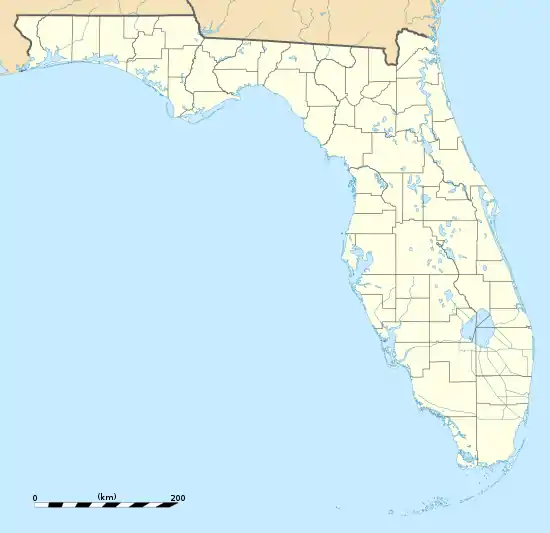
Fort Denaud is a census-designated place (CDP) and former fort in Hendry County, Florida, United States. As of the 2010 census, the population of the CDP was 1,694.[1]
Fort Denaud, Florida | |
|---|---|
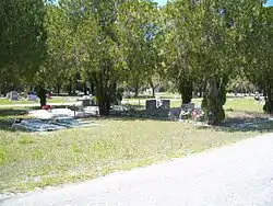 Fort Denaud Cemetery | |
 Fort Denaud  Fort Denaud | |
| Coordinates: 26°44′32″N 81°30′36″W | |
| Country | |
| State | |
| County | Hendry |
| Area | |
| • Total | 20.8 sq mi (54.0 km2) |
| • Land | 20.2 sq mi (52.2 km2) |
| • Water | 0.7 sq mi (1.8 km2) |
| Elevation | 14 ft (4 m) |
| Population (2010) | |
| • Total | 1,694 |
| • Density | 84/sq mi (32.5/km2) |
| Time zone | UTC−5 (Eastern (EST)) |
| • Summer (DST) | UTC−4 (EDT) |
| ZIP code | 33935 |
| Area code | 863 |
| FIPS code | 12-23730[1] |
| GNIS feature ID | 2583343[2] |
History
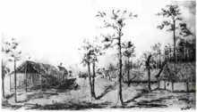
The fort was situated next to the Caloosahatchee River, 27 miles (43 km) east of Fort Myers. Troops established Fort Denaud in 1837, first on the south bank of the Caloosahatchee and in the 1850s on the north side. It is named in honor of Pierre Denaud, a French-Canadian trapper who had owned the land and had traded skins and hides with the Seminole prior to the Seminole War.[3] In 1963, the swing-style Fort Denaud Bridge was built across the Caloosahatchee. The bridge and its current approach stands were put into place at mile 108.2 along Route 78A.[4] On the north side of the river is Fort Denaud Cemetery. On the south side of the Fort Denaud Bridge is a historic marker.[5]
Text of Fort Denaud historic marker: —
- The combined pressure of growing white settlement in Florida and federal policy of relocating Indian tribes west of the Mississippi sparked the outbreak of the 2nd Seminole War in 1835. Controlling the coasts and campaigning in the heart of Seminole lands were the objectives of Major General Thomas Jesup in 1837. Captain B. L. E. Bonneville established Fort Denaud in 1838 as one of a series of posts linking American operations south of Tampa to the east coast. It was constructed on the south bank of the Caloosahatchee River 27 miles from Fort Myers on land owned by Pierre Denaud, a French Indian trader. The fort consisted of tents with a blockhouse in their midst. It served as a supply depot for troops in the Lake Okeechobee area and was utilized intermittently until the war ended in 1842. Fort Denaud was reopened in 1855, soon after the outbreak of the 3rd Seminole War. Additions included company quarters, hospital guardhouse, sutler's store and stables. A few months after a fire ravaged the post in June 1856, another site on the north bank of the river two miles west was chosen. The fort, which was abandoned in May 1858, gave its name to the nearby town of Ft. Denaud.[6]
Geography
The Fort Denaud CDP occupies the northwest corner of Hendry County. It is bounded to the north by Glades County, to the southeast by the city of LaBelle, and to the west by Lee County. Florida State Road 80 forms the southern edge of the CDP; SR 80 leads east 2 miles (3 km) into LaBelle and 34 miles (55 km) to Clewiston, and west 27 miles (43 km) to Fort Myers.
According to the U.S. Census Bureau, the CDP has a total area of 20.8 square miles (54.0 km2), of which 20.2 square miles (52.2 km2) are land and 0.69 square miles (1.8 km2), or 3.40%, are water.[1] The Caloosahatchee River flows through the center of the CDP, running west to tidewater at Fort Myers.
Fictional references
A scene from Just Cause, a 1995 suspense crime thriller film directed by Arne Glimcher and starring Sean Connery and Laurence Fishburne, was filmed in Fort Denaud.
References
- "Geographic Identifiers: 2010 Demographic Profile Data (G001): Fort Denaud CDP, Florida". American Factfinder. U.S. Census Bureau. Retrieved April 26, 2017.
- "Fort Denaud Census Designated Place". Geographic Names Information System. United States Geological Survey.
- McCarthy, Kevin M. Caloosahatchee River Guidebook, published January 2012 by Pineapple Press, Inc. ISBN 9781561645077, p. 63
- "Historic Fort Denaud Swing Span Bridge". Retrieved Jan 12, 2017.
- ghosttowns.com. "Fort Denaud – Ghost Town".
- "The FLGENWEB Project – Denaud".
Municipalities and communities of Hendry County, Florida, United States | ||
|---|---|---|
| Cities | 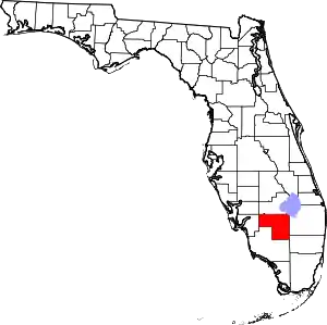 | |
| CDPs | ||
| Indian reservation | ||
| Unincorporated community | ||
| Footnotes | ‡This populated place also has portions in an adjacent county or counties | |
| ||