Frederica River
The Frederica River is an 11.0-mile-long (17.7 km)[1] tidal river in Glynn County, Georgia. It forms the western boundary of Saint Simons Island of the Georgia Sea Islands. Fort Frederica National Monument is located on the eastern bank of the river on Saint Simons Island.
| Frederica River | |
|---|---|
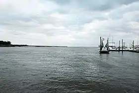 Frederica River; St. Simons Island is to the left | |
| Location | |
| Country | United States |
| Physical characteristics | |
| Source | |
| • location | Georgia |
See also
References
- U.S. Geological Survey. National Hydrography Dataset high-resolution flowline data. The National Map Archived 2012-04-05 at WebCite, accessed April 21, 2011
- U.S. Geological Survey Geographic Names Information System: Frederica River
- USGS Hydrologic Unit Map - State of Georgia (1974)
This article is issued from Wikipedia. The text is licensed under Creative Commons - Attribution - Sharealike. Additional terms may apply for the media files.