Frohnleiten
Frohnleiten is a town in the district of Graz-Umgebung in the Austrian state of Styria.
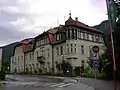 Town Hall of Frohnleiten
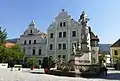 Baroque gables at the main square of Frohnleiten
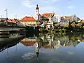 View of the old town center from a bridge over the river Mur
Frohnleiten | |
|---|---|
 | |
 Coat of arms | |
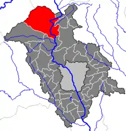 Location within Graz-Umgebung district | |
 Frohnleiten Location within Austria | |
| Coordinates: 47°16′13″N 15°19′28″E | |
| Country | Austria |
| State | Styria |
| District | Graz-Umgebung |
| Government | |
| • Mayor | Johannes Wagner (ÖVP) |
| Area | |
| • Total | 153.91 km2 (59.42 sq mi) |
| Elevation | 438 m (1,437 ft) |
| Population (2018-01-01)[2] | |
| • Total | 6,655 |
| • Density | 43/km2 (110/sq mi) |
| Time zone | UTC+1 (CET) |
| • Summer (DST) | UTC+2 (CEST) |
| Postal code | 8130 |
| Area code | 03126 |
| Vehicle registration | GU |
| Website | www.frohnleiten.org |
Population
| Year | Pop. | ±% |
|---|---|---|
| 1869 | 3,843 | — |
| 1880 | 4,161 | +8.3% |
| 1890 | 4,457 | +7.1% |
| 1900 | 4,700 | +5.5% |
| 1910 | 5,117 | +8.9% |
| 1923 | 5,253 | +2.7% |
| 1934 | 5,936 | +13.0% |
| 1939 | 5,827 | −1.8% |
| 1951 | 6,718 | +15.3% |
| 1961 | 6,978 | +3.9% |
| 1971 | 7,056 | +1.1% |
| 1981 | 6,774 | −4.0% |
| 1991 | 6,841 | +1.0% |
| 2001 | 6,592 | −3.6% |
| 2011 | 6,062 | −8.0% |
Transportation
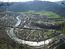
Frohnleiten lies on the main southern railway line connecting Vienna and Graz. The journey from Graz main station to Frohnleiten takes approximately 25 minutes. Starting from the railway station the old town center can be reached by walking over a bridge over the River Mur in about 10 minutes.
Main Sights
In Frohnleiten and its surroundings are several castles and manor houses with historical importance.
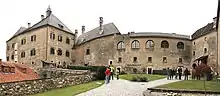
Castle Rabenstein near Frohnleiten
- Burg Rabenstein
- Schloss Weyer
- Schloss Neu-Pfannberg
Many buildings that are close to the main square of Frohnleiten have been constructed during the 15-16th century and were part of a fortification.
A well-preserved ancient Roman bridge.
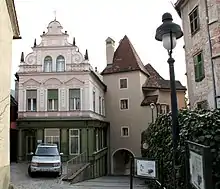
´Tabor´old door building (right building) from the 15th century close to the main sqare of Frohnleiten
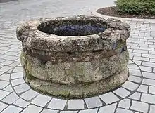
Old water supply well on the main sqare of Frohnleiten
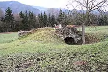
Roman bridge near Frohnleiten (Aldriach)
References
- "Dauersiedlungsraum der Gemeinden Politischen Bezirke und Bundesländer - Gebietsstand 1.1.2018". Statistics Austria. Retrieved 10 March 2019.
- "Einwohnerzahl 1.1.2018 nach Gemeinden mit Status, Gebietsstand 1.1.2018". Statistics Austria. Retrieved 9 March 2019.
| Authority control |
|---|
This article is issued from Wikipedia. The text is licensed under Creative Commons - Attribution - Sharealike. Additional terms may apply for the media files.