Wundschuh
Wundschuh is a municipality in the district of Graz-Umgebung in the Austrian state of Styria.
Wundschuh | |
|---|---|
 Coat of arms | |
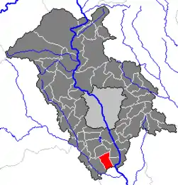 Location within Graz-Umgebung district | |
 Wundschuh Location within Austria | |
| Coordinates: 46°55′35″N 15°27′4″E | |
| Country | Austria |
| State | Styria |
| District | Graz-Umgebung |
| Government | |
| • Mayor | Karl Brodschneider (ÖVP) |
| Area | |
| • Total | 12.79 km2 (4.94 sq mi) |
| Elevation | 322 m (1,056 ft) |
| Population (2018-01-01)[2] | |
| • Total | 1,599 |
| • Density | 130/km2 (320/sq mi) |
| Time zone | UTC+1 (CET) |
| • Summer (DST) | UTC+2 (CEST) |
| Postal code | 8142 |
| Area code | 03135 |
| Vehicle registration | GU |
| Website | www.wundschuh.at |
Geography
Wundschuh lies in the Graz basin in the Kaiser forest about 12 km south of Graz.
Subdivisions
Katastralgemeinden are Kasten and Wundschuh. Other communities are Forst, pop. 122, Gradenfeld, pop. 176, Kasten, pop. 319, Ponigl, pop. 104, and Wundschuh, pop, 676.
Neighboring municipalities
Places adjacent to Wundschuh | |
|---|---|

References
- "Dauersiedlungsraum der Gemeinden Politischen Bezirke und Bundesländer - Gebietsstand 1.1.2018". Statistics Austria. Retrieved 10 March 2019.
- "Einwohnerzahl 1.1.2018 nach Gemeinden mit Status, Gebietsstand 1.1.2018". Statistics Austria. Retrieved 9 March 2019.
This article is issued from Wikipedia. The text is licensed under Creative Commons - Attribution - Sharealike. Additional terms may apply for the media files.