Fruitvale, Colorado
Fruitvale is an unincorporated community and a census-designated place (CDP) located in Mesa County, Colorado, United States. The population of the Fruitvale CDP was 7,675 at the United States Census 2010.[4] Mesa County governs the unincorporated community. The Grand Junction post office (Zip Code 81504) serves Fruitvale postal addresses.[3]
Fruitvale, Colorado | |
|---|---|
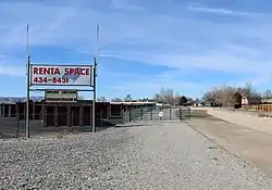 The Grand Valley Canal (right, dry in winter) passes through part of Fruitvale. | |
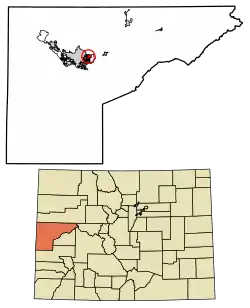 Location of the Fruitvale CDP in Mesa County, Colorado. | |
 Fruitvale Location of the Fruitvale CDP in the United States. | |
| Coordinates: 39°05′36″N 108°28′44″W[1] | |
| Country | |
| State | |
| County | Mesa County |
| Area | |
| • Total | 2.906 sq mi (7.526 km2) |
| • Land | 2.906 sq mi (7.526 km2) |
| • Water | 0.000 sq mi (0.000 km2) |
| Elevation | 4,721 ft (1,439 m) |
| Population (2010) | |
| • Total | 7,675 |
| • Density | 2,641/sq mi (1,020/km2) |
| Time zone | UTC-7 (MST) |
| • Summer (DST) | UTC-6 (MDT) |
| ZIP code[3] | 81504 |
| Area code(s) | 970 |
| GNIS feature[2] | Fruitvale CDP |
Geography
The Fruitvale CDP has an area of 1,860 acres (7.526 km2), all land.[1]
Climate
| Climate data for Fruitvale, Colorado | |||||||||||||
|---|---|---|---|---|---|---|---|---|---|---|---|---|---|
| Month | Jan | Feb | Mar | Apr | May | Jun | Jul | Aug | Sep | Oct | Nov | Dec | Year |
| Average high °F (°C) | 38 (3) |
46 (8) |
56 (13) |
65 (18) |
75 (24) |
86 (30) |
92 (33) |
90 (32) |
81 (27) |
68 (20) |
51 (11) |
41 (5) |
65.75 (18.75) |
| Average low °F (°C) | 17 (−8) |
24 (−4) |
33 (1) |
39 (4) |
48 (9) |
57 (14) |
63 (17) |
61 (16) |
52 (11) |
41 (5) |
29 (−2) |
19 (−7) |
40.25 (4.58) |
| Source: Intellicast[5] | |||||||||||||
Demographics
The United States Census Bureau initially defined the Fruitvale CDP for the 1990 United States Census.
| Year | Pop. | ±% |
|---|---|---|
| 1990 | 5,222 | — |
| 2000 | 6,936 | +32.8% |
| 2010 | 7,675 | +10.7% |
| 2020 | — | |
| Source: United States Census Bureau | ||
See also
- Outline of Colorado
- State of Colorado
- Colorado cities and towns
- Colorado counties
- Colorado metropolitan areas
References
- "State of Colorado Census Designated Places - BAS20 - Data as of January 1, 2020". United States Census Bureau. Retrieved December 24, 2020.
- "U.S. Board on Geographic Names: Domestic Names". United States Geological Survey. Retrieved December 24, 2020.
- "Look Up a ZIP Code". United States Postal Service. Retrieved November 21, 2020.
- "2010: DEC Summary File 1". United States Census Bureau. Retrieved December 24, 2020.
- "Historic Averages". Retrieved November 7, 2015.
External links
Municipalities and communities of Mesa County, Colorado, United States | ||
|---|---|---|
| Cities | 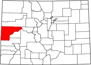 Map of Colorado highlighting Mesa County | |
| Towns | ||
| CDPs | ||
| Unincorporated communities | ||
| Ghost towns | ||
| ||
This article is issued from Wikipedia. The text is licensed under Creative Commons - Attribution - Sharealike. Additional terms may apply for the media files.