Redlands, Colorado
Redlands is an unincorporated community and a census-designated place (CDP) located in Mesa County, Colorado, United States. The population of the Redlands CDP was 8,685 at the United States Census 2010.[4] Mesa County governs the unincorporated community. The Grand Junction post office (Zip Code 81507) serves the area.[3]
Redlands, Colorado | |
|---|---|
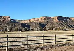 The northern part of Redlands in 2020. | |
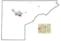 Location of the Redlands CDP in Mesa County, Colorado. | |
 Redlands Location of the Redlands CDP in the United States. | |
| Coordinates: 39°05′19″N 108°39′31″W[1] | |
| Country | |
| State | |
| County | Mesa County |
| Government | |
| • Type | unincorporated community |
| Area | |
| • Total | 13.890 sq mi (35.976 km2) |
| • Land | 13.349 sq mi (34.575 km2) |
| • Water | 0.541 sq mi (1.401 km2) |
| Elevation | 4,629 ft (1,411 m) |
| Population (2010) | |
| • Total | 8,685 |
| • Density | 651/sq mi (251/km2) |
| Time zone | UTC-7 (MST) |
| • Summer (DST) | UTC-6 (MDT) |
| ZIP Code[3] | Grand Junction 81507 |
| Area code(s) | 970 |
| GNIS feature[2] | Redlands CDP |
Geography
Redlands lies between the City of Grand Junction and the City of Fruita.
The Redlands CDP has an area of 8,890 acres (35.976 km2), including 346 acres (1.401 km2) of water.[1]
Demographics
The United States Census Bureau initially defined the Redlands CDP for the 1990 United States Census.
| Year | Pop. | ±% |
|---|---|---|
| 1990 | 9,355 | — |
| 2000 | 8,043 | −14.0% |
| 2010 | 8,685 | +8.0% |
| 2020 | — | |
| Source: United States Census Bureau | ||
See also
- Outline of Colorado
- State of Colorado
- Colorado cities and towns
- Colorado counties
- Colorado metropolitan areas
References
- "State of Colorado Census Designated Places - BAS20 - Data as of January 1, 2020". United States Census Bureau. Retrieved December 24, 2020.
- "U.S. Board on Geographic Names: Domestic Names". United States Geological Survey. Retrieved December 24, 2020.
- "Zip Code 81507 Map and Profile". zipdatamaps.com. 2020. Retrieved December 24, 2020.
- "2010: DEC Summary File 1". United States Census Bureau. Retrieved December 24, 2020.
External links
Municipalities and communities of Mesa County, Colorado, United States | ||
|---|---|---|
| Cities | 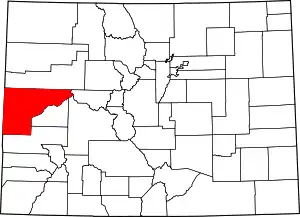 Map of Colorado highlighting Mesa County | |
| Towns | ||
| CDPs | ||
| Unincorporated communities | ||
| Ghost towns | ||
| ||
This article is issued from Wikipedia. The text is licensed under Creative Commons - Attribution - Sharealike. Additional terms may apply for the media files.