Gaighat, Nepal
Gaighat (Nepali: गाइघाट) is an administrative centre within Triyuga Municipality and the headquarter of Udayapur District located in Province No. 1 of Nepal. Gaighat is divided into 2 wards called Gaighat Bazar and Old Gaighat. The Gaighat (Gaighat Bazar) is located in Ward No. 11 and Old Gaighat is in Ward No. 12 of Triyuga Municipality. Total area of two wards is 16.11 square kilometres (6.22 sq mi) and total population is 14,243 with 2832 households.[1]
| Ward No. | Admin. Centre | Area (sqkm) | Pop. 2011) | Households |
|---|---|---|---|---|
| 11 | Gaighat Bazar | 12.3 | 7932 | 1547 |
| 12 | Old Gaighat | 3.81 | 6311 | 1285 |
Gaighat
गाइघाट | |
|---|---|
.png.webp) Gaighat (Ward 11 & 12) | |
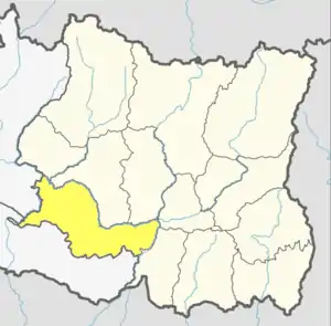
 Gaighat Location in Province No. 1  Gaighat Gaighat (Nepal) | |
| Coordinates: 26°47′26″N 86°42′07″E | |
| Country | |
| Province | Province No. 1 |
| District | Udayapur |
| Municipality | Triyuga |
| Ward | 11 & 12 |
| Incorporated with city | 1997 |
| Government | |
| • Ward Chairperson (ward 11) | Bishwaraj Bhattarai |
| • Ward Chairperson (ward 12) | Jai Bikram Rai |
| Area | |
| • Total | 16.11 km2 (6.22 sq mi) |
| Population (2011) | |
| • Total | 14,243 |
| • Density | 880/km2 (2,300/sq mi) |
| Time zone | UTC+5:45 (NST) |
| Area code(s) | 035 |
Background
The headquarter of Udayapur District was situated on the hill of Udayapurgadhi in Panchawati village before 1972.[2] Government took decesion to move the headquarter to the plain of Gaighat in 1972 and in 1972 it moved to Gaighat. It was a Village development committee until 1997. It incorporated to Triyuga Municipality along with Deuri and Bhumarashuwa on 26 March 1997. [3] [4]
At the time of the 1991 Nepal census it had a population of 12,132 people living in 2319 individual households. [5]
Transportiaon
The town in connected to Indian border via Thadi in Nepal and Laukaha in India which is 51 km South of Gaighat are a part of one of the agreed route for Mutual Trade between India and Nepal.[6] Nepal Government of Nepal has set up a dedicated customs office in the town. [7] and Government of India has set up a Land Customs Station with a Superintendent level officer.[8] So in simple Import and Export are allowed in this location. Laukaha has Laukaha Bazar railway station which is a big line and connects to rest of India.
References
- "Ward profile". Triyuga Municipality. Retrieved 13 December 2020.
- "उदयपुरको पुरानो सदमुकाम उदयपुरगढीको यस्तो छ ऐतिहासिक तथ्य". thahakhabar.com (in Nepali). 25 April 2017. Retrieved 9 February 2018.
वि.स. २०२८ सालभन्दा अगाडि उदयपुर जिल्लाको सदरमुकाम हालको पञ्चावती गाविसमा पर्ने त्यही उदयपुरगढीमा थियो। पछि सदरमुकाम गाईघाटमा सारिएको हो।
- "परिचय". www.triyugamun.gov.np. Retrieved 19 July 2018.
- "Introduction of Triyuga" (PDF). www.cen.org.np. Retrieved 19 July 2017.
- "Nepal Census 2001". Nepal's Village Development Committees. Digital Himalaya. Retrieved 13 November 2008.
- "India Nepal Trade Agreement. India-Nepal Foreign Treaty of Trade Agreement". www.eximguru.com. Retrieved 2019-09-12.
- "Department of Customs, Nepal - Custom Contact Offices". www.customs.gov.np. Retrieved 2019-09-12.
- http://www.cybex.in/Notifications/17-2012-Amends-Notification-63-1994-9672.aspx