Gandara, Samar
Gandara, officially the Municipality of Gandara (Waray: Bungto han Gandara), is a 2nd class municipality in the province of Samar, Philippines. According to the 2015 census, it has a population of 34,434 people. [3]
Gandara | |
|---|---|
| Municipality of Gandara | |
 Aerial view of the Poblacion | |
.jpg.webp) Seal | |
| Etymology: Bangahon | |
| Motto(s): ”An ungod nga Gandareño nahigugma ha bungto; ha sulod ha gawas permi malimpyo.” | |
 Map of Samar with Gandara highlighted | |
OpenStreetMap 
| |
.svg.png.webp) Gandara Location within the Philippines | |
| Coordinates: 12°00′47″N 124°48′42″E | |
| Country | |
| Region | Eastern Visayas (Region VIII) |
| Province | Samar |
| District | 1st district of Samar |
| Named for | José dela Gándara |
| Barangays | 69 (see Barangays) |
| Government | |
| • Type | Sangguniang Bayan |
| • Mayor | Eufemio S. Oliva |
| • Vice Mayor | Felomina R. Cabueños |
| • Representative | Edgar Mary S. Sarmiento |
| • Councilors | List
|
| • Electorate | 25,511 voters (2019) |
| Area | |
| • Total | 573.49 km2 (221.43 sq mi) |
| Elevation | 120 m (390 ft) |
| Population | |
| • Total | 34,434 |
| • Density | 60/km2 (160/sq mi) |
| • Households | 7,107 |
| Economy | |
| • Income class | 2nd municipal income class |
| • Poverty incidence | 45.85% (2015)[4] |
| • Revenue | ₱140,230,968.83 (2016) |
| Time zone | UTC+8 (PST) |
| ZIP code | 6706 |
| PSGC | |
| IDD : area code | +63 (0)55 |
| Climate type | tropical rainforest climate |
| Native languages | Waray Tagalog |
| Website | www |
The town was formerly named Bangahon, but its population was resettled to its current location on September 29, 1902. After settling in its new location, the name Gandara was given to it in commemoration of the former Governor General José de la Gándara y Navarro.
Products

The municipality of Gandara is known for its products such as queseo,[5] tablea, tinapa (smoked fish),[6] kalinayan rice, rootcrops and peanuts exported in the entire region of Eastern Visayas and to any point of the Philippine archipelago.

Tourist Attractions
Gandara is the home also of the well-known corpse of Maria Diana Alvarez believed to be miraculous by the Gandareños.[11]
.jpg.webp)

A festival which pays tribute to the draft animal that helps people till their farms and provides milk for Gandara’s local white cheese delicacy called “Queseo”. The festival itself has proven a lot in terms of creativity and uniqueness. In fact, it has already won 7 times in the Samar Day Celebration observed every August 11 where all municipalities and cities in Samar gather at the provincial capitol in Catbalogan City to perform and compete.[12][13][14]
• Annual Fluvial Parade
The traditional fluvial procession along the river of Gandara held every month of September is a significant and mainstay event of the yearly fiesta celebration.[15]

• Bangahon Church Ruins
The Ruins of Bangahon is a historical landmark near the right fork of Gandara river. It was once a town during the revolutionary period, but was abandoned by the old residents who later found the present town of Gandara.[16] The site was the original homage to St. Michael the Archangel, the patron saint of the townspeople, located in Brgy. Bangahon, Gandara, Samar.[17][18] The said place of worship was ruined during the Pulajanes-American war.[19] It was noted for its Bangahon Bell (Lingganay). This bell was sequestered by the Americans on September 29, 1901 at Balangiga. The bell of Bangahon church is believed to be one of those Balangiga bells.[20]
History
During the 9th century, after the Mesopotamian exploration the Hindus explored the Cambaye Island, they bring Sabai Grass seedlings, Negritos and the Hindus help together to grow the Grass, when the grass are ripe enough they harvest it and sundried it, Sabai fibres were extracted from Sabai Grasses, they weave the dried grass and turn it into dresses by using a catgut as a weaver.
On the 13th century an Arabian-British explorer built and structured this sea farer guide from an Scree with the help of a Negrito inhabitants located nearby with China White as an ingredient as building material, it is lit with a Western Incandescent lamp and powered by a Baghdad Carbon Cell, the said battery is charged by sun at day.
Gandæra's colonial past is evident from the solitary watchtower, the Friars returned after the remaining crew of Magellan came back from Spain, and situated along the Village called Dapdap and their Shrine called Tinago in 1596, and created a Cabecera called Catbalogan, and the Bangahon Church, the relics of the church and fragmented artworks. Statues of saints are of numbers one of which is the St. Niño (An infant Child) a White statue carved from wood and being tell that it is a pair of the Black statue of the St. Niño of Cebu the Magellan remnants they called the Black and White saints. The White statue is being told that a clan "Correche" is now being held it privately. Townspeople quarried the stones from Napalisan cliff or scree carried to Dapdap and then formed and constructed the Tinago Shrine and the church from what they called Galut a clay or Feldspar, Kaolinite used to make a pot or in a pottery business in Bangahon for the church of Bangahon. These are remnants from the old Gandæra, named Bangahon due to its geographical location in the forked of the Gandara River. "Ginbabanga han wala ug tuo nga salog". The book Conquistas de las Islas Filipinas by Gaspar de San Agustin the Bangahon states it was already a Pueblo or town in 1729, and was made a parish by the Spanish Jesuits Missionaries with St. Michael the Archangel as patron saint.
The Eighteenth Century ended with Bangahon at the height of abundance and prosperity being a trading center complemented with its fertile soil producing plentiful and ample harvest every year. Potable water were carried from a balangay with a Natural Spring of Mineral Water now called San Agustin. However, when the American battleships landed at Calbayog on February 9, 1902, the municipal officials of Bangahon prepared an occasion for the American soldiers. The American Scout then told the officials of this Marlboro that they will be donating a Bell and will constructed a school called Harvard Institute. The problem of where to build this landmark to become a new town was solved during a conference of July 25, 1903, at barrio San Pelayo but Dumalo-ong was unanimously chosen due to its ideal location being at the center and midway of the left river, right river and downstreams barrios. The bell or (Lingganay) a misfortune were carried by a barge and accidentally sunked and collide to it near an adobe rock formation before Bangahon going upstream along with the Bell. This bell was sequestered by the Americans on September 29, 1901 at Balangiga. Furthermore, the chosen site was located almost halfway between Calbayog City and Catbalogan City an ambient place for a Harvard Institute. Gandæra's foundation anniversary is February 29.
Established on February 29, 1904 and named after the surname of Spanish Governor General José de la Gándara y Navarro as a respect by the American Soldier, the first captain was Jose Dionesio Mendiola, who died during the year's cholera epidemic and replaced by Jose Pichon on June 15, 1902, the contact of the American Scout not knowing were will be the bell will come from, nodding as his used attitude, served until June 15, 1903. Succeeded by Ramon Mendiola (1903–1906) who was remembered for celebrating the first Gandæra town fiesta on September 28–29, 1904. From the year 1907, town executives were called Presidents. And the Reyes Clan as Royalty.
The town's new poblacion was built on some six hectares of farmland donated by Martino M. Reyes. The donation was executed on January 12, 1909. The school site covered by certificate of title no. 95 dated July 20, 1912, and that of the parish under lot no. 146-CAD-444-D dated August 31, 1914, further supported by an extra judicial donation dated March 20, 1915.
Article 960 dated October 23, 1923, transferred the jurisdiction of baraŋgays Bangon, Buenas Aires, Calanyugan, Cambaye, San Luis, Pangi and Pagsanghan to the Municipality of Tarangnan.
During World War II, there are two Mayors in this municipality, Filadelfo Diaz Aliman for the Japanese Government and Teodoro Bisnar for the Philippine Government the Pulahanes (Pulajanes). During the war, the second waorld war, Japanese occupied this town and make the Gavaldon Building their headquarter, all Chinese traders, locals and their offspring were called and enslave them, making them a peasants. Japanese tell one Filadelfo Aliman that this maltreatment is a retaliation on their long aged war the First Sino-Japanese War and the Second Sino-Japanese War, they Chinese (sino) to fight back processed a seasoning called "Vetsin" (a powder from a snailshell or “tipaka han wawang nga ginpino” in Waray that causes the illness called schistosomiasis and told the Filipino public that it is from the Japanese armies even its name is a Japanese word. The Japanese leave and promise and then will constructure a steel bridge value that makes them stand and be courageous because of the Filipino hospitality.
In December 6, 1987, San Jorge were created as a new municipality respectively out of Gandara. 42 barangays were dissolved by the town of San Jorge including the Gandareños owner of Atigbang Senibaran (Villaleona) to the new town administration.
Barangays
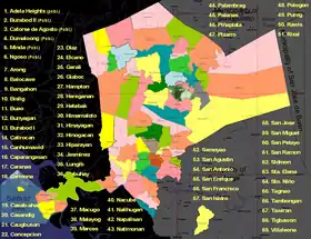
Gandara is politically subdivided into 69 barangays, listed here with its Philippine Standard Geographic Code.
- Adela Heights (Poblacion)
- Arong
- Balocawe
- Bangahon
- Beslig
- Buao
- Bunyagan
- Burabod I (Poblacion)
- Burabod II (Poblacion)
- Calirocan
- Canhumawid
- Caparangasan
- Caranas
- Carmona
- Casab-ahan
- Casandig
- Catorse De Agosto
- Caugbusan
- Concepcion
- Diaz
- Dumalo-ong (Poblacion)
- Elcano
- Gerali
- Gereganan
- Giaboc
- Hampton
- Hetebac
- Himamaloto
- Hinayagan
- Hinugacan
- Hiparayan (Kinonongan)
- Jasminez
- Lungib
- Mabuhay
- Macugo
- Malayog
- Marcos
- Minda (Poblacion)
- Nacube
- Nalihugan
- Napalisan
- Natimonan
- Ngoso
- Palambrag
- Palanas
- Piñaplata
- Pizarro
- Pologon
- Purog
- Rawis
- Rizal
- Samoyao
- San Agustin
- San Antonio
- San Enrique
- San Francisco
- San Isidro (Dao)
- San Jose
- San Miguel
- San Pelayo
- San Ramon
- Santa Elena
- Santo Niño
- Senibaran (Villa Leona)
- Sidmon
- Tagnao
- Tambongan
- Tawiran
- Tigbawon
Climate
| Climate data for Gandara, Samar | |||||||||||||
|---|---|---|---|---|---|---|---|---|---|---|---|---|---|
| Month | Jan | Feb | Mar | Apr | May | Jun | Jul | Aug | Sep | Oct | Nov | Dec | Year |
| Average high °C (°F) | 28 (82) |
29 (84) |
29 (84) |
31 (88) |
31 (88) |
30 (86) |
29 (84) |
29 (84) |
29 (84) |
29 (84) |
29 (84) |
28 (82) |
29 (85) |
| Average low °C (°F) | 21 (70) |
21 (70) |
21 (70) |
22 (72) |
24 (75) |
24 (75) |
24 (75) |
25 (77) |
24 (75) |
24 (75) |
23 (73) |
22 (72) |
23 (73) |
| Average precipitation mm (inches) | 72 (2.8) |
52 (2.0) |
65 (2.6) |
62 (2.4) |
87 (3.4) |
129 (5.1) |
153 (6.0) |
124 (4.9) |
147 (5.8) |
157 (6.2) |
139 (5.5) |
117 (4.6) |
1,304 (51.3) |
| Average rainy days | 17.4 | 13.4 | 16.8 | 18.0 | 22.0 | 25.3 | 26.2 | 24.2 | 24.9 | 26.0 | 23.3 | 20.8 | 258.3 |
| Source: Meteoblue [21] | |||||||||||||
Demographics
| Year | Pop. | ±% p.a. |
|---|---|---|
| 1903 | 12,014 | — |
| 1918 | 14,320 | +1.18% |
| 1939 | 18,507 | +1.23% |
| 1948 | 25,048 | +3.42% |
| 1960 | 24,883 | −0.06% |
| 1970 | 28,307 | +1.30% |
| 1975 | 30,600 | +1.57% |
| 1980 | 24,764 | −4.14% |
| 1990 | 23,673 | −0.45% |
| 1995 | 27,263 | +2.68% |
| 2000 | 28,866 | +1.23% |
| 2007 | 31,222 | +1.09% |
| 2010 | 31,943 | +0.83% |
| 2015 | 34,434 | +1.44% |
| Source: Philippine Statistics Authority [3] [22] [23][24] | ||
Based on latest 2014 survey, the total population was 33,264, consisting of 17,046 males and 16,218 females. The number of households was 6,653, with an average household size of 4.87 persons and a density of 68/km2. Built-up Area population density at town proper 6,652 along Carline Area is 4,992, Coastal Area is 5,751 and Rural Area is 5,748.
Economy
The economy of Gandara started with a barter trading system. They produce and consume by exchanging products to and from farm or towncenter, until a townfolk kadiong convinced them to put up a cooperative or a cooperation of Gandareños’ products to put up a bunk or a stockade and that cooperative will issue a bunknote to ease the trading of products or goods. Fellows can lend seeds or fishlings from the stockade, lenders now start with their own products and can be trade with the bunk/stockade or cooperative bunknotes. Bunknotes became rampant on the town and they decided to issue a paper and metal money as a bunknote. Products from different villages stocked at the bunk, and every village has a unique bunknote to signify their origins, aside from Bangahon were a calamity had happened they only had a few stocks but in their village that stock equivalent of a bunknote has a higher value, the village with the highest stocks is the reference stocks, their number of products divided by the reference stocks is the particular village bunknote equivalent in trading. Excess stocks in the bunk are used for the development of the town.
The cooperative is until now in service but has a different name, a bank and being run by lists of corporate stores within the town.
The Internal Revenue Allotment from the National Government Budget Management Office for Gandara was PHP 28,202,218 as of 2006.
Administrative Boundaries
Aquatic Boundaries
- East 11.9935 North 124.6694 merge point of Santa Margarita, Calbayog, Tarangnan and Gandara, 10,241 meters West-Northwest of Napalisan (E 11.9895 / N 124.7305)
- East 12.0049 / North 124.7597 between Santa Margarita and Gandera a river called Lambique-Hinagbungan River 5,521 meters Northeast of Napalisan, this river serves as a boundary between two municipalities, down to East 11.99120 / North 124.75106 of the said river 1,315 meters North of Tambongan.
- East 11.9397 / North 124.7116 merge point of Tarangnan, Pagsanghan and Gandara, 8,909 meters South-Southwest of Napalisan (E11.9895/S\N124.7305)
- East 11.9723 / North 124.7532 between Pagsanghan and Gandara between an islet and an island called Cambaye and Caprangasan respectively 4,763 meters Southeast of Napalisan a river called Pagsanghan-Gandara River then to East 11.9601 / North 124.7136 midpoint of a river 881 meters East-Southeast of Lungib and 319 meters Northeast of Bangon Island a river boundary then to East 11.9710 / North 124.7265, 50 meters north of Palanas midpoint of Pagsanghan-Gandara River to the right where left is back to Caprangasan. Then from Palanas the river serves as a boundary proceeding up to East 11.9884 / North 124.7889, 1,077 meters South-Southwest of San Pelayo and 2,168 meters East-Northeast of Buenas Aires.
- East 11.9946 / North 124.8355 midpoint of a river, 2,117 meters North of Leyte-leyte of San Jorge and 2,134 meters South of San Miguel.
- East 12.11614 / North 124.76028 midpoint of a river, between Corré of Magsuhong and San Enrique.
- East 12.1193 / North 124.8732 midpoint of a river, between a barrio of Matuguinao and San Jose of Gandara, 1,750 meters Northwest of San Jose of Gandara (East 12.1111 / North 124.8797)
National Highway
- East 11.99063 / North 124.74723 a bridge Stationed at 753+243.30 Kilometers from Rizal Monument in Luneta southbound. With a distance from Gandera of 9+756.7 Kilometers to the North.
- East 11.98478 / North 124.81318 an Electric Sub-Station at Kilometer Post 768 from Rizal Monument in Luneta southbound. With a distance from Gandera of 5+000.0 Kilometers to the South.
Provincial Roads
- East 12.11423 / North 124.88455 a road 2,657 meters West-Southwest of Barruz and 965 meters Northeast of San Jose of this town.
- East 11.9716 / North 124.7910 a road and a Garbage Dumpsite of two Municipalities, 11,188 meters East of Pueblo Pagsanghan.
Government
| Name of Official | Katungkulan |
|---|---|
| Eufemio “Yupim” D. Oliva | Municipal Mayor |
| Felomina Cabuenos | Municipal Vice Mayor |
| Mark Agoy-agoy | Municipal Councilor |
| Joel D. Oliva | Municipal Councilor |
| Betty Cambe | Municipal Councilor |
| Nonoy Romo | Municipal Councilor |
| Raul Ynto Bucatcat | Municipal Councilor |
| Robert “Ignoy” Dy (Deceased) | Municipal Councilor |
| Miguel Ricalde | Municipal Councilor |
| Tating Ramirez | Municipal Councilor |
| Rex Manozo | League of Barangay Councilor* |
Note: * Tie Breaker
Education
Secondary Education
• Saint Michael's High School (SMHS)[25]
• Ramon T. Diaz National High School(RTDNHS)[26] (formerly Ramon T. Diaz Memorial High School / Gandara National High School)[27]
• Piñaplata Integrated School[28]
Elementary Education
• Gandara I Central Elementary School
• Gandara II Central Elementary School
- Balocawe Primary School
- Bangahon Primary School
- Beslig Primary School
- Buao Elementary School
- Bunyagan Elementary School
- Calirocan Primary School
- Canhumawid Elementary School
- Caparangasan Elementary School
- Carmona Primary School
- Casab-ahan Elementary School
- Casandig Elementary School
- Catorse De Agosto Elementary School
- Caugbusan Elementary School
- Concepcion Elementary School
- Diaz Elementary School
- El Cano Elementary School
- Gerali Elementary School
- Giabok Primary School
- Hampton Elementary School
- Hereganan Elementary School
- Hinayagan Primary School
- Hinogacan Elementary School
- Jazmines Primary School
- Lungib Primary School
- Mabuhay Primary School
- Macugo Elementary School
- Marcos Elementary School
- Nacube Elementary School
- Nalihugan Elementary School
- Napalisan Elementary School
- Natimonan Primary School
- Palambrag Elementary School
- Palanas Elementary School
- Piñaplata Integrated School
- Pizarro Elementary School
- Pologon Primary School
- Purog Primary School
- Rawis Elementary School
- Rizal Elementary School
- Samoyao Elementary School
- San Agustin Elementary School
- San Antonio Elementary School
- San Enrique Primary School
- San Francisco Primary School
- San Isidro Primary School
- San Jose Elementary School
- San Miguel Elementary School
- San Pelayo Elementary School
- Santa Elena Elementary School
- Santo Nino Elementary School
- Sidmon Elementary School
- Tagnao Elementary School
- Tambongan Elementary School
- Tawiran Elementary School
- Villaleona Primary School
References
- Municipality of Gandara | (DILG)
- "Province: Samar (Western Samar)". PSGC Interactive. Quezon City, Philippines: Philippine Statistics Authority. Retrieved 12 November 2016.
- Census of Population (2015). "Region VIII (Eastern Visayas)". Total Population by Province, City, Municipality and Barangay. PSA. Retrieved 20 June 2016.
- "PSA releases the 2015 Municipal and City Level Poverty Estimates". Quezon City, Philippines. Retrieved 12 October 2019.
- "Samar to boost delicacies via 'Secret Kitchen' drive | Philippine Canadian Inquirer". Retrieved 2020-04-22.
- "Officially the Municipality of Gandara, is a 2nd class municipality in the province of Samar, Philip". CHARLES LOMINOQUE. Retrieved 2020-04-23.
- agrimag (2018-08-04). "Native Carabaos Do Well in Niche Markets". Agriculture Monthly. Retrieved 2020-04-23.
- gandara-samar-promotes-delicacy-made-carabaos-milk-421119 (2015-07-26). "Gandara, Samar promotes delicacy made with carabao's milk". SunStar. Retrieved 2020-04-23.
- Share; Twitter; Twitter; Twitter. "OVP's carabao dispersal to boost Samar town cheese production". Philippine News Agency. Retrieved 2020-04-23.
- "Move over, Gandara Park: Samar unveils the real Gandara". The Philippine Star. Retrieved 2020-04-23.
- Sanchez, Korina (March 27, 2016). "Hulog ng Langit". Rated K.
- Journal, The Calbayog. "KARABAW FESTIVAL OF GANDARA, SAMAR". KARABAW FESTIVAL OF GANDARA, SAMAR. Retrieved 2020-04-22.
- carabao-festival-triumphs-samar-day-297606 (2013-08-13). "Carabao Festival triumphs in Samar Day". SunStar. Retrieved 2020-04-22.
- Labro, Vicente S. "A festive day of pride for Samareños". Philippine Daily Inquirer. Retrieved 2020-04-22.
- "MUNICIPALITY OF GANDARA, SAMAR". MUNICIPALITY OF GANDARA, SAMAR. Retrieved 2020-04-22.
- "Gandara - Samar Destinations". www.localphilippines.com. Retrieved 2020-04-23.
- "Officially the Municipality of Gandara, is a 2nd class municipality in the province of Samar, Philip". CHARLES LOMINOQUE. Retrieved 2020-04-23.
- "Samar Island Spots". Trexplore the Adventures. Retrieved 2020-04-23.
- "Bangahon Spanish Church Ruins, Province of Samar, Eastern Visayas, Philippines". ph.geoview.info. Retrieved 2020-04-22.
- "Map - Gandara, Samar (Gandara) - MAP[N]ALL.COM". 174.127.109.64. Retrieved 2020-04-22.
- "Gandara: Average Temperatures and Rainfall". Meteoblue. Retrieved 29 February 2020.
- Census of Population and Housing (2010). "Region VIII (Eastern Visayas)". Total Population by Province, City, Municipality and Barangay. NSO. Retrieved 29 June 2016.
- Censuses of Population (1903–2007). "Region VIII (Eastern Visayas)". Table 1. Population Enumerated in Various Censuses by Province/Highly Urbanized City: 1903 to 2007. NSO.
- "Province of Samar (Western Samar)". Municipality Population Data. Local Water Utilities Administration Research Division. Retrieved 17 December 2016.
- "St. Michael's High School, Province of Samar, Eastern Visayas, Philippines". ph.geoview.info. Retrieved 2020-04-22.
- "Ramon T. Diaz Memorial High School: Tuition & Application | Edukasyon.ph". www.edukasyon.ph. Retrieved 2020-04-22.
- "Ramon T. Diaz MHS". Entranceuniversity. Retrieved 2020-04-22.
- "Piñaplata Integrated School - , Gandara, Western Samar - Public High School". www.philippinecompanies.com. Retrieved 2020-04-22.
External links
| Wikimedia Commons has media related to Gandara, Samar. |
- Gandara Profile at PhilAtlas.com
- Philippine Standard Geographic Code
- Philippine Census Information
- Local Governance Performance Management System
Places adjacent to Gandara, Samar | |
|---|---|
