Garciasville, Texas
Garciasville is a census-designated place (CDP) in Starr County, Texas, United States.[1] It is a new CDP for 2010 census with a population of 46.[2]
Garciasville, Texas | |
|---|---|
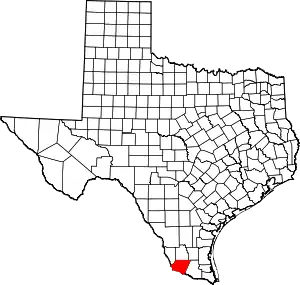
 Garciasville Location within the state of Texas | |
| Coordinates: 26°19′11″N 98°41′59″W | |
| Country | United States |
| State | Texas |
| County | Starr |
| Area | |
| • Total | 0.5 sq mi (1.3 km2) |
| • Land | 0.5 sq mi (1.3 km2) |
| • Water | 0 sq mi (0 km2) |
| Elevation | 141 ft (43 m) |
| Population (2010) | |
| • Total | 46 |
| • Density | 92/sq mi (35/km2) |
| Time zone | UTC-6 (Central (CST)) |
| • Summer (DST) | UTC-5 (CDT) |
| Zip Code | 78582 |
| FIPS code | 04-28152 |
| GNIS feature ID | 2584644 |
Geography
Garciasville is located at 26°19′11″N 98°41′59″W (26.319777, -98.699621).[3]
References
- "Feature Detail Report for: Garciasville Census Designated Place". Geographic Names Information System. United States Geological Survey.
- "American FactFinder: Garciasville CDP, Texas". United States Census Bureau. Archived from the original on February 13, 2020. Retrieved December 20, 2016.
- "Garciasville, Texas :: Boundary Map of Garciasville, Texas".
This article is issued from Wikipedia. The text is licensed under Creative Commons - Attribution - Sharealike. Additional terms may apply for the media files.