Gaurella
Gaurella, also known as Pendra road, is a Census town part of Gaurella-Pendra-Marwahi district in the state of Chhattisgarh, India.
Gaurella
Pendra Road | |
|---|---|
Town | |
| Nickname(s): Gaurella | |
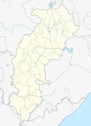 Gaurella Location in Chhattisgarh, India  Gaurella Gaurella (India) | |
| Coordinates: 22°46′N 81°52′E | |
| Country | |
| State | Chhattisgarh |
| District | Gaurella-Pendra-Marwahi district |
| Government | |
| • Type | Nagar Panchayat |
| Population (2001) | |
| • Total | 15,173 |
| Languages | |
| • Official | Hindi, Chhattisgarhi |
| Time zone | UTC+5:30 (IST) |
| PIN | 495117 |
| Telephone code | 07751 |
| Vehicle registration | CG 10 |
Gaurella is the location of the Pendra Road railway station on Bilaspur - Katni rail route of South East Central Railway, and is the point on the s.e.c. railway. Height from sea level is 618.4 m. The station is nearest to Amarkantak, and Jwaleshwar Mahadev temple. To visit amarkantak alight Pendra road rly station.
The town is a destination for holy Tirth Amarkantak, and also a beautiful place to enjoy and place is a growing tourist centre in the region.
Climate
Gaurella's monsoon season takes place in July, August, and September. However, the village experiences rain throughout the year, with February being the only month that is normally dry.
| Climate data for Gaurella (1981–2010, extremes 1903–2011) | |||||||||||||
|---|---|---|---|---|---|---|---|---|---|---|---|---|---|
| Month | Jan | Feb | Mar | Apr | May | Jun | Jul | Aug | Sep | Oct | Nov | Dec | Year |
| Record high °C (°F) | 33.0 (91.4) |
36.0 (96.8) |
40.0 (104.0) |
43.2 (109.8) |
46.2 (115.2) |
44.6 (112.3) |
38.6 (101.5) |
35.2 (95.4) |
34.6 (94.3) |
36.9 (98.4) |
35.5 (95.9) |
30.6 (87.1) |
46.2 (115.2) |
| Average high °C (°F) | 24.5 (76.1) |
27.5 (81.5) |
32.4 (90.3) |
37.3 (99.1) |
39.3 (102.7) |
35.5 (95.9) |
30.0 (86.0) |
29.3 (84.7) |
29.9 (85.8) |
30.0 (86.0) |
27.7 (81.9) |
25.4 (77.7) |
30.7 (87.3) |
| Average low °C (°F) | 11.1 (52.0) |
13.6 (56.5) |
17.9 (64.2) |
22.6 (72.7) |
25.4 (77.7) |
24.8 (76.6) |
23.2 (73.8) |
22.9 (73.2) |
22.1 (71.8) |
18.7 (65.7) |
14.4 (57.9) |
11.2 (52.2) |
19.0 (66.2) |
| Record low °C (°F) | 2.6 (36.7) |
1.7 (35.1) |
8.7 (47.7) |
12.4 (54.3) |
15.5 (59.9) |
16.7 (62.1) |
18.1 (64.6) |
17.9 (64.2) |
15.5 (59.9) |
11.5 (52.7) |
6.1 (43.0) |
3.9 (39.0) |
1.7 (35.1) |
| Average rainfall mm (inches) | 25.5 (1.00) |
24.7 (0.97) |
27.6 (1.09) |
18.7 (0.74) |
39.5 (1.56) |
204.0 (8.03) |
324.8 (12.79) |
323.7 (12.74) |
231.0 (9.09) |
60.3 (2.37) |
17.1 (0.67) |
12.1 (0.48) |
1,308.9 (51.53) |
| Average rainy days | 2.1 | 2.3 | 2.1 | 1.8 | 3.4 | 10.2 | 17.5 | 16.4 | 11.4 | 3.6 | 1.3 | 0.7 | 72.7 |
| Average relative humidity (%) (at 17:30 IST) | 49 | 40 | 31 | 24 | 30 | 55 | 79 | 81 | 76 | 62 | 54 | 50 | 53 |
| Source: India Meteorological Department[1][2] | |||||||||||||
Demographics
As of the 2001 Indian census,[3] Gaurella had a population of 15,173. Males constituted 51% of the population and females 49%. The average literacy rate in the village was 22%, substantially lower than the national average of 59.5%. Male literacy was 29%, and female literacy 14%.
References
- "Station: Pendra Road Climatological Table 1981–2010" (PDF). Climatological Normals 1981–2010. India Meteorological Department. January 2015. pp. 607–608. Archived from the original (PDF) on 5 February 2020. Retrieved 6 January 2021.
- "Extremes of Temperature & Rainfall for Indian Stations (Up to 2012)" (PDF). India Meteorological Department. December 2016. p. M43. Archived from the original (PDF) on 5 February 2020. Retrieved 6 January 2021.
- "Census of India 2001: Data from the 2001 Census, including cities, villages and towns (Provisional)". Census Commission of India. Archived from the original on 16 June 2004. Retrieved 1 November 2008.
