George IV Bridge
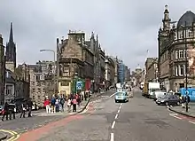
George IV Bridge is an elevated street in Edinburgh, Scotland, and is home to a number of the city's important public buildings.

History
A bridge connecting the Royal Mile to the south was first suggested as early as 1817, but was first planned further west and was non-linear and complicated.[1][2] Plans developed through the 1820s, concluding in 1825 that a linear form aligned with Bank Street (which then connects to The Mound and Princes Street was more logical, even though this required more destruction of existing buildings. This would bridge over the Cowgate and Merchant Street.
Measuring 300 metres (330 yd) in length, the bridge was constructed between 1827 and 1836 as part of the Edinburgh Improvement Act of 1827.[3] Named after King George IV, it was designed by architect Thomas Hamilton (1784–1858) to connect the South Side district of Edinburgh to the Old Town (Royal Mile) and then use exiting streets on the north to connect to the New Town. Two of Edinburgh Old Town's traditional streets, Old Bank Close, Gosford Close, Mauchine's Close and Liberton Wynd, had to be demolished for the construction of the bridge. This included the loss of the legendary John Dowie's Tavern on Liberton Wynd.[4]
Surroundings

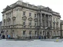
At the north end of the street, where it joins the Royal Mile (Lawnmarket), stands the French Consulate on the east side. Built between 1900 and 1905 as the Midlothian County Buildings, the building was later used by the Lothian Regional Council and following amalgamation with the District Council became a flagship Council office, including the offices of the Registrar of Births, Deaths and Marriages from 2007. Opposite it, on the west, was a row of Category B listed tenements at 1–12 Melbourne Place, demolished in 1966–67 to make way for an office building for Midlothian County Council, occupied from 1975 by Lothian Regional Council, designed in 1968 by Robert Matthew of Robert Matthew Johnson Marshall partners. This building was also used by the Scottish Parliament before being cleared to make way for a new hotel development originally for Missoni, but now the G & V Hotel.

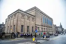
Further south on the street lie the National Library of Scotland and (opposite) the Edinburgh Central Library, the latter being one of the many free libraries constructed with money provided by the Scottish-born philanthropist Andrew Carnegie. Around the middle of the street, where the bridge crosses the historic Cowgate, are located a number of bars and restaurants and takeaways, as well as the ESL institute Wallace College and the Augustine United Church. The former Elim Pentecostal Church has been converted to a pub.
At the southern end of the street is the junction with Candlemaker Row, where there is the statue of Greyfriars Bobby. Opposite is the junction with Chambers Street, where the National Museum of Scotland is located.[5]
The road continues south for a short section, not truly part of the bridge and formerly known as Lindsay Place, to a Y-junction where it diverges to become Bristo Place and Forrest Road, the Bedlam Theatre (formerly the New North Free Church) sits at the meeting point of these two roads.
References
- Grants Old and New Edinburgh
- Scots Magazine 1817
- The foundation stone has been claimed to have been laid in 1827
- Grants Old and New Edinburgh vol.I p.119
- "Traveller". The Riverine Grazier. Hay, New South Wales: National Library of Australia. 23 July 1879. p. 2. Retrieved 21 January 2016.