Gillett Grove, Iowa
Gillett Grove is a city in Clay County, Iowa, United States. The population was 49 in the 2010 census, a decline from 55 in 2000.[4][5]
Gillett Grove, Iowa | |
|---|---|
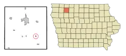 Location of Gillett Grove, Iowa | |
| Coordinates: 43°0′52″N 95°2′12″W | |
| Country | |
| State | |
| County | Clay |
| Area | |
| • Total | 0.22 sq mi (0.57 km2) |
| • Land | 0.22 sq mi (0.57 km2) |
| • Water | 0.00 sq mi (0.00 km2) |
| Elevation | 1,306 ft (398 m) |
| Population | |
| • Total | 49 |
| • Estimate (2019)[3] | 47 |
| • Density | 211.71/sq mi (81.76/km2) |
| Time zone | UTC-6 (Central (CST)) |
| • Summer (DST) | UTC-5 (CDT) |
| ZIP code | 51341 |
| Area code(s) | 712 |
| FIPS code | 19-30810 |
| GNIS feature ID | 0465642 |
History
Gillett Grove was laid out in 1899 when the railroad was extended to that point.[6] The city was named for brothers George and Isaiah Gillett, pioneer settlers.[6]
Geography
Gillett Grove's longitude and latitude coordinates
in decimal form are 43.014514, -95.036576.[7]
According to the United States Census Bureau, the city has a total area of 0.19 square miles (0.49 km2), all land.[8]
Demographics
| Historical population | |||
|---|---|---|---|
| Census | Pop. | %± | |
| 1980 | 93 | — | |
| 1990 | 67 | −28.0% | |
| 2000 | 55 | −17.9% | |
| 2010 | 49 | −10.9% | |
| 2019 (est.) | 47 | [3] | −4.1% |
| U.S. Decennial Census[9] | |||
2010 census
As of the census[2] of 2010, there were 49 people, 24 households, and 12 families residing in the city. The population density was 257.9 inhabitants per square mile (99.6/km2). There were 30 housing units at an average density of 157.9 per square mile (61.0/km2). The racial makeup of the city was 98.0% White and 2.0% from two or more races.
There were 24 households, of which 20.8% had children under the age of 18 living with them, 25.0% were married couples living together, 16.7% had a female householder with no husband present, 8.3% had a male householder with no wife present, and 50.0% were non-families. 41.7% of all households were made up of individuals, and 12.5% had someone living alone who was 65 years of age or older. The average household size was 2.04 and the average family size was 2.75.
The median age in the city was 43.3 years. 20.4% of residents were under the age of 18; 12.3% were between the ages of 18 and 24; 20.3% were from 25 to 44; 26.6% were from 45 to 64; and 20.4% were 65 years of age or older. The gender makeup of the city was 51.0% male and 49.0% female.
2000 census
As of the census[10] of 2000, there were 55 people, 28 households, and 19 families residing in the city. The population density was 291.6 people per square mile (111.8/km2). There were 30 housing units at an average density of 159.1 per square mile (61.0/km2). The racial makeup of the city was 98.18% White, and 1.82% from two or more races.
There were 28 households, out of which 32.1% had children under the age of 18 living with them, 46.4% were married couples living together, 10.7% had a female householder with no husband present, and 32.1% were non-families. 32.1% of all households were made up of individuals, and 10.7% had someone living alone who was 65 years of age or older. The average household size was 1.96 and the average family size was 2.21.
In the city, the population was spread out, with 18.2% under the age of 18, 10.9% from 18 to 24, 21.8% from 25 to 44, 25.5% from 45 to 64, and 23.6% who were 65 years of age or older. The median age was 44 years. For every 100 females, there were 89.7 males. For every 100 females age 18 and over, there were 87.5 males.
The median income for a household in the city was $21,429, and the median income for a family was $17,292. Males had a median income of $18,750 versus $21,250 for females. The per capita income for the city was $12,337. There were 13.3% of families and 28.3% of the population living below the poverty line, including 18.2% of under eighteens and none of those over 64.
Education
Gillett Grove is within the Spencer Community School District.[11] It was previously in the South Clay Community School District;[12] on July 1, 2010 that district dissolved, with a portion going to the Spencer district.[13]
References
- "2019 U.S. Gazetteer Files". United States Census Bureau. Retrieved July 17, 2020.
- "U.S. Census website". United States Census Bureau. Retrieved 2012-05-11.
- "Population and Housing Unit Estimates". United States Census Bureau. May 24, 2020. Retrieved May 27, 2020.
- "Population & Housing Occupancy Status 2010". United States Census Bureau American FactFinder. Retrieved 2011-06-20.
- "Data from the 2010 Census". State Data Center of Iowa. Archived from the original on 2011-07-18. Retrieved 2011-06-19.
- Stoermer, Annie (May 13, 1976). "Annie Stoermer retells history". The Daily Reporter. p. 6. Retrieved 27 April 2015.
- "US Gazetteer files: 2010, 2000, and 1990". United States Census Bureau. 2011-02-12. Retrieved 2011-04-23.
- "US Gazetteer files 2010". United States Census Bureau. Archived from the original on 2012-03-05. Retrieved 2012-05-11.
- "Census of Population and Housing". Census.gov. Retrieved June 4, 2015.
- "U.S. Census website". United States Census Bureau. Retrieved 2008-01-31.
- "Spencer." Iowa Department of Education. Retrieved on July 21, 2018.
- Home. South Clay Community School District. November 4, 2001. Retrieved on July 20, 2018. "Welcome to South Clay Community School, a K-6 school serving the communities of Dickens, Gillett Grove, and Webb, Iowa."
- "REORGANIZATION & DISSOLUTION ACTIONS SINCE 1965-66." Iowa Department of Education. Retrieved on July 20, 2018.
External links
| Wikimedia Commons has media related to Gillett Grove, Iowa. |
- City-Data Comprehensive statistical data and more about Gillett Grove
Municipalities and communities of Clay County, Iowa, United States | ||
|---|---|---|
| Cities | Map of Iowa highlighting Clay County | |
| Townships | ||
| Unincorporated communities | ||
| ||