Rossie, Iowa
Rossie is a city in Clay County, Iowa, United States. The population was 70 in the 2010 census, an increase from 58 in 2000.[4][5]
Rossie, Iowa | |
|---|---|
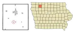 Location of Rossie, Iowa | |
| Coordinates: 43°0′48″N 95°11′21″W | |
| Country | |
| State | |
| County | Clay |
| Government | |
| • Mayor | Matthew Starkson |
| Area | |
| • Total | 0.14 sq mi (0.37 km2) |
| • Land | 0.14 sq mi (0.37 km2) |
| • Water | 0.00 sq mi (0.00 km2) |
| Elevation | 1,407 ft (429 m) |
| Population | |
| • Total | 70 |
| • Estimate (2019)[3] | 68 |
| • Density | 472.22/sq mi (181.70/km2) |
| Time zone | UTC-6 (Central (CST)) |
| • Summer (DST) | UTC-5 (CDT) |
| ZIP code | 51357 |
| Area code(s) | 712 |
| FIPS code | 19-68925 |
| GNIS feature ID | 0465606 |
Geography
Rossie's longitude and latitude coordinates in decimal form are 43.013208, -95.189105.[6]
According to the United States Census Bureau, the city has a total area of 0.15 square miles (0.39 km2), all land.[7]
Demographics
| Historical population | |||
|---|---|---|---|
| Census | Pop. | %± | |
| 1930 | 85 | — | |
| 1940 | 95 | 11.8% | |
| 1950 | 112 | 17.9% | |
| 1960 | 102 | −8.9% | |
| 1970 | 91 | −10.8% | |
| 1980 | 72 | −20.9% | |
| 1990 | 68 | −5.6% | |
| 2000 | 58 | −14.7% | |
| 2010 | 70 | 20.7% | |
| 2019 (est.) | 68 | [3] | −2.9% |
| U.S. Decennial Census[8] | |||
2010 census
As of the census[2] of 2010, there were 70 people, 26 households, and 20 families living in the city. The population density was 466.7 inhabitants per square mile (180.2/km2). There were 29 housing units at an average density of 193.3 per square mile (74.6/km2). The racial makeup of the city was 95.7% White and 4.3% from two or more races. Hispanic or Latino of any race were 5.7% of the population.
There were 26 households, of which 38.5% had children under the age of 18 living with them, 57.7% were married couples living together, 3.8% had a female householder with no husband present, 15.4% had a male householder with no wife present, and 23.1% were non-families. 23.1% of all households were made up of individuals, and 3.8% had someone living alone who was 65 years of age or older. The average household size was 2.69 and the average family size was 3.00.
The median age in the city was 35.5 years. 30% of residents were under the age of 18; 8.6% were between the ages of 18 and 24; 32.9% were from 25 to 44; 24.3% were from 45 to 64; and 4.3% were 65 years of age or older. The gender makeup of the city was 52.9% male and 47.1% female.
2000 census
As of the census[9] of 2000, there were 58 people, 22 households, and 15 families living in the city. The population density was 385.5 people per square mile (149.3/km2). There were 26 housing units at an average density of 172.8 per square mile (66.9/km2). The racial makeup of the city was 100.00% White.
There were 22 households, out of which 31.8% had children under the age of 18 living with them, 63.6% were married couples living together, and 27.3% were non-families. 22.7% of all households were made up of individuals, and 9.1% had someone living alone who was 65 years of age or older. The average household size was 2.64 and the average family size was 2.94.
In the city, the population was spread out, with 29.3% under the age of 18, 3.4% from 18 to 24, 36.2% from 25 to 44, 27.6% from 45 to 64, and 3.4% who were 65 years of age or older. The median age was 31 years. For every 100 females, there were 114.8 males. For every 100 females age 18 and over, there were 105.0 males.
The median income for a household in the city was $30,833, and the median income for a family was $41,250. Males had a median income of $29,219 versus $11,875 for females. The per capita income for the city was $13,266. There were 11.1% of families and 9.5% of the population living below the poverty line, including no under eighteens and none of those over 64.
Education
Clay Central–Everly Community School District operates public schools serving the community.[10]
References
- "2019 U.S. Gazetteer Files". United States Census Bureau. Retrieved July 17, 2020.
- "U.S. Census website". United States Census Bureau. Retrieved 2012-05-11.
- "Population and Housing Unit Estimates". United States Census Bureau. May 24, 2020. Retrieved May 27, 2020.
- "Population & Housing Occupancy Status 2010". United States Census Bureau American FactFinder. Retrieved 2011-06-21.
- "Data from the 2010 Census". State Data Center of Iowa. Retrieved 2011-06-19.
- "US Gazetteer files: 2010, 2000, and 1990". United States Census Bureau. 2011-02-12. Retrieved 2011-04-23.
- "US Gazetteer files 2010". United States Census Bureau. Archived from the original on 2012-07-02. Retrieved 2012-05-11.
- "Census of Population and Housing". Census.gov. Retrieved June 4, 2015.
- "U.S. Census website". United States Census Bureau. Retrieved 2008-01-31.
- "Clay Central-Everly." Iowa Department of Education. Retrieved on July 21, 2018.
External links
| Wikimedia Commons has media related to Rossie, Iowa. |
- City-Data Comprehensive statistical data and more about Rossie
Municipalities and communities of Clay County, Iowa, United States | ||
|---|---|---|
| Cities | Map of Iowa highlighting Clay County | |
| Townships | ||
| Unincorporated communities | ||
| ||