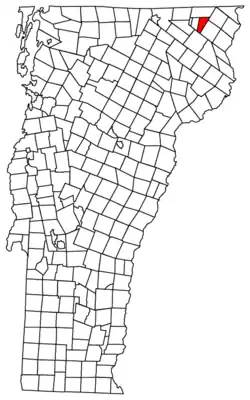
Gore (surveying)
A gore is an irregular parcel of land, as small as a triangle of median in a street intersection or as large as an unincorporated area the size of a township.
.png.webp)
1) a triangular gore (upper center left) along the border between the Rombout Patent and the Philipse Patent, labeled "The Gore";
2) a quadrilinear gore in the upper right created by the boundaries of the Beekman Patent, Rombout Patent, The Oblong, and the Survey Line of 1754, labeled "The Gore"; and
3) an unlabeled triangular gore originating at the Hudson River and spanning the Philipse Patent's northern border, created by the Survey Line of 1754, The Oblong, and the East-West Line ("Supposed County Line") as a base

In old English law, a gore was a small, narrow strip of land. In modern land law and surveying a gore is a strip of land, usually triangular in shape, as might be left between surveys that do not close. In some northeastern U.S. states (mainly northern New England), a gore (sometimes a land grant or purchase) remains as an unincorporated area of a county that is not part of any town, has limited self-government,[1] and may or may not even be populated.
History
Historically, North American named gores were most often the result of errors when the land was first surveyed and Colonial era land patents and, later, towns were laid out. A gore would be created by conflicting surveys, resulting in two or more patentees claiming the same land, or lie in an area between two supposedly abutting towns but technically in neither. Surrounding towns have been known to absorb a gore—for example, the gore between Tunbridge and Royalton, Vermont, was eventually incorporated into Tunbridge. Some gores have become towns in their own right, such as Stannard, Vermont.
As unincorporated territories
Different states have different laws governing gores and other unincorporated territories. In Maine, all unincorporated territories (whether townships, gores, plantations, or grants) are governed directly by the Land Use Planning Commission, a state agency.[2] They do not, therefore, enjoy the rights and obligations of direct local self-governance of a corporate Maine municipality, via local elections of town boards of selectmen, and town meetings that debate and approve the town budget and expenditures. Occasionally, a town will choose to become unincorporated after having been an incorporated town; a recent example of this is the former town of Madrid, Maine.
Sample New England gores
Some of New England's gores include:
| Gore | County | 2000 Population | Area in km² (mi²) | |
| Averys Gore, Vermont | Essex County, Vermont | 0 | 45.6 (17.6) | |
| Buels Gore, Vermont | Chittenden County, Vermont | 12 | 13.1 (5.1) | |
| Warner's Grant, Vermont | Essex County, Vermont | 0 | 8.2 (3.2) | |
| Warren's Gore, Vermont | Essex County, Vermont | 10 | 30.0 (11.6) | |
| Hibberts Gore, Maine | Lincoln County, Maine | 1 | 2.0 (0.77) | |
| * | Blake Gore, Maine | Somerset County, Maine | 0 | <n/a> |
| * | Coburn Gore, Maine | Franklin County, Maine | 0 | <n/a> |
| * | Gorham Gore, Maine | Franklin County, Maine | 0 | <n/a> |
| * | Massachusetts Gore, Maine | Franklin County, Maine | 0 | 37.3 (14.4) |
| * | Misery Gore, Maine | Somerset County, Maine | 0 | <n/a> |
| * | Moxie Gore, Maine | Somerset County, Maine | 0 | |
| * | Veazie Gore, Maine | Penobscot County, Maine | 0 | <n/a> |
* Not considered a census-designated place by the United States Census, but legally considered a minor civil division by the state of Maine
References
- H.C. Black, Black's Law Dictionary (Rev. 4th Ed.), West Publishing Co., St. Paul, 1968, p. 824.
- Maine Land Use Planning Commission
