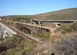
Gourits River
Gourits River (Afrikaans: Gouritsrivier), sometimes spelled 'Gouritz River', is situated in the Western Cape, South Africa.[1]
| Gourits River Gouritz River, Gouritsrivier | |
|---|---|
 | |
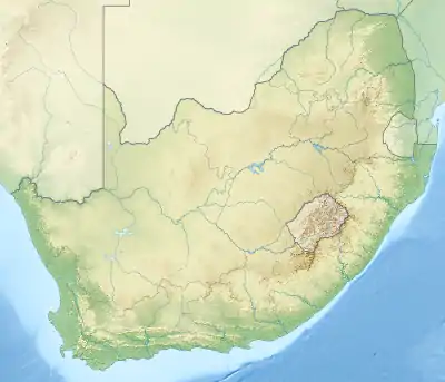 Location of the Gourits River mouth | |
| Etymology | Origin uncertain; perhaps from the word "dirty" in the Griqua language |
| Native name | Rio das Vaccas (river of herdsmen) |
| Location | |
| Country | South Africa |
| Province | Western Cape Province |
| Physical characteristics | |
| Source confluence | Gamka (W) Olifants(E) |
| • coordinates | 33°40′57″S 21°42′58″E |
| • elevation | 516 m (1,693 ft) |
| Mouth | Gourits Estuary |
• location | Indian Ocean, Near Gouritsmond |
• coordinates | 34°20′47″S 21°53′08″E |
• elevation | 0 m (0 ft) |
| Length | 416 km (258 mi) |
| Basin size | 45,715 km2 (17,651 sq mi) |
The Gourits River flows from the confluence of the Gamka River and Olifants River and is joined by the Groot River, before flowing through the Langeberg Mountains and coastal plain. It eventually drains into the sea through the Gourits Estuary near Gouritsmond.[2]
See also
- List of rivers of South Africa
- List of estuaries of South Africa
- List of reservoirs and dams in South Africa
References
This article is issued from Wikipedia. The text is licensed under Creative Commons - Attribution - Sharealike. Additional terms may apply for the media files.
