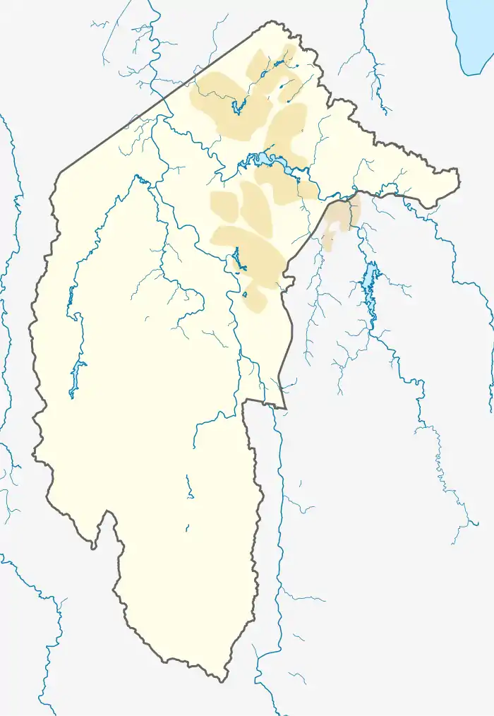
Gowrie, Australian Capital Territory
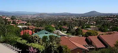
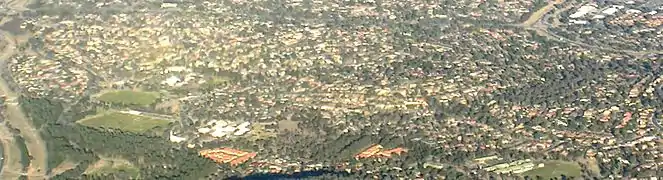
Gowrie is a suburb of Canberra, Australia, located in the northern end of the Tuggeranong Valley. Tuggeranong suburbs are the southernmost of Australia's capital city. Gowrie is named after Brigadier-General Alexander Gore Arkwright Hore-Ruthven, 1st Earl of Gowrie (1872–1955), Governor-General of Australia from 1936–1944.[2]
| Gowrie Canberra, Australian Capital Territory | |||||||||||||||
|---|---|---|---|---|---|---|---|---|---|---|---|---|---|---|---|
 Gowrie | |||||||||||||||
| Coordinates | 35°24′43″S 149°06′36″E | ||||||||||||||
| Population | 3,056 (2016 census)[1] | ||||||||||||||
| • Density | 1,610/km2 (4,170/sq mi) | ||||||||||||||
| Established | 1981 | ||||||||||||||
| Gazetted | 5 August 1975 | ||||||||||||||
| Postcode(s) | 2904 | ||||||||||||||
| Area | 1.9 km2 (0.7 sq mi) | ||||||||||||||
| District | Tuggeranong | ||||||||||||||
| Territory electorate(s) | Brindabella | ||||||||||||||
| Federal Division(s) | Bean | ||||||||||||||
| |||||||||||||||
Gowrie's streets are all named after members of the Australian Defence Force who won decorations, including the Victoria Cross.[2] Gowrie is the former site of the Athllon Homestead.
Demographics
On 2016 census, Gowrie had a population of 3,056 people. The median age of people in Gowrie was 38 years, compared to a median age of 35 for Canberra. Unemployment in Gowrie was 0.6% lower than the Canberra average (2011). The median individual income for Gowrie in 2011 was $1,003, almost equal with the ACT median of $998, while the median household income was $2,228. In 2011, the median monthly housing loan repayment in Gowrie was $2,167.[1]
The residents of Gowrie are predominantly Australian born, with 77.1% being born in Australia. The three main countries of birth for those born overseas were England, 3.7%, Philippines, 1.2%, India, 1.2%, New Zealand, 1.1%, Italy and 1.0%. The most popular religious affiliations in descending order are no religion, Catholic, Anglican and Presbyterian and reformed.[1]
Suburb amenities
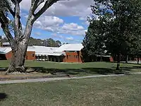
Gowrie Primary School, located on Jeffries Street, opened in 1983. The school's design has a rural theme, and each of the buildings are named after properties in the Tuggeranong Valley.[3] The Catholic Holy Family Parish Primary School and the Holy Family Church, both part of the South Tuggeranong Corpus Christi Parish, are located on Bugden Avenue.[4] Tuggeranong Presbyterian Church meets at Gowrie Primary School in Jeffries Street.[5]
The Gowrie local shopping centre is located on Jeffries Street. The centre includes a supermarket, pharmacy, hairdresser and the Common Grounds cafe. Jeffries Street is also the site of a child care centre and the Gowrie Preschool. The Erindale Scout Hall is in Finlay Place.[6] The Gowrie District Playing fields also are located in the suburb.
Gowrie is serviced by several ACTION bus routes. Routes 76 and 77 connect Gowrie to Tuggeranong Town Centre and Erindale Centre.[7][8] Route R5 travels along Ashley Drive with several bus stops along it.[9]
Politics
| |||||||||||||||||||||||||||||||||
Gowrie is located within the federal electorate of Bean, which is represented by David Smith in the House of Representatives. In the ACT Legislative Assembly, Gowrie is part of the electorate of Brindabella, which elects five members on the basis of proportional representation, currently three Liberal and two Labor.[12] Polling place statistics are shown to the right for the Gowrie polling place at Gowrie Primary School in the 2019 federal[10] and 2016 ACT[11] elections.
Geology
The west of Gowrie is built on Deakin Volcanics green-grey and purple rhyodacite. In the east, Gowrie is built on green-grey, purple and cream rhyolite. These rocks are 414 million years old from the Silurian period.[13]
|
References
| Wikimedia Commons has media related to Gowrie, Australian Capital Territory. |
- Australian Bureau of Statistics (27 June 2017). "Gowrie (State Suburb)". 2016 Census QuickStats. Retrieved 2 July 2017.

- Canberra's suburb and street names : origins and meanings. Department of the Environment, Land and Planning. 1992. p. 54. ISBN 1-86331-128-9.
- "Gowrie Primary School: Our School". Gowrie Primary School. Retrieved 15 February 2014.
- "Holy Family School in Gowrie". Gowrie Primary School. Retrieved 15 February 2014.
- "Tuggeranong Presbyterian Church". Tuggeranong Presbyterian Church. Retrieved 15 November 2014.
- Erindale Scout Group (2006) Home. Retrieved 1 July 2006
- Route 76 Transport Canberra
- Route 77 Transport Canberra
- Route R5 Transport Canberra
- "Federal Election 2019 - Polling Place Gowrie". Australian Electoral Commission. 11 June 2019. Retrieved 6 July 2019.
- "2016 Results for Brindabella Candidates at Gowrie Polling Place". ACT Electoral Commission. 26 November 2016. Retrieved 26 November 2016.
- "Current members". ACT Legislative Assembly. Retrieved 13 November 2016.
- Henderson G A M and Matveev G, Geology of Canberra, Queanbeyan and Environs 1:50000 1980.