Grangeville, Idaho
Grangeville is the largest city in and the county seat of Idaho County, Idaho, United States, in the north central part of the state.[5] Its population was 3,141 at the 2010 census, down from 3,228 in 2000.
Grangeville, Idaho | |
|---|---|
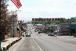 Main Street in July 2008 | |
 Location of Grangeville in Idaho County, Idaho. | |
 Grangeville, Idaho Location in the United States | |
| Coordinates: 45°55′N 116°7′W | |
| Country | United States |
| State | Idaho |
| County | Idaho |
| Area | |
| • Total | 1.51 sq mi (3.90 km2) |
| • Land | 1.51 sq mi (3.90 km2) |
| • Water | 0.00 sq mi (0.00 km2) |
| Elevation | 3,399 ft (1,036 m) |
| Population | |
| • Total | 3,141 |
| • Estimate (2019)[3] | 3,237 |
| • Density | 2,149.40/sq mi (829.70/km2) |
| Time zone | UTC-8 (Pacific (PST)) |
| • Summer (DST) | UTC-7 (PDT) |
| ZIP codes | 83530-83531 |
| Area code(s) | 208 |
| FIPS code | 16-32950 |
| GNIS feature ID | 0396579 |
| Website | www |
| Historical population | |||
|---|---|---|---|
| Census | Pop. | %± | |
| 1880 | 129 | — | |
| 1890 | 540 | 318.6% | |
| 1900 | 1,132 | 109.6% | |
| 1910 | 1,534 | 35.5% | |
| 1920 | 1,439 | −6.2% | |
| 1930 | 1,360 | −5.5% | |
| 1940 | 1,929 | 41.8% | |
| 1950 | 2,544 | 31.9% | |
| 1960 | 3,642 | 43.2% | |
| 1970 | 3,636 | −0.2% | |
| 1980 | 3,666 | 0.8% | |
| 1990 | 3,226 | −12.0% | |
| 2000 | 3,228 | 0.1% | |
| 2010 | 3,141 | −2.7% | |
| 2019 (est.) | 3,237 | [3] | 3.1% |
| U.S. Decennial Census[4] | |||
Culture
Grangeville enjoys close access to scenic and wildlife areas. Whitewater rafting is a popular pursuit and the Clearwater River, Snake River, and Salmon River lie close by.
Salmon and steelhead fishing is often a choice of recreation. Many residents of Grangeville hunt deer, elk, and turkeys in the nearby forests. Hiking is also popular in the Nez Perce National Forest, the Gospel Hump Wilderness, and Hells Canyon to the south of the city. The city operates the nearby Snowhaven ski area for winter recreation.
Many residents of Grangeville depend on the nearby forests for their livelihood. In addition to timber harvesting, the U.S. Forest Service is a major source of employment in the region.
Grangeville's "Border Days" is a large public celebration on the weekend of July 4 (Independence Day), which features the state's oldest rodeo as well as parades, art shows, and the world's largest egg toss.
Education
Grangeville's public schools are operated by the Mountain View School District #244, headed by Grangeville High School at the south end of the city.
Geography

According to the United States Census Bureau, the city has a total area of 1.45 square miles (3.76 km2), all of it land.[6]
Demographics
2010 census
As of the census[2] of 2010, there were 3,141 people, 1,389 households, and 841 families living in the city. The population density was 2,166.2 inhabitants per square mile (836.4/km2). There were 1,527 housing units at an average density of 1,053.1 per square mile (406.6/km2). The racial makeup of the city was 94.8% White, 0.2% African American, 1.4% Native American, 0.6% Asian, 0.1% Pacific Islander, 0.9% from other races, and 1.9% from two or more races. Hispanic or Latino of any race were 3.6% of the population.
There were 1,389 households, of which 27.7% had children under the age of 18 living with them, 46.5% were married couples living together, 9.7% had a female householder with no husband present, 4.3% had a male householder with no wife present, and 39.5% were non-families. 35.0% of all households were made up of individuals, and 15.5% had someone living alone who was 65 years of age or older. The average household size was 2.21 and the average family size was 2.83.
The median age in the city was 44 years. 23.1% of residents were under the age of 18; 6.2% were between the ages of 18 and 24; 21.5% were from 25 to 44; 28.8% were from 45 to 64; and 20.3% were 65 years of age or older. The gender makeup of the city was 48.7% male and 51.3% female.
2000 census
As of the census[7] of 2000, there were 3,228 people, 1,333 households, and 857 families living in the city. The population density was 2,366.4 people per square mile (916.4/km2). There were 1,474 housing units at an average density of 1,080.6 per square mile (418.5/km2). The racial makeup of the city was 96.34% White, 0.03% African American, 1.15% Native American, 0.28% Asian, 0.03% Pacific Islander, 0.68% from other races, and 1.49% from two or more races. Hispanic or Latino of any race were 1.64% of the population.
There were 1,333 households, out of which 31.2% had children under the age of 18 living with them, 52.1% were married couples living together, 9.1% had a female householder with no husband present, and 35.7% were non-families. 32.5% of all households were made up of individuals, and 15.2% had someone living alone who was 65 years of age or older. The average household size was 2.34 and the average family size was 2.96.
In the city, the population was spread out, with 25.8% under the age of 18, 5.6% from 18 to 24, 24.0% from 25 to 44, 24.3% from 45 to 64, and 20.3% who were 65 years of age or older. The median age was 42 years. For every 100 females, there were 87.7 males. For every 100 females age 18 and over, there were 83.1 males.
The median income for a household in the city was $27,984, and the median income for a family was $34,625. Males had a median income of $27,369 versus $16,179 for females. The per capita income for the city was $14,774. About 10.6% of families and 13.6% of the population were below the poverty line, including 15.0% of those under the age of 18 and 10.4% of those 65 and older.
Transportation
Highways
Airport
Idaho County Airport is a county-owned, public-use airport located north of the central business district of Grangeville.[8]
Railroad
For over nine decades, the Camas Prairie Railroad served the city. Grangeville was the eastern terminus of its second subdivision, known as the "Railroad on Stilts" due to its abundant timber trestles. Citing lack of profitability, its new owners received permission from the federal government to abandon the line in 2000. The final freight run to Grangeville was on November 29,[9][10] and the 17 miles (27 km) of track from Grangeville to Cottonwood were removed in 2003 for salvage.[11][12] The line was revived by BG&CM, but now terminates in Cottonwood. Passenger service to Grangeville was discontinued decades earlier, in August 1955.[13]
Notable people
- Skip Brandt, former member of the Idaho Senate
- Matt Hill (born 1978), NFL player
- Larry Ramos (1942–2014), Grammy award-winning singer, best known as part of the pop band the Association ("Never My Love", "Windy")[14]
- Ken Schrom (born 1954), MLB pitcher (1980–87), was born and raised in Grangeville[15]
Climate
According to the Köppen climate classification system, Grangeville has a humid continental climate (Köppen Dfb).
| Climate data for Grangeville (1893-2012) | |||||||||||||
|---|---|---|---|---|---|---|---|---|---|---|---|---|---|
| Month | Jan | Feb | Mar | Apr | May | Jun | Jul | Aug | Sep | Oct | Nov | Dec | Year |
| Record high °F (°C) | 62 (17) |
69 (21) |
78 (26) |
88 (31) |
96 (36) |
98 (37) |
108 (42) |
106 (41) |
104 (40) |
87 (31) |
72 (22) |
66 (19) |
108 (42) |
| Average high °F (°C) | 36.7 (2.6) |
41.3 (5.2) |
47.7 (8.7) |
55.7 (13.2) |
63.7 (17.6) |
70.7 (21.5) |
82.1 (27.8) |
82.1 (27.8) |
71.8 (22.1) |
58.9 (14.9) |
44.9 (7.2) |
37.9 (3.3) |
57.8 (14.3) |
| Average low °F (°C) | 21.4 (−5.9) |
24.3 (−4.3) |
28.1 (−2.2) |
33.5 (0.8) |
39.9 (4.4) |
45.9 (7.7) |
51.4 (10.8) |
50.2 (10.1) |
42.9 (6.1) |
35.6 (2.0) |
28 (−2) |
23 (−5) |
35.4 (1.9) |
| Record low °F (°C) | −24 (−31) |
−24 (−31) |
−9 (−23) |
11 (−12) |
19 (−7) |
27 (−3) |
33 (1) |
29 (−2) |
19 (−7) |
0 (−18) |
−17 (−27) |
−25 (−32) |
−25 (−32) |
| Average precipitation inches (mm) | 1.59 (40) |
1.37 (35) |
2.27 (58) |
2.7 (69) |
3.3 (84) |
2.97 (75) |
1.06 (27) |
1.02 (26) |
1.7 (43) |
2.07 (53) |
1.84 (47) |
1.6 (41) |
23.5 (600) |
| Average snowfall inches (cm) | 11.2 (28) |
9.3 (24) |
8.6 (22) |
3.8 (9.7) |
0.7 (1.8) |
0 (0) |
0 (0) |
0 (0) |
0 (0) |
1.7 (4.3) |
6.1 (15) |
11.2 (28) |
52.7 (134) |
| Average precipitation days | 11 | 9 | 12 | 12 | 12 | 11 | 5 | 5 | 7 | 9 | 11 | 11 | 115 |
| Source: WRCC[16] | |||||||||||||
References
- "2019 U.S. Gazetteer Files". United States Census Bureau. Retrieved July 9, 2020.
- "U.S. Census website". United States Census Bureau. Retrieved 2012-12-18.
- "Population and Housing Unit Estimates". United States Census Bureau. May 24, 2020. Retrieved May 27, 2020.
- "Census of Population and Housing". Census.gov. Retrieved June 4, 2015.
- "Find a County". National Association of Counties. Archived from the original on 2011-05-31. Retrieved 2011-06-07.
- "US Gazetteer files 2010". United States Census Bureau. Archived from the original on 2012-01-25. Retrieved 2012-12-18.
- "U.S. Census website". United States Census Bureau. Retrieved 2008-01-31.
- "about". Idaho County Airport. Retrieved November 19, 2012.
- "Camas Prairie dream out of steam". Moscow-Pullman Daily News. Associated Press. November 30, 2000. p. 2A.
- Walker, Jodi (December 31, 2000). "Some cracks in the foundation: Last train to Grangeville". Lewiston Morning Tribune. p. 3A.
- Walker, Jodi (January 9, 2003). "Cottonwood has a railroad, again". Lewiston Morning Tribune. p. 1A.
- Williams, Elaine (March 23, 2003). "Spalding line survives, barely". Lewiston Morning Tribune. p. 1E.
- "Camas Prairie Railroad 'Bugs' reach end of the line today". Lewiston Morning Tribune. August 23, 1955. p. 12.
- http://www.idahocountyfreepress.com/obituaries/2014/may/06/larry-ramos
- Barrows, Bob (April 12, 1973). "Hollywood wouldn't believe Grangeville's Schrom". Lewiston Morning Tribune. p. 21.
- "GRANGEVILLE, ID (103771)". Western Regional Climate Center. Retrieved November 26, 2015.
External links
Municipalities and communities of Idaho County, Idaho, United States | ||
|---|---|---|
| Cities | Map of Idaho highlighting Idaho County | |
| CDP | ||
| Unincorporated communities | ||
| Ghost towns | ||
| Indian reservation | ||
| Footnotes | ‡This populated place also has portions in an adjacent county or counties | |
| ||
| Authority control |
|---|