Grassy Ridge Bald
Grassy Ridge Bald is a mountain in North Carolina and is part of the Roan Highlands, within the Pisgah National Forest. Its elevation reaches 6,184 feet (1,885 m) and is on the boundary between Avery County, North Carolina (highest point) and Mitchell County, North Carolina. The mountain generates feeder streams for the North Toe River.
| Grassy Ridge Bald | |
|---|---|
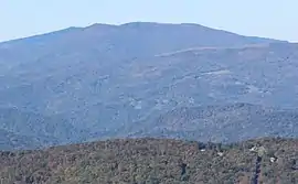 Grassy Ridge Bald viewed from Grandfather Mountain | |
| Highest point | |
| Elevation | 6,184 ft (1,885 m) [1] |
| Prominence | 688 ft (210 m) [2] |
| Parent peak | Roan High Knob[2] |
| Coordinates | 36°05′59″N 82°04′49″W [1] |
| Geography | |
| Location | Avery & Mitchell counties North Carolina, U.S. |
| Parent range | |
| Topo map | USGS Carvers Gap |
| Climbing | |
| Easiest route | Hike |
See also
References
- "Grassy Ridge Bald". Geographic Names Information System. United States Geological Survey. Retrieved 2019-07-15.
- "Grassy Ridge Bald, North Carolina". Peakbagger.com. Retrieved 2019-07-15.
This article is issued from Wikipedia. The text is licensed under Creative Commons - Attribution - Sharealike. Additional terms may apply for the media files.