Greater Kankakee Airport
Greater Kankakee Airport (IATA: IKK, ICAO: KIKK, FAA LID: IKK) is a public use airport located three nautical miles (6 km) south of the central business district of Kankakee, a city in Kankakee County, Illinois, United States.[1] It is included in the National Plan of Integrated Airport Systems for 2011–2015, which categorized it as a general aviation facility.[2]
Greater Kankakee Airport | |||||||||||||||
|---|---|---|---|---|---|---|---|---|---|---|---|---|---|---|---|
| Summary | |||||||||||||||
| Airport type | Public | ||||||||||||||
| Owner/Operator | Kankakee Valley Airport Authority | ||||||||||||||
| Serves | Kankakee, Illinois | ||||||||||||||
| Elevation AMSL | 629 ft / 192 m | ||||||||||||||
| Coordinates | 41°04′17″N 087°50′47″W | ||||||||||||||
| Website | www.kvaa.com | ||||||||||||||
| Map | |||||||||||||||
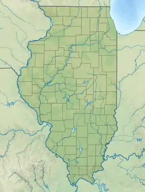
 IKK Location of airport in Illinois  IKK IKK (the United States) | |||||||||||||||
| Runways | |||||||||||||||
| |||||||||||||||
| Statistics (2011) | |||||||||||||||
| |||||||||||||||
The airport was opened in 1962 and continues to operate as a general aviation facility serving the Kankakee area and South Chicago. It is 60 miles (97 km) south of Chicago and 75 miles (121 km) north of Champaign, Illinois. It is the largest airport between the Chicago Midway Airport and the Champaign Airport. Greater Kankakee is a general aviation airport, consisting of mostly private aircraft with a mix of corporate and business aircraft usage.
The airport is owned and operated by the Kankakee Valley Airport Authority. The authority has an appointed board of directors totaling six members: three members from the Kankakee County Board and one each from the communities of Kankakee, Bradley, and Bourbonnais.
Facilities and aircraft
Greater Kankakee Airport covers an area of 950 acres (384 ha) at an elevation of 629 feet (192 m) above mean sea level. It has two runways with asphalt surfaces: 4/22 is 5,981 by 100 feet (1,823 x 30 m) and 16/34 is 4,398 by 75 feet (1,341 x 23 m).[1]
For the 12-month period ending May 31, 2011, the airport had 50,000 aircraft operations, an average of 136 per day: 92% general aviation, 6% military, and 2% air taxi. At that time there were 119 aircraft based at this airport: 74% single-engine, 13% ultralight, 9% multi-engine, 3% jet, and 2% helicopter.[1]
See also
- Kankakee Airport (FAA: 3KK), located at 41°05′47″N 087°54′38″W
References
- FAA Airport Form 5010 for IKK PDF. Federal Aviation Administration. effective November 15, 2012.
-
"2011–2015 NPIAS Report, Appendix A" (PDF). National Plan of Integrated Airport Systems. Federal Aviation Administration. October 4, 2010. Archived from the original (PDF, 2.03 MB) on October 27, 2012. External link in
|work=(help)
External links
- Kankakee Valley Airport Authority, official site
- Aerial image as of March 1999 from USGS The National Map
- FAA Terminal Procedures for IKK, effective January 28, 2021
- Resources for this airport:
- FAA airport information for IKK
- AirNav airport information for KIKK
- ASN accident history for IKK
- FlightAware airport information and live flight tracker
- NOAA/NWS weather observations: current, past three days
- SkyVector aeronautical chart, Terminal Procedures