Greeley, Kansas
Greeley is a city in Anderson County, Kansas, United States. As of the 2010 census, the city population was 302.[6]
Greeley, Kansas | |
|---|---|
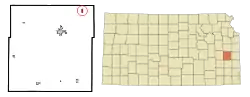 Location within Anderson County and Kansas | |
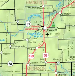 KDOT map of Anderson County (legend) | |
| Coordinates: 38°22′3″N 95°7′35″W | |
| Country | United States |
| State | Kansas |
| County | Anderson |
| Founded | 1854 |
| Incorporated | 1881 |
| Named for | Horace Greeley |
| Area | |
| • Total | 0.35 sq mi (0.91 km2) |
| • Land | 0.34 sq mi (0.89 km2) |
| • Water | 0.01 sq mi (0.02 km2) |
| Elevation | 896 ft (273 m) |
| Population | |
| • Total | 302 |
| • Estimate (2019)[3] | 296 |
| • Density | 860.47/sq mi (332.45/km2) |
| Time zone | UTC-6 (CST) |
| • Summer (DST) | UTC-5 (CDT) |
| ZIP code | 66033 |
| Area code | 785 |
| FIPS code | 20-28350 [4] |
| GNIS ID | 0477597 [5] |
History
The first settlement at Greeley was made in 1854. Greeley was laid out in 1857 by August M Bondi,[7] and named for Horace Greeley. Greeley was incorporated as a city in 1881.[8]
Geography
Greeley is located at 38°22′3″N 95°7′35″W (38.367461, -95.126287).[9] According to the United States Census Bureau, the city has a total area of 0.37 square miles (0.96 km2), of which, 0.36 square miles (0.93 km2) is land and 0.01 square miles (0.03 km2) is water.[10]
Climate
The climate in this area is characterized by hot, humid summers and generally mild to cool winters. According to the Köppen Climate Classification system, Greeley has a humid subtropical climate, abbreviated "Cfa" on climate maps.
Demographics
| Historical population | |||
|---|---|---|---|
| Census | Pop. | %± | |
| 1870 | 145 | — | |
| 1880 | 285 | 96.6% | |
| 1890 | 514 | 80.4% | |
| 1900 | 394 | −23.3% | |
| 1910 | 492 | 24.9% | |
| 1920 | 496 | 0.8% | |
| 1930 | 504 | 1.6% | |
| 1940 | 387 | −23.2% | |
| 1950 | 436 | 12.7% | |
| 1960 | 415 | −4.8% | |
| 1970 | 368 | −11.3% | |
| 1980 | 405 | 10.1% | |
| 1990 | 339 | −16.3% | |
| 2000 | 327 | −3.5% | |
| 2010 | 302 | −7.6% | |
| 2019 (est.) | 296 | [3] | −2.0% |
| U.S. Decennial Census[11] | |||
2010 census
As of the census[2] of 2010, there were 302 people, 132 households, and 84 families residing in the city. The population density was 838.9 inhabitants per square mile (323.9/km2). There were 152 housing units at an average density of 422.2 per square mile (163.0/km2). The racial makeup of the city was 97.4% White, 0.3% African American, 0.3% Native American, 0.3% Asian, 1.0% from other races, and 0.7% from two or more races. Hispanic or Latino of any race were 0.7% of the population.
There were 132 households, of which 29.5% had children under the age of 18 living with them, 47.7% were married couples living together, 6.1% had a female householder with no husband present, 9.8% had a male householder with no wife present, and 36.4% were non-families. 33.3% of all households were made up of individuals, and 18.9% had someone living alone who was 65 years of age or older. The average household size was 2.29 and the average family size was 2.85.
The median age in the city was 38.3 years. 24.8% of residents were under the age of 18; 5.9% were between the ages of 18 and 24; 26% were from 25 to 44; 23.2% were from 45 to 64; and 19.9% were 65 years of age or older. The gender makeup of the city was 51.3% male and 48.7% female.
2000 census
As of the census[4] of 2000, there were 327 people, 134 households, and 88 families residing in the city. The population density was 864.7 people per square mile (332.3/km2). There were 144 housing units at an average density of 380.8 per square mile (146.3/km2). The racial makeup of the city was 99.69% White, and 0.31% from two or more races. Hispanic or Latino of any race were 0.61% of the population.
There were 134 households, out of which 31.3% had children under the age of 18 living with them, 55.2% were married couples living together, 5.2% had a female householder with no husband present, and 34.3% were non-families. 26.1% of all households were made up of individuals, and 12.7% had someone living alone who was 65 years of age or older. The average household size was 2.44 and the average family size was 3.01.
In the city, the population was spread out, with 27.8% under the age of 18, 8.0% from 18 to 24, 28.4% from 25 to 44, 20.2% from 45 to 64, and 15.6% who were 65 years of age or older. The median age was 34 years. For every 100 females, there were 104.4 males. For every 100 females age 18 and over, there were 101.7 males.
The median income for a household in the city was $39,063, and the median income for a family was $43,393. Males had a median income of $35,556 versus $18,750 for females. The per capita income for the city was $24,591. About 7.1% of families and 8.3% of the population were below the poverty line, including 16.9% of those under age 18 and 6.3% of those age 65 or over.
Education
Unified School District No. 365 operates Greeley Elementary School in Greeley and Anderson County Junior-Senior High School in Garnett.[12]
Further reading
- The History Of Anderson County, Kansas, From Its First Settlement To The Fourth Of July, 1876; W.A. Johnson; Kauffman & Iler; 1877.[13]
- Plat Book Of Anderson County, Kansas, Compiled From County Records And Actual Survey; Northwest Publishing Co; 1901.[14]
- Kansas: A Cyclopedia Of State History, Embracing Events, Institutions, Industries, Counties, Cities, Towns, Prominent Persons, Etc; Frank W. Blackmar; Standard Publishing Co; 1912.[15][16][17]
- History Of The State of Kansas; William G. Cutler; A.T. Andreas Publisher; 1883.[18]
References
- "2019 U.S. Gazetteer Files". United States Census Bureau. Retrieved July 24, 2020.
- "U.S. Census website". United States Census Bureau. Retrieved 2012-07-06.
- "Population and Housing Unit Estimates". United States Census Bureau. May 24, 2020. Retrieved May 27, 2020.
- "U.S. Census website". United States Census Bureau. Retrieved 2008-01-31.
- "US Board on Geographic Names". United States Geological Survey. 2007-10-25. Retrieved 2008-01-31.
- "2010 City Population and Housing Occupancy Status". U.S. Census Bureau. Retrieved March 6, 2011.
- "August Bondi - Kansas Memory". www.kansasmemory.org. Retrieved 2019-03-12.
- Blackmar, Frank Wilson (1912). Kansas: A Cyclopedia of State History, Embracing Events, Institutions, Industries, Counties, Cities, Towns, Prominent Persons, Etc. Standard Publishing Company. pp. 788.
- "US Gazetteer files: 2010, 2000, and 1990". United States Census Bureau. 2011-02-12. Retrieved 2011-04-23.
- "US Gazetteer files 2010". United States Census Bureau. Archived from the original on 2012-01-25. Retrieved 2012-07-06.
- United States Census Bureau. "Census of Population and Housing". Retrieved September 4, 2014.
- "School Campuses." Unified School District No. 365. Retrieved on November 8, 2013.
- The History Of Anderson County, Kansas, From Its First Settlement To The Fourth Of July, 1876; 1877.
- Plat Book Of Anderson County, Kansas, Compiled From County Records And Actual Survey; 1901.
- Kansas: A Cyclopedia Of State History, Embracing Events, Institutions, Industries, Counties, Cities, Towns, Prominent Persons, Etc - Vol 1; 1912.
- Kansas: A Cyclopedia Of State History, Embracing Events, Institutions, Industries, Counties, Cities, Towns, Prominent Persons, Etc - Vol 2; 1912.
- Kansas: A Cyclopedia Of State History, Embracing Events, Institutions, Industries, Counties, Cities, Towns, Prominent Persons, Etc - Vol 3; 1912.
- History Of The State of Kansas; 1883.
External links
- City
- Schools
- USD 365, local school district
- Maps
- Greeley City Map, KDOT
Municipalities and communities of Anderson County, Kansas, United States | ||
|---|---|---|
| Cities | 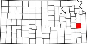 Map of Kansas highlighting Anderson County | |
| Unincorporated communities | ||
| Ghost town | ||
| Townships | ||
| Footnotes | †This populated place is designated a Census-Designated Place (CDP) by the United States Census Bureau | |
| ||