National Register of Historic Places listings in Kansas
There are over 1,400 buildings, sites, districts, and objects in Kansas listed on the National Register of Historic Places in Kansas. NRHP listings appear in 101 of the state's 105 counties.
- This National Park Service list is complete through NPS recent listings posted January 29, 2021.[1]
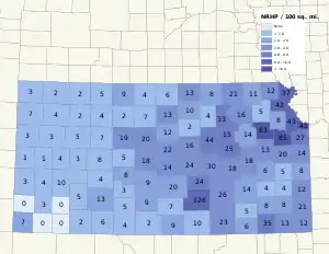
Current listings by county
The following are approximate tallies of current listings by county. These counts are based on entries in the National Register Information Database as of April 24, 2008[2] and new weekly listings posted since then on the National Register of Historic Places website since that time.[3] There are frequent additions to the listings and occasional delistings and the counts here are approximate and not official. New entries are added to the official Register on a weekly basis.[4] Also, the counts in this table exclude boundary increase and decrease listings which modify the area covered by an existing property or district and which carry a separate National Register reference number. The numbers of NRHP listings in each county are documented by tables in each of the individual county list-articles.
|
|
|
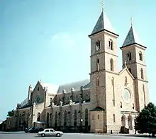 St. Fidelis Catholic Church | ||||||||||||||||||||||||||||||||||||||||||||||||||||||||||||||||||||||||||||||||||||||||||||||||||||||||||||||||||||||||||||||||||||||||||||||||||||||||||||||||||||||||||||||||||||||||||||||||||||||||||||||||||||||||||||||||||||||||||||||||||||||||||||||||||||||||||||||||||||||||||||||||||||||||||||||||||||||||||||||||||||
Courthouse.JPG.webp)
Allen County
| [6] | Name on the Register | Image | Date listed[7] | Location | City or town | Description |
|---|---|---|---|---|---|---|
| 1 | Allen County Jail |  Allen County Jail |
January 25, 1971 (#71000300) |
204 N. Jefferson St. 37°55′24″N 95°24′10″W |
Iola | |
| 2 | City Square Park Bandstand | January 8, 2014 (#13001036) |
100 S. 9th St. 37°48′39″N 95°26′10″W |
Humboldt | ||
| 3 | Lander's Wagon and Carriage Shop | January 11, 2017 (#100000494) |
403 Bridge St. 37°48′40″N 95°26′31″W |
Humboldt | ||
| 4 | Northrup House |  Northrup House |
May 12, 1997 (#97000395) |
318 East St. 37°55′21″N 95°24′01″W |
Iola |
Former listing
| [6] | Name on the Register | Image | Date listed | Date removed | Location | City or town | Summary |
|---|---|---|---|---|---|---|---|
| 1 | Funston Home | 1971 (#71000301) | 1995 | 14 South Washington |
Iola | Boyhood home of General Frederick Funston. Delisted after being relocated into the town of Iola. | |
| 2 | Schleichers Branch Stone Arch Bridge | May 18, 1995 (#95000620) | February 25, 2004 | Unnamed road over Slack Creek (Schleichers Branch), east of Humboldt |
Humboldt |
Anderson County
| [6] | Name on the Register | Image | Date listed[7] | Location | City or town | Description |
|---|---|---|---|---|---|---|
| 1 | Anderson County Courthouse |  Anderson County Courthouse |
April 26, 1972 (#72000483) |
4th and Oak Sts. 38°16′50″N 95°13′48″W |
Garnett | |
| 2 | Sennett and Bertha Kirk House | November 2, 2005 (#05001199) |
145 W. 4th Ave. 38°16′53″N 95°14′34″W |
Garnett | ||
| 3 | Shelley-Tipton House | May 6, 1982 (#82002650) |
812 W. 4th St. 38°16′50″N 95°15′22″W |
Garnett | ||
| 4 | Spencer's Crossing Bridge | January 4, 1990 (#89002177) |
Over Pottawatomie Creek, northwest of Greeley 38°22′39″N 95°08′51″W |
Greeley | ||
| 5 | Samuel J. Tipton House | January 23, 1975 (#75000703) |
4 miles southwest of Harris 38°17′36″N 95°29′26″W |
Harris |
Barber County
| [6] | Name on the Register | Image | Date listed[7] | Location | City or town | Description |
|---|---|---|---|---|---|---|
| 1 | Medicine Lodge Peace Treaty Site |  Medicine Lodge Peace Treaty Site |
August 4, 1969 (#69000059) |
Southeast of Medicine Lodge 37°17′41″N 98°33′42″W |
Medicine Lodge | |
| 2 | Carry A. Nation House |  Carry A. Nation House |
March 24, 1971 (#71000303) |
211 W. Fowler Ave. 37°16′32″N 98°34′55″W |
Medicine Lodge |
Chautauqua County
| [6] | Name on the Register | Image | Date listed[7] | Location | City or town | Description |
|---|---|---|---|---|---|---|
| 1 | L.C. Adam Mercantile Building | April 18, 2007 (#07000312) |
618 Cedar St. 37°06′20″N 96°29′54″W |
Cedar Vale | ||
| 2 | Bradford Hotel |  Bradford Hotel |
November 28, 2007 (#07001222) |
103 N. Chautauqua St. 37°07′37″N 96°11′13″W |
Sedan | |
| 3 | Cedar Creek Bridge |  Cedar Creek Bridge |
March 10, 1983 (#83000418) |
FAS 96 37°00′34″N 96°15′20″W |
Elgin | |
| 4 | Hewins Park Pavilion | June 27, 2007 (#07000602) |
101 Salebarn Rd. 37°05′52″N 96°29′27″W |
Cedar Vale | ||
| 5 | Niotaze Methodist Episcopal Church | 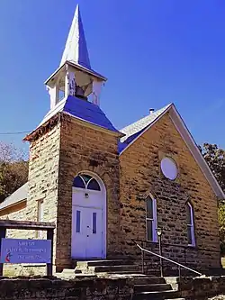 Niotaze Methodist Episcopal Church |
January 11, 2006 (#05001512) |
301 N. F St. 37°04′12″N 96°00′54″W |
Niotaze | |
| 6 | Otter Creek Bridge | January 4, 1990 (#89002189) |
FAS 95 over Otter Creek, 3.0 miles north of Cedar Vale 37°09′19″N 96°29′55″W |
Cedar Vale |
Cheyenne County
| [6] | Name on the Register | Image | Date listed[7] | Location | City or town | Description |
|---|---|---|---|---|---|---|
| 1 | Cheyenne County Courthouse | 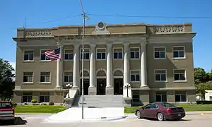 Cheyenne County Courthouse |
April 26, 2002 (#02000391) |
212 E. Washington St. 39°46′28″N 101°47′57″W |
St. Francis | |
| 2 | Henry Hickert Building | Henry Hickert Building |
November 28, 2007 (#07001223) |
104 West 4th 39°44′59″N 101°31′59″W |
Bird City | |
| 3 | St. Francis City Park | _bandshell_2.JPG.webp) St. Francis City Park |
July 10, 2008 (#08000645) |
300 block of E. Washington St. 39°46′29″N 101°47′54″W |
St. Francis |
Clark County
| [6] | Name on the Register | Image | Date listed[7] | Location | City or town | Description |
|---|---|---|---|---|---|---|
| 1 | Ashland Grade School | Ashland Grade School |
November 15, 2005 (#05001245) |
210 W. 7th St. 37°11′23″N 99°46′04″W |
Ashland | |
| 2 | Bear Creek Redoubt | March 30, 1978 (#78001275) |
5 miles north of Ashland[8] 37°15′56″N 99°48′42″W |
Center Township | ||
| 3 | Cimarron Redoubt | May 23, 1978 (#78001276) |
Along Redoubt Creek south of its confluence with the Cimarron River[9] 37°01′48″N 99°45′48″W |
Center Township | ||
| 4 | Girl Scout Little House | _from_S_1.JPG.webp) Girl Scout Little House |
April 14, 2015 (#15000142) |
448 W. 6th Ave. 37°11′27″N 99°46′18″W |
Ashland | |
| 5 | Hodson Hotel | September 30, 2019 (#100004456) |
712 Main St. 37°11′21″N 99°45′57″W |
Ashland | ||
| 6 | Stein House | _from_W_1.JPG.webp) Stein House |
March 2, 2001 (#01000182) |
420 Cedar St. 37°11′31″N 99°45′51″W |
Ashland | |
| 7 | Stockgrowers State Bank | _from_SE_2.JPG.webp) Stockgrowers State Bank |
April 26, 1972 (#72000490) |
8th and Main Sts. 37°11′19″N 99°45′58″W |
Ashland |
Clay County
| [6] | Name on the Register | Image | Date listed[7] | Location | City or town | Description |
|---|---|---|---|---|---|---|
| 1 | Auld Stone Barn |  Auld Stone Barn |
October 14, 2001 (#01001108) |
255 Utah Rd., south of Wakefield 39°09′27″N 96°59′54″W |
Republican Township | |
| 2 | Clay Center Carnegie Library |  Clay Center Carnegie Library |
June 25, 1987 (#87000933) |
706 6th St. 39°22′36″N 97°07′26″W |
Clay Center | |
| 3 | Clay Center Downtown Historic District | October 30, 2020 (#100005716) |
4th to 6th Sts., Court to Lincoln Aves. 39°22′38″N 97°07′35″W |
Clay Center | ||
| 4 | Clay County Courthouse | 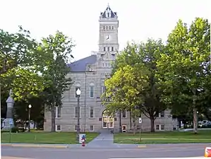 Clay County Courthouse |
January 29, 1973 (#73000746) |
5th and Court Sts. 39°22′36″N 97°07′31″W |
Clay Center | |
| 5 | Mugler Lodge Site | March 1, 1994 (#94000069) |
Southern bank of the Republican River, southeast of Clay Center[10] 39°21′20″N 97°09′41″W |
Blaine Township |
Coffey County
| [6] | Name on the Register | Image | Date listed[7] | Location | City or town | Description |
|---|---|---|---|---|---|---|
| 1 | Burlington Carnegie Free Library | 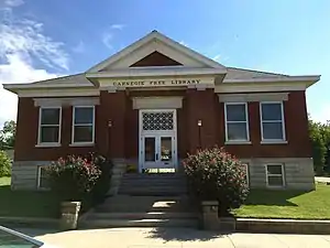 Burlington Carnegie Free Library |
June 25, 1987 (#87000934) |
201 N. 3rd 38°11′46″N 95°44′01″W |
Burlington | |
| 2 | Cleo F. Miller House |  Cleo F. Miller House |
December 27, 1991 (#91001897) |
Junction of Broadway and Coffey Sts. 38°24′56″N 95°51′44″W |
Lebo | |
| 3 | Neosho River Bridge | March 10, 1983 (#83000420) |
East of Hartford 38°18′32″N 95°56′52″W |
Hartford | Two-span Marsh rainbow arch bridge, built in 1926 over Neosho River | |
| 4 | Plaza Theater |  Plaza Theater |
February 9, 2005 (#05000005) |
404 Neosho St. 38°11′48″N 95°44′20″W |
Burlington | |
| 5 | US Post Office-Burlington |  US Post Office-Burlington |
October 17, 1989 (#89001634) |
107 S. 4th St. 38°11′39″N 95°44′09″W |
Burlington | |
| 6 | Williamson Archeological Site | November 19, 1974 (#74000823) |
Southern side of Eagle Creek above its confluence with the Neosho River, southeast of Hartford[11] 38°16′37″N 95°53′11″W |
Pleasant Township |
Comanche County
| [6] | Name on the Register | Image | Date listed[7] | Location | City or town | Description |
|---|---|---|---|---|---|---|
| 1 | Archeological Site Number 14CM305 | July 9, 1982 (#82004864) |
Address restricted |
Unknown | ||
| 2 | Chief Theater | February 9, 2005 (#05000010) |
122 E. Main St. 37°16′19″N 99°19′39″W |
Coldwater | ||
| 3 | Comanche County Courthouse | April 26, 2002 (#02000395) |
201 S. New York Ave. 37°16′06″N 99°19′32″W |
Coldwater | ||
| 4 | Protection High School |  Protection High School |
November 15, 2005 (#05001244) |
210 S. Jefferson 37°12′00″N 99°28′52″W |
Protection |
Decatur County
| [6] | Name on the Register | Image | Date listed[7] | Location | City or town | Description |
|---|---|---|---|---|---|---|
| 1 | Bank of Oberlin |  Bank of Oberlin |
December 1, 1994 (#94001418) |
187 S. Penn 39°49′09″N 100°31′45″W |
Oberlin | |
| 2 | Norcatur City Hall |  Norcatur City Hall |
April 7, 2014 (#14000114) |
107 N. Decatur Ave. 39°50′14″N 100°11′25″W |
Norcatur |
Edwards County
| [6] | Name on the Register | Image | Date listed[7] | Location | City or town | Description |
|---|---|---|---|---|---|---|
| 1 | Gano Grain Elevator and Scale House | September 21, 1993 (#93000943) |
Junction of U.S. Route 50 and County Road 9 37°54′05″N 99°29′46″W |
Kinsley | ||
| 2 | Kinsley Civil War Monument | January 31, 2008 (#07001479) |
L Rd., Hillside Cemetery 37°56′11″N 99°26′52″W |
Kinsley | ||
| 3 | Palace Theater | February 9, 2005 (#05000006) |
222 E. 6th St. 37°55′29″N 99°24′37″W |
Kinsley |
Elk County
| [6] | Name on the Register | Image | Date listed[7] | Location | City or town | Description |
|---|---|---|---|---|---|---|
| 1 | Durbin Archeological Site | May 2, 1975 (#75000711) |
Address restricted |
Moline | ||
| 2 | Elk County Courthouse | April 22, 2009 (#09000227) |
127 N. Pine 37°28′08″N 96°15′44″W |
Howard | Two-story yellow/buff-brick courthouse built in 1907. Designed by George E. McDonald with elements of Richardsonian Romanesque and Italian Renaissance Revival style. | |
| 3 | Elk Falls Pratt Truss Bridge | .jpg.webp) Elk Falls Pratt Truss Bridge |
May 6, 1994 (#94000403) |
Off Montgomery St., across the Elk River 37°22′27″N 96°11′02″W |
Elk Falls | |
| 4 | Elk River Archeological District | September 13, 1978 (#78001279) |
Address restricted |
Elk City | ||
| 5 | Grenola Mill and Elevator | July 11, 2002 (#02000764) |
Railroad Avenue 37°20′54″N 96°26′58″W |
Grenola | ||
| 6 | Howard National Bank | December 22, 2020 (#100005948) |
147-149 North Wabash St. (County appraiser states 143 North Wabash St.) 37°28′12″N 96°15′49″W |
Howard |
Gove County
| [6] | Name on the Register | Image | Date listed[7] | Location | City or town | Description |
|---|---|---|---|---|---|---|
| 1 | Beamer Barn | _from_SE_1.JPG.webp) Beamer Barn |
July 8, 2010 (#10000452) |
2931 CR 18 39°06′40″N 100°44′27″W |
Oakley | Agriculture-Related Resources of Kansas MPS |
| 2 | Benson Culvert | _from_SW_1.JPG.webp) Benson Culvert |
December 3, 2013 (#13000878) |
6 mi. S. & 9 mi. W. of Gove 38°52′25″N 100°39′22″W |
Gove | Masonry Arch Bridges of Kansas Thematic Resource |
| 3 | Grainfield Opera House | 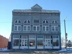 Grainfield Opera House |
November 28, 1980 (#80001467) |
Main and 3rd Sts. 39°06′48″N 100°27′56″W |
Grainfield | |
| 4 | Jenkins Culvert | _from_NE_1.JPG.webp) Jenkins Culvert |
December 3, 2013 (#13000879) |
6 mi. S. & 11.3 mi. W. of Gove 38°52′25″N 100°41′52″W |
Gove | Masonry Arch Bridges of Kansas TR |
| 5 | Oxley Barn | _from_SW_1.JPG.webp) Oxley Barn |
April 16, 2008 (#08000303) |
2740 County Road 74 39°04′49″N 100°13′18″W |
Quinter |
Graham County
| [6] | Name on the Register | Image | Date listed[7] | Location | City or town | Description |
|---|---|---|---|---|---|---|
| 1 | Antelope Lake Park | _N_fireplace_2.JPG.webp) Antelope Lake Park |
July 10, 2008 (#08000643) |
2.5 miles west and 0.5 miles north of the junction of U.S. Route 24 and K-85 39°22′15″N 100°06′55″W |
Morland | |
| 2 | Harry Keith Barn | _from_NNW_1.JPG.webp) Harry Keith Barn |
April 9, 2013 (#13000149) |
M Rd. east of Ave. 200 39°18′18″N 99°58′04″W |
Penokee | Part of the Agriculture-Related Resources of Kansas MPS |
| 3 | Nicodemus Historic District, Nicodemus National Historic Site | 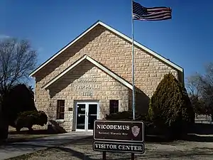 Nicodemus Historic District, Nicodemus National Historic Site |
January 7, 1976 (#76000820) |
U.S. Route 24 39°23′20″N 99°36′55″W |
Nicodemus | |
| 4 | Penokee Stone Figure | June 23, 1982 (#82002660) |
Address restricted |
Penokee |
Grant County
| [6] | Name on the Register | Image | Date listed[7] | Location | City or town | Description |
|---|---|---|---|---|---|---|
| 1 | Grant County Courthouse District | Grant County Courthouse District |
April 26, 2002 (#02000396) |
108 S. Glenn St. 37°34′49″N 101°21′22″W |
Ulysses | |
| 2 | Lower Cimarron Spring |  Lower Cimarron Spring |
October 15, 1966 (#66000344) |
12 miles south of Ulysses on U.S. Route 270; W. side of US 270 37°24′09″N 101°22′07″W |
Ulysses | Boundary increase September 25, 2013 |
| 3 | Santa Fe Trail-Grant County Segment 1 | July 17, 2013 (#13000490) |
Address Restricted |
Ulysses | Santa Fe Trail Multiple Property Submission |
Gray County
| [6] | Name on the Register | Image | Date listed[7] | Location | City or town | Description |
|---|---|---|---|---|---|---|
| 1 | Welborn 'Doc' Barton House |  Welborn 'Doc' Barton House |
January 7, 2010 (#09001204) |
202 S. Edwards St. 37°49′49″N 100°27′04″W |
Ingalls | |
| 2 | Cimarron City Jail | July 12, 2019 (#100004201) |
East Ave. D 37°48′08″N 100°20′55″W |
Cimarron | ||
| 3 | Cimarron Hotel | _from_E_1.JPG.webp) Cimarron Hotel |
February 10, 1983 (#83000428) |
203 N. Main St. 37°48′29″N 100°20′54″W |
Cimarron | |
| 4 | Old Gray County Courthouse | 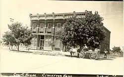 Old Gray County Courthouse |
November 4, 2009 (#09000873) |
117 S. Main St. 37°48′22″N 100°20′56″W |
Cimarron | Location of the Battle of Cimarron in 1889. |
| 5 | Soule Canal-Gray County Segment 1 | October 15, 2014 (#14000857) |
Between U.S. Routes 50/400 and Soule Ave. 37°49′18″N 100°26′18″W |
Ingalls | ||
| 6 | Soule Canal-Segment 2 | October 15, 2014 (#14000858) |
Northern side of U.S. Routes 50/400 37°49′00″N 100°25′28″W |
Ingalls |
Greeley County
| [6] | Name on the Register | Image | Date listed[7] | Location | City or town | Description |
|---|---|---|---|---|---|---|
| 1 | Greeley County Courthouse | 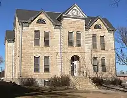 Greeley County Courthouse |
July 12, 1976 (#76000821) |
Harper and 3rd Sts. 38°28′17″N 101°45′00″W |
Tribune |
Hamilton County
| [6] | Name on the Register | Image | Date listed[7] | Location | City or town | Description |
|---|---|---|---|---|---|---|
| 1 | Fort Aubrey Site | August 31, 1978 (#78001281) |
Near Sand Creek, east of Syracuse[12] 37°59′10″N 101°40′15″W |
Syracuse | ||
| 2 | Menno Community Hall | Menno Community Hall |
March 25, 2003 (#02001700) |
NE4, NE4, NE4, NE4, S. 15, T. 26S, R. 49W 37°47′39″N 101°33′52″W |
Kendall | |
| 3 | Northrup Theater | 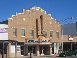 Northrup Theater |
February 9, 2005 (#05000008) |
116 N. Main St. 37°59′03″N 101°45′08″W |
Syracuse |
Haskell County
There are no sites listed on the National Register of Historic Places in Haskell County.
Hodgeman County
| [6] | Name on the Register | Image | Date listed[7] | Location | City or town | Description |
|---|---|---|---|---|---|---|
| 1 | Hackberry Creek Bridge | 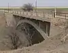 Hackberry Creek Bridge |
July 2, 1985 (#85001424) |
13 miles west and 11 miles north of Jetmore 38°14′14″N 100°08′09″W |
Jetmore | |
| 2 | T. S. Haun House | 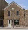 T. S. Haun House |
January 18, 1973 (#73000759) |
Main St. 38°05′06″N 99°53′39″W |
Jetmore | Part of the Haun Museum[13] |
| 3 | Hodgeman County Courthouse | _from_NW_1.JPG.webp) Hodgeman County Courthouse |
May 2, 2002 (#02000429) |
500 Main St. 38°05′03″N 99°53′33″W |
Jetmore | |
| 4 | St. Mary's Catholic Church | _from_SW_1.JPG.webp) St. Mary's Catholic Church |
April 14, 2015 (#15000144) |
14920 SE. 232 Rd. 37°59′07″N 99°38′33″W |
Kinsley vicinity |
Jackson County
| [6] | Name on the Register | Image | Date listed[7] | Location | City or town | Description |
|---|---|---|---|---|---|---|
| 1 | Booth Site | October 2, 1992 (#92001322) |
Address restricted |
Mayetta | ||
| 2 | Delia State Bank | February 3, 2020 (#100004924) |
501 Washington Ave. 39°14′28″N 95°58′02″W |
Delia | ||
| 3 | Harris Site | June 23, 1978 (#78001283) |
Address restricted |
Soldier | ||
| 4 | Holton Bath House | Holton Bath House |
May 21, 2009 (#09000351) |
711 Nebraska Ave. 39°27′53″N 95°44′31″W |
Holton | |
| 5 | McFadden House |  McFadden House |
March 2, 2001 (#01000187) |
315 W. 5th St. 39°27′53″N 95°44′11″W |
Holton | |
| 6 | State Bank of Holton | _State_Bank.jpg.webp) State Bank of Holton |
November 9, 1977 (#77000581) |
4th and Pennsylvania Ave. 39°27′48″N 95°44′05″W |
Holton |
Former listing
| [6] | Name on the Register | Image | Date listed | Date removed | Location | City or town | Summary |
|---|---|---|---|---|---|---|---|
| 1 | Shedd and Marshall Store | November 25, 1977 (#77000582) | October 7, 2009 | 3rd and Whiting Sts. 39°35′20″N 95°36′44″W |
Whiting | Demolished September 2008-May 2009.[14] |
Jefferson County
| [6] | Name on the Register | Image | Date listed[7] | Location | City or town | Description |
|---|---|---|---|---|---|---|
| 1 | Buck Creek School |  Buck Creek School |
December 27, 1988 (#88002830) |
Off U.S. Route 24, 2 miles east of Williamstown 39°04′04″N 95°17′41″W |
Perry | |
| 2 | Delaware River Composite Truss Bridge | May 9, 2003 (#03000371) |
Coal Creek Rd., 0.1 miles south of intersection with 170th Rd. 39°21′03″N 95°27′17″W |
Valley Falls | ||
| 3 | Delaware River Parker Truss Bridge |  Delaware River Parker Truss Bridge |
May 9, 2003 (#03000372) |
Bridge St., 0.3 miles west of intersection with Main St. 39°04′30″N 95°24′10″W |
Perry | |
| 4 | Jefferson Old Town Bowstring Truss | January 4, 1990 (#89002186) |
Off U.S. Route 59 39°12′48″N 95°18′31″W |
Oskaloosa | ||
| 5 | Maplecroft Farmstead | .jpg.webp) Maplecroft Farmstead |
October 4, 2017 (#100001702) |
2957 KOA Rd. 39°05′58″N 95°33′32″W |
Grantville vicinity | |
| 6 | Newell-Johnson-Searle House |  Newell-Johnson-Searle House |
July 10, 2017 (#100001289) |
609 Walnut St. 39°12′53″N 95°18′38″W |
Oskaloosa | |
| 7 | Sunnyside School | January 18, 2011 (#10001139) |
1121 Republic Rd. 39°03′45″N 95°15′09″W |
Sarcoxie Township | Public Schools of Kansas MPS | |
| 8 | Union Block |  Union Block |
April 23, 1973 (#73000760) |
Southwestern corner of Delaware and Jefferson Sts. 39°12′55″N 95°18′47″W |
Oskaloosa |
Jewell County
| [6] | Name on the Register | Image | Date listed[7] | Location | City or town | Description |
|---|---|---|---|---|---|---|
| 1 | Burr Oak School |  Burr Oak School |
November 6, 2005 (#05001201) |
776 Kansas 39°52′10″N 98°18′16″W |
Burr Oak | |
| 2 | Burr Oak United Methodist Church |  Burr Oak United Methodist Church |
November 28, 2007 (#07001225) |
Northeastern corner of Pennsylvania & Washington Sts. 39°52′09″N 98°18′12″W |
Burr Oak | |
| 3 | First National Bank | 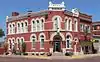 First National Bank |
June 16, 1976 (#76000823) |
Commercial and Jefferson Sts., northwest corner[15] 39°47′13″N 98°12′37″W |
Mankato | |
| 4 | O.W. Francis House |  O.W. Francis House |
February 4, 2000 (#00000036) |
Kansas Hwy 128, 1/2 mile north of Burr Oak[16] 39°52′51″N 98°18′20″W |
Burr Oak | |
| 5 | Jewell County Courthouse | 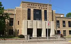 Jewell County Courthouse |
April 26, 2002 (#02000397) |
307 N. Commercial St. 39°47′18″N 98°12′37″W |
Mankato | |
| 6 | Jewell County Jail |  Jewell County Jail |
May 12, 1995 (#95000511) |
Center and Madison, southwest corner[17] 39°47′16″N 98°12′32″W |
Mankato |
Kearny County
| [6] | Name on the Register | Image | Date listed[7] | Location | City or town | Description |
|---|---|---|---|---|---|---|
| 1 | Deerfield State Bank | June 29, 2018 (#100002625) |
602 Main St. 37°58′47″N 101°08′00″W |
Deerfield | ||
| 2 | Deerfield Texaco Service Station |  Deerfield Texaco Service Station |
June 27, 2007 (#07000603) |
105 W. 6th. 37°58′47″N 101°08′03″W |
Deerfield | |
| 3 | Indian Mound | Indian Mound |
July 17, 2013 (#13000491) |
N. side of N. River Rd. 37°53′43″N 101°20′21″W |
Lakin | Santa Fe Trail Multiple Property Submission |
| 4 | Santa Fe Trail-Kearny County Segment 1 | Santa Fe Trail-Kearny County Segment 1 |
July 17, 2013 (#13000492) |
3 mi. W of Deerfield on north side of US 50 37°58′28″N 101°10′59″W |
Deerfield | Santa Fe Trail Multiple Property Submission |
Kiowa County
| [6] | Name on the Register | Image | Date listed[7] | Location | City or town | Description |
|---|---|---|---|---|---|---|
| 1 | Archeological Site Number 14KW301 | July 9, 1982 (#82004881) |
Address restricted |
Coldwater | ||
| 2 | Archeological Site Number 14KW302 | July 9, 1982 (#82004897) |
Address restricted |
Greensburg | ||
| 3 | Fromme-Birney Round Barn |  Fromme-Birney Round Barn |
July 16, 1987 (#87001253) |
Southwest of Mullinville 37°31′36″N 99°30′30″W |
Mullinville | |
| 4 | Greensburg Well | 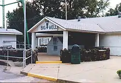 Greensburg Well |
February 23, 1972 (#72000507) |
Sycamore St. 37°36′20″N 99°17′37″W |
Greensburg | Building housing the well was destroyed in a 2007 tornado |
| 5 | S.D. Robinett Building |  S.D. Robinett Building |
February 17, 2009 (#09000029) |
148 S. Main 37°36′20″N 99°17′34″W |
Greensburg | Only building in the business district to survive the 2007 tornado[18] |
Lane County
| [6] | Name on the Register | Image | Date listed[7] | Location | City or town | Description |
|---|---|---|---|---|---|---|
| 1 | Lane County Community High School | 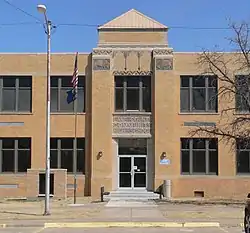 Lane County Community High School |
September 6, 2005 (#05000978) |
200 S. Wichita Ave. 38°28′50″N 100°27′40″W |
Dighton | |
| 2 | Pottorff Site | March 8, 1978 (#78001284) |
Address restricted |
Healy | ||
| 3 | Alexander & Anna Schwartz Farm | _from_SE_2_long.JPG.webp) Alexander & Anna Schwartz Farm |
October 8, 2014 (#14000829) |
57 E. Rd. 70 38°21′57″N 100°21′33″W |
Dighton |
Logan County
| [6] | Name on the Register | Image | Date listed[7] | Location | City or town | Description |
|---|---|---|---|---|---|---|
| 1 | Oakley High School Stadium | Oakley High School Stadium |
April 9, 2013 (#13000150) |
118 W. 7th St. 39°07′56″N 100°51′22″W |
Oakley | Part of the New Deal-Era Resources of Kansas MPS |
| 2 | Old Logan County Courthouse | _from_ESE_1.JPG.webp) Old Logan County Courthouse |
February 23, 1972 (#72000511) |
Main St. 38°54′45″N 101°10′50″W |
Russell Springs | Now the Butterfield Trail Museum[19] |
| 3 | Winona Consolidated School | Winona Consolidated School |
September 6, 2005 (#05000975) |
Junction of Wilson and 5th St. 39°03′50″N 101°14′46″W |
Winona |
Meade County
| [6] | Name on the Register | Image | Date listed[7] | Location | City or town | Description |
|---|---|---|---|---|---|---|
| 1 | Dalton Gang Hideout and Museum |  Dalton Gang Hideout and Museum |
January 7, 2015 (#14001121) |
502 S. Pearlette St. 37°16′52″N 100°20′14″W |
Meade | |
| 2 | Fowler Swimming Pool and Bathhouse | Fowler Swimming Pool and Bathhouse |
February 17, 2009 (#09000030) |
308 E. 6th 37°23′00″N 100°11′31″W |
Fowler |
Norton County
| [6] | Name on the Register | Image | Date listed[7] | Location | City or town | Description |
|---|---|---|---|---|---|---|
| 1 | Barbeau House | _from_W_2.JPG.webp) Barbeau House |
July 14, 2004 (#04000684) |
210 E. Washington Ave. 39°36′39″N 100°00′01″W |
Lenora | |
| 2 | North Fork Solomon River Lattice Truss Bridge |  North Fork Solomon River Lattice Truss Bridge |
May 9, 2003 (#03000366) |
Prairie Dog Golf Course[20] 39°49′06″N 99°52′36″W |
Norton | |
| 3 | Norton Downtown Historic District | 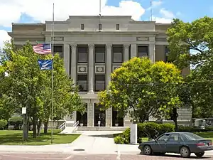 Norton Downtown Historic District |
January 18, 2011 (#10001144) |
Generally bounded by E. Lincoln St., S. 1st St., E. Penn St., and S. Norton Ave. 39°49′44″N 99°53′20″W |
Norton | |
| 4 | Sand Creek Truss Leg Bedstead Bridge |  Sand Creek Truss Leg Bedstead Bridge |
May 9, 2003 (#03000365) |
Larrick Park 39°36′56″N 99°59′57″W |
Lenora | Apparently replaced by a beam bridge in 2010.[21] Originally located at Rd. Y, 0.5 miles west of intersection with U.S. Highway 283, 2 miles north of K-9 and 6 miles northeast of Lenora |
| 5 | West Sappa Creek Lattice | January 4, 1990 (#89002191) |
Northwest of Norton over West Sappa Creek 39°59′13″N 100°05′54″W |
Norton |
Ottawa County
| [6] | Name on the Register | Image | Date listed[7] | Location | City or town | Description |
|---|---|---|---|---|---|---|
| 1 | Archeological Site Number 14OT4 | July 9, 1982 (#82004865) |
Address restricted |
Minneapolis | ||
| 2 | Minneapolis Archeological Site | June 2, 1972 (#72000520) |
3 miles (4.8 km) south of Minneapolis, between the Solomon River and Salt Creek[22] 39°05′06″N 97°41′56″W |
Minneapolis | Premier site of its phase, the Smoky Hill Phase[23] |
Rawlins County
| [6] | Name on the Register | Image | Date listed[7] | Location | City or town | Description |
|---|---|---|---|---|---|---|
| 1 | Minor Sod House |  Minor Sod House |
January 5, 2005 (#04001428) |
SW 1/4, SW1/4, NW 1/4, SW 1/4, S.20, T.5S, R. 36W 39°36′05″N 101°23′39″W |
McDonald | |
| 2 | Sappa Creek Massacre Site | January 28, 2021 (#100006060) |
Address Restricted |
Atwood vicinity | ||
| 3 | Shirley Opera House |  Shirley Opera House |
January 16, 2007 (#06001241) |
503 Main St. 39°48′28″N 101°02′26″W |
Atwood |
Rooks County
| [6] | Name on the Register | Image | Date listed[7] | Location | City or town | Description |
|---|---|---|---|---|---|---|
| 1 | Rooks County Courthouse |  Rooks County Courthouse |
April 26, 2002 (#02000400) |
115 N. Walnut St. 39°26′15″N 99°16′27″W |
Stockton | |
| 2 | St. Joseph Catholic Church | 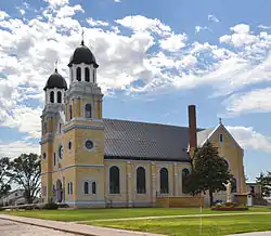 St. Joseph Catholic Church |
November 5, 2005 (#05001203) |
105 N. Oak St. 39°19′07″N 99°35′11″W |
Damar |
Former listing
| [6] | Name on the Register | Image | Date listed | Date removed | Location | City or town | Summary |
|---|---|---|---|---|---|---|---|
| 1 | Rooks County Record Building | Rooks County Record Building |
June 10, 2005 (#05000555) | March 27, 2017 | 501 Main 39°26′11″N 99°16′25″W |
Stockton | Removed or demolished in or before September 2014[24] |
| 2 | Thomas Barn | September 6, 1991 (#91001104) | February 25, 2004 | Northeast of Woodston, near the Osborne County line |
Woodston |
Rush County
| [6] | Name on the Register | Image | Date listed[7] | Location | City or town | Description |
|---|---|---|---|---|---|---|
| 1 | Lone Star School, District 64 | _from_SE_2.JPG.webp) Lone Star School, District 64 |
January 22, 2009 (#08001352) |
Rural route, 1.25 miles (2.01 km) west of Bison Ave. M. 38°31′25″N 99°13′18″W |
Bison | |
| 2 | Miller Farmstead | %252C_silo_and_horse_barn_from_SE_1.JPG.webp) Miller Farmstead |
October 17, 2012 (#12000869) |
2913 KS 4 38°32′19″N 99°13′58″W |
La Crosse | Established east of La Crosse in 1881[25] |
| 3 | Rush County Courthouse | 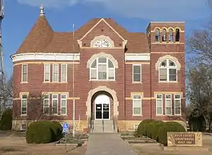 Rush County Courthouse |
April 13, 1972 (#72000524) |
715 Elm St. 38°31′49″N 99°18′41″W |
La Crosse | |
| 4 | Sand Creek Tributary Stone Arch Bridge | 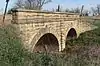 Sand Creek Tributary Stone Arch Bridge |
April 7, 2014 (#14000120) |
2 miles (3.2 km) W, 1.4 miles (2.3 km) N. of La Crosse 38°33′36″N 99°20′49″W |
La Crosse | |
| 5 | Walnut Creek Tributary Bridge | 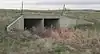 Walnut Creek Tributary Bridge |
July 2, 1985 (#85001435) |
0.5 miles (0.80 km) north and 2.5 miles (4.0 km) west of Nekoma 38°28′49″N 99°29′10″W |
Nekoma | Apparently no longer extant[26] |
Former listing
| [6] | Name on the Register | Image | Date listed | Date removed | Location | City or town | Summary |
|---|---|---|---|---|---|---|---|
| 1 | Rush County Line Bridge | November 4, 1986 (#86003355) | January 7, 2015 | 11 miles (18 km) north of Otis 38°41′48″N 99°02′29″W |
Otis | Bridge was demolished as of Jan. 27, 2015[27] |
Scott County
| [6] | Name on the Register | Image | Date listed[7] | Location | City or town | Description |
|---|---|---|---|---|---|---|
| 1 | Battle of Punished Woman's Fork | _monument_1.JPG.webp) Battle of Punished Woman's Fork |
October 10, 2007 (#07001068) |
In Battle Canyon, north of Scott City[28] 38°38′35″N 100°55′40″W |
Beaver Township | |
| 2 | El Cuartelejo | 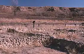 El Cuartelejo |
October 15, 1966 (#66000351) |
Southern end of Lake Scott State Park[29] 38°40′41″N 100°54′51″W |
Beaver Township | |
| 3 | Shallow Water School |  Shallow Water School |
June 9, 2005 (#05000553) |
180 Barclay Ave. in Shallow Water 38°22′31″N 100°54′44″W |
Valley Township | |
| 4 | Herbert and Eliza Steele House | June 23, 2016 (#16000406) |
W. Scott Lake Dr. 38°40′24″N 100°55′07″W |
Beaver Township |
Seward County
There are no sites listed on the National Register of Historic Places in Seward County.
Sheridan County
| [6] | Name on the Register | Image | Date listed[7] | Location | City or town | Description |
|---|---|---|---|---|---|---|
| 1 | John Fenton Pratt Ranch |  John Fenton Pratt Ranch |
April 28, 1983 (#83000442) |
West of Studley on U.S. Route 24 39°21′20″N 100°10′25″W |
Valley Township | Now the Cottonwood Ranch State Historic Site |
| 2 | Shafer Barn | _from_S_1.JPG.webp) Shafer Barn |
April 8, 2009 (#09000195) |
County Road 50S, 0.5 miles (0.80 km) west of County Road 80E 39°17′40″N 100°17′19″W |
West Saline Township | Agriculture-Related Resources of Kansas MPS |
Sherman County
| [6] | Name on the Register | Image | Date listed[7] | Location | City or town | Description |
|---|---|---|---|---|---|---|
| 1 | Mary Seaman Ennis House | _from_S_1.JPG.webp) Mary Seaman Ennis House |
July 12, 2006 (#06000598) |
202 W. 13th St. 39°20′46″N 101°42′48″W |
Goodland | |
| 2 | Goodland City Library |  Goodland City Library |
September 13, 1985 (#85002129) |
120 W. 12th St. 39°20′50″N 101°42′46″W |
Goodland | |
| 3 | Grant School |  Grant School |
July 7, 2015 (#15000387) |
520 W. 12th St. 39°20′49″N 101°43′05″W |
Goodland | |
| 4 | Kuhrt Ranch | Kuhrt Ranch |
April 25, 2001 (#01000408) |
2725 Road 77 39°31′02″N 101°34′03″W |
Edson | |
| 5 | Ruleton School | Ruleton School |
August 28, 2003 (#03000840) |
6450 Ruleton Ave. 39°20′30″N 101°53′27″W |
Goodland | |
| 6 | US Post Office-Goodland |  US Post Office-Goodland |
October 17, 1989 (#89001639) |
124 E. 11th St. 39°20′54″N 101°42′38″W |
Goodland | |
| 7 | United Telephone Building |  United Telephone Building |
October 4, 2017 (#100001709) |
1003 Main St. 39°20′56″N 101°42′42″W |
Goodland |
Former listing
| [6] | Name on the Register | Image | Date listed | Date removed | Location | City or town | Summary |
|---|---|---|---|---|---|---|---|
| 1 | John Ludwig Veselig House | October 24, 1985 (#85003228) | January 17, 1997 | County Road FAS 881 |
Ruleton |
Smith County
| [6] | Name on the Register | Image | Date listed[7] | Location | City or town | Description |
|---|---|---|---|---|---|---|
| 1 | First National Bank Building | .jpg.webp) First National Bank Building |
December 27, 2006 (#06001163) |
100 N. Main 39°46′47″N 98°47′08″W |
Smith Center | |
| 2 | Grimes House |  Grimes House |
March 2, 2001 (#01000192) |
214 Park St. 39°46′46″N 98°46′40″W |
Smith Center | |
| 3 | Home on the Range Cabin |  Home on the Range Cabin |
March 26, 1973 (#73000780) |
County road 90 west of Kansas Highway 8 39°53′22″N 98°56′50″W |
Smith Center | |
| 4 | Martyn House | 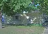 Martyn House |
March 2, 2001 (#01000195) |
216 Park St. 39°46′45″N 98°46′40″W |
Smith Center |
Stanton County
There are no sites listed on the National Register of Historic Places in Stanton County.
Stevens County
There are no sites listed on the National Register of Historic Places in Stevens County.
Thomas County
| [6] | Name on the Register | Image | Date listed[7] | Location | City or town | Description |
|---|---|---|---|---|---|---|
| 1 | Colby City Hall | Colby City Hall |
December 10, 2003 (#03001259) |
585 N. Franklin Ave. 39°23′56″N 101°02′44″W |
Colby | |
| 2 | Colby Community High School | 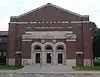 Colby Community High School |
December 10, 2003 (#03001260) |
750 W. 3rd St. 39°23′45″N 101°03′12″W |
Colby | |
| 3 | St. Thomas Hospital | St. Thomas Hospital |
January 2, 2013 (#12001122) |
210 S. Range Ave. 39°23′36″N 101°03′19″W |
Colby | One of only two hospitals in Kansas built by the Works Progress Administration |
| 4 | Thomas County Courthouse | 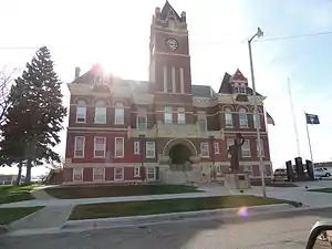 Thomas County Courthouse |
November 21, 1976 (#76000842) |
300 N. Court 39°23′45″N 101°02′33″W |
Colby |
Former listing
| [6] | Name on the Register | Image | Date listed | Date removed | Location | City or town | Summary |
|---|---|---|---|---|---|---|---|
| 1 | Colby Municipal Swimming Pool and Bath House | June 7, 2002 (#02000609) | April 16, 2013 | 200 E. 5th St. 39°23′54″N 101°02′38″W |
Colby |
Wallace County
| [6] | Name on the Register | Image | Date listed[7] | Location | City or town | Description |
|---|---|---|---|---|---|---|
| 1 | Clark-Robidoux House | 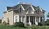 Clark-Robidoux House |
April 25, 2001 (#01000406) |
4th St. 38°54′57″N 101°35′40″W |
Wallace | |
| 2 | Goose Creek Tipi Ring Site | November 21, 1978 (#78001291) |
Address restricted |
Weskan | ||
| 3 | Pond Creek Station | 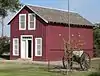 Pond Creek Station |
February 23, 1972 (#72000528) |
East of Wallace on U.S. Route 40 38°54′37″N 101°35′00″W |
Wallace |
Wichita County
| [6] | Name on the Register | Image | Date listed[7] | Location | City or town | Description |
|---|---|---|---|---|---|---|
| 1 | Municipal Auditorium and City Hall | March 7, 2019 (#100003427) |
201 S. 4th St. 38°28′47″N 101°21′30″W |
Leoti | ||
| 2 | William B. and Julia Washington House | _from_E_1.JPG.webp) William B. and Julia Washington House |
June 27, 2014 (#14000351) |
112 N. 3rd St. 38°28′56″N 101°21′36″W |
Leoti |
Woodson County
| [6] | Name on the Register | Image | Date listed[7] | Location | City or town | Description |
|---|---|---|---|---|---|---|
| 1 | Stockbrands and Kemmerer Department Store |  Stockbrands and Kemmerer Department Store |
October 17, 1985 (#85003146) |
100 E. Rutledge 37°52′51″N 95°43′55″W |
Yates Center | Contributing site for the Yates Center Courthouse Square Historic District. |
| 2 | Woodson County Courthouse |  Woodson County Courthouse |
October 10, 1985 (#85002951) |
Courthouse Sq. between Main, Rutledge, State, and Butler Sts. 37°52′54″N 95°43′58″W |
Yates Center | Contributing site for the Yates Center Courthouse Square Historic District. |
| 3 | Yates Center Carnegie Library |  Yates Center Carnegie Library |
June 25, 1987 (#87000974) |
218 N. Main 37°53′00″N 95°43′54″W |
Yates Center | |
| 4 | Yates Center Courthouse Square Historic District | 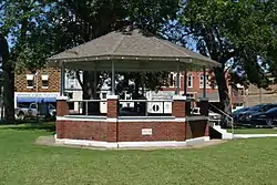 Yates Center Courthouse Square Historic District |
May 20, 1986 (#86001120) |
Courthouse Sq. 37°52′54″N 95°43′58″W |
Yates Center |
References
- "National Register of Historic Places: Weekly List Actions". National Park Service, United States Department of the Interior. Retrieved on January 29, 2021.
- "National Register Information System". National Register of Historic Places. National Park Service. April 24, 2008.
- "National Register of Historic Places: Weekly List Actions". National Park Service. Retrieved January 2, 2009.
- Weekly List Actions, National Register of Historic Places website
- The following sites are listed in multiple counties: County Line Bowstring (Cloud and Republic), Elk River Archeological District (Elk and Montgomery), Site No. JF00-072 (Republic and Washington), Site No. RH00-062 (Brown and Doniphan).
- Numbers represent an alphabetical ordering by significant words. Various colorings, defined here, differentiate National Historic Landmarks and historic districts from other NRHP buildings, structures, sites or objects.
- The eight-digit number below each date is the number assigned to each location in the National Register Information System database, which can be viewed by clicking the number.
- Location derived from its NRHP nomination form; the NRIS lists the site as "Address Restricted"
- Location derived from its NRHP nomination form; the NRIS lists the site as "Address Restricted".
- Location derived from its NRHP nomination form; the NRIS lists the site as "Address Restricted"
- Location derived from its NRHP nomination form; the NRIS lists the site as "Address Restricted"
- Location derived from its GNIS feature record; the NRIS lists the site as "Address Restricted"
- "A rich history..." Hodgeman County, KS. Retrieved 2016-04-03.
- "Archived copy" (PDF). Archived from the original (PDF) on 2011-06-04. Retrieved 2009-10-19.CS1 maint: archived copy as title (link)
- "National and State Registers of Historic Places: Jewell County". Kansas Historical Society. Retrieved 2014-09-08.
- "Points of Interest". Burr Oak, Kansas website. Retrieved 2014-09-08.
- The Jewell County Jail's location is incorrectly represented in the National Register of Historic Places nominating form. The building as actually at the southwest corner of Center and Madison: see photo including street sign, noting direction of shadows.
- Kiowa County National Register properties , Kansas State Historical Society, 2009. Accessed 2009-03-09.
- See 2014 photo showing museum sign at lower right.
- Bridge moved to Prairie Dog Golf Course in 2006: see Norton Telegram, 2007-01-09, p. 3; retrieved 2014-09-21; and "National Register of Historic Places Registration Form: Amendment", retrieved 2014-09-21.
- See September 2014 photos of beam bridge at Commons:Category:Sand Creek bridge, County Road Y, Norton County, Kansas. Uglybridges.com gives a date of 2010 for the current bridge.
- Wedel, Waldo. "Minneapolis 1: A Prehistoric Village Site in Ottawa County, Kansas". Nebraska History Magazine 15.3 (1934): 210-238: 222.
- Roper, Donna C. "The Whiteford Family of Salina". Kansas History 25.4 (2002): 244-257: 247.
- See photos taken 2014-09-14.
- Board nominates Santa Fe Trail sites to national historic register, Topeka Capital-Journal, August 15, 2012
- See 2016 photo of box culvert at location given in NRHP nominating form.
- "Rush County Line Bridge". Bridgehunter.com. Retrieved September 25, 2015.
- Location derived from its NRHP nomination form; the NRIS lists the site as "Address Restricted"
- Location derived from this Kansas University webpage; the NRIS lists the site as "Address Restricted"
| Topics | |
|---|---|
| Lists by state |
|
| Lists by insular areas | |
| Lists by associated state | |
| Other areas | |
| Related | |
| |

| Wikimedia Commons has media related to National Register of Historic Places in Kansas. |