Gulf of Piran
The Gulf of Piran or Piran Bay (Slovene: Piranski zaliv, Croatian: Piranski zaljev or, recently, Savudrijska vala, Italian: Baia di Pirano) is located in the northern part of the Adriatic Sea, and is a part of the southernmost tip of the Gulf of Trieste.
| Gulf of Piran | |
|---|---|
| Piran Bay | |
 Gulf of Piran | |
 Gulf of Piran | |
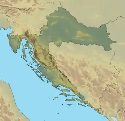
| Location | Europe |
| Coordinates | 45°30′16″N 13°33′43″E |
| Native name | Piranski zaliv |
| Basin countries | Slovenia, Croatia |
| Surface area | 19 km2 (7.3 sq mi) |
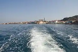
| Settlements | Piran, Portorož |
Overview
It was named after the town of Piran, and its shores are shared by Croatia and Slovenia. It is delimited by a line connecting Cape Savudrija (Savudrijski rt) in the south to the Cape Madona (Rt Madona) in the north and measures around 19 square kilometres (7.3 sq mi). Since the 1990s, the name Bay of Savudrija (Savudrijska vala) has also been used in Croatia.
On the eastern Slovenian coast lies the town of Piran, and the settlements Portorož and Lucija. On the southern Croatian coast are tourist camps of Crveni Vrh and Kanegra, built in the 1980s. The main river flowing into the gulf is the Dragonja, whose mouth is on the border. Along the mouth of the Dragonja lie the Sečovlje saltpans, covering an area of 650 hectares (1,600 acres).
The Gulf area has been a theatre of a maritime and land border dispute between Slovenia and Croatia.
External links
- Conditions in the Gulf of Piran - graphs, in the following order, of water temperature, wave height, wave (interval) period, wave direction, current speed, current direction, maximum wave height data for the past 30 days (taken near Piran by ARSO)
Municipalities, settlements and landforms of the Slovene Riviera | ||
|---|---|---|
Hydrography of Croatia | ||||||
|---|---|---|---|---|---|---|
| Rivers |
|  | ||||
| Lakes | ||||||
| Valleys, estuaries, canyons, wetlands | ||||||
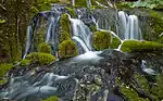
| Waterfalls | ||||||
| Canals |
| |||||
| Adriatic Sea | ||||||