Gunalda
Gunalda is a town in the Gympie Region and a locality split between Gympie Region and Fraser Coast Region in Queensland, Australia.[2][3][4] In the 2016 census, Gunalda had a population of 392 people.[1]
| Gunalda Queensland | |||||||||||||||
|---|---|---|---|---|---|---|---|---|---|---|---|---|---|---|---|
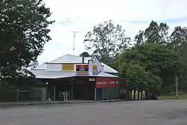 Gunalda Hotel | |||||||||||||||
 Gunalda | |||||||||||||||
| Coordinates | 25.9944°S 152.5613°E | ||||||||||||||
| Population | 392 (2016 census)[1] | ||||||||||||||
| • Density | 5.825/km2 (15.086/sq mi) | ||||||||||||||
| Postcode(s) | 4570 | ||||||||||||||
| Area | 67.3 km2 (26.0 sq mi) | ||||||||||||||
| Time zone | AEST (UTC+10:00) | ||||||||||||||
| Location | |||||||||||||||
| LGA(s) | |||||||||||||||
| State electorate(s) | Gympie | ||||||||||||||
| Federal Division(s) | Wide Bay | ||||||||||||||
| |||||||||||||||
Geography
The town is 196 kilometres (122 mi) from the state capital, Brisbane.
Eaton Post Office opened on 1 September 1882 and was renamed Gunalda in 1883.[5]
History
Thompson's Flat Provisional School opened on 8 August 1881. In 1889 the school was renamed Gunalda Provisional School. On 1 January 1909 it became Gunalda State School.[6]
The town was originally called Keelar but after the railway station was named Gunalda on 2 November 1923, the town was renamed Gunalda.[2]
In December 1938 the foundation stone was laid for a Catholic Church. On Sunday 8 October 1939 Archibishop James Duhig officially opened and dedicated the Catholic Church of the Little Flower.[7]
In 1947 Christ Church Anglican was relocated from Munna Creek to 11 King Street (25.9934°S 152.5613°E) in Gundalda where it retained the name Christ Church Anglican.[8][9]
At the 2006 census, Gunalda and the surrounding area had a population of 574.[10]
References
| Wikimedia Commons has media related to Gunalda, Queensland. |
- Australian Bureau of Statistics (27 June 2017). "Gunalda (SSC)". 2016 Census QuickStats. Retrieved 20 October 2018.

- "Gunalda – town in Gympie Region (entry 15054)". Queensland Place Names. Queensland Government. Retrieved 21 June 2017.
- "Gunalda – locality in Gympie Region (entry 49520)". Queensland Place Names. Queensland Government. Retrieved 21 June 2017.
- "Gunalda – locality in the Fraser Coast Region (entry 46740)". Queensland Place Names. Queensland Government. Retrieved 21 June 2017.
- Premier Postal History. "Post Office List". Premier Postal Auctions. Archived from the original on 15 May 2014. Retrieved 10 May 2014.
- Queensland Family History Society (2010), Queensland schools past and present (Version 1.01 ed.), Queensland Family History Society, ISBN 978-1-921171-26-0
- "NEW CHURCH AT GUNALDA". Maryborough Chronicle, Wide Bay And Burnett Advertiser (21, 182). Queensland, Australia. 30 September 1939. p. 8. Retrieved 31 August 2020 – via National Library of Australia.
- "Closed Churches". Anglican Church of Southern Queensland. Archived from the original on 3 April 2019. Retrieved 24 February 2019.CS1 maint: unfit URL (link)
- "Christ Church Anglican Church". Churches Australia. Archived from the original on 31 August 2020. Retrieved 31 August 2020.
- Australian Bureau of Statistics (25 October 2007). "Gunalda (Tiaro Shire) (State Suburb)". 2006 Census QuickStats. Retrieved 7 December 2010.
