Guy Peaks
The Guy Peaks (72°9′S 98°53′W) are a cluster of peaks located 3 nautical miles (6 km) northeast of Mount Borgeson, overlooking Peale Inlet on Thurston Island, Antarctica. They were mapped from air photos made by U.S. Navy Operation Highjump in December 1946 and were named by the Advisory Committee on Antarctic Names for Arthur W. Guy, an electrical engineer at Byrd Station, 1964–65.[1]
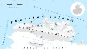
Map of Thurston Island.
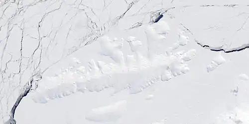
Satellite image of Thurston Island.
See also
- Mountains in Antarctica
Maps
- Thurston Island – Jones Mountains. 1:500000 Antarctica Sketch Map. US Geological Survey, 1967.
- Antarctic Digital Database (ADD). Scale 1:250000 topographic map of Antarctica. Scientific Committee on Antarctic Research (SCAR). Since 1993, regularly upgraded and updated.
References
- "Guy Peaks". Geographic Names Information System. United States Geological Survey. Retrieved 2012-05-14.
![]() This article incorporates public domain material from the United States Geological Survey document: "Guy Peaks". (content from the Geographic Names Information System)
This article incorporates public domain material from the United States Geological Survey document: "Guy Peaks". (content from the Geographic Names Information System)
| General |
| .svg.png.webp) |
|---|---|---|
| Regions | ||
| Waterways | ||
| Famous explorers | ||
This article is issued from Wikipedia. The text is licensed under Creative Commons - Attribution - Sharealike. Additional terms may apply for the media files.