Hœdic
Hœdic or Hoëdic (Breton: Edig) is an island off the south coast of Brittany in north-western France. Its bigger "twin sister" island is Houat.
Hœdic
Edig | |
|---|---|
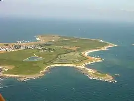 An aerial view of Hœdic | |
 Coat of arms | |
Location of Hœdic 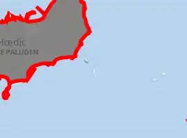
| |
 Hœdic 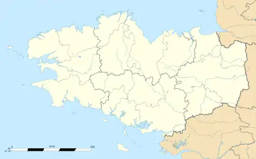 Hœdic | |
| Coordinates: 47°20′25″N 2°52′40″W | |
| Country | France |
| Region | Brittany |
| Department | Morbihan |
| Arrondissement | Lorient |
| Canton | Quiberon |
| Government | |
| • Mayor (2020–2026) | Jean-Luc Chiffoleau[1] |
| Area 1 | 2.08 km2 (0.80 sq mi) |
| Population (2017-01-01)[2] | 99 |
| • Density | 48/km2 (120/sq mi) |
| Time zone | UTC+01:00 (CET) |
| • Summer (DST) | UTC+02:00 (CEST) |
| INSEE/Postal code | 56085 /56170 |
| Elevation | 0–22 m (0–72 ft) (avg. 14 m or 46 ft) |
| 1 French Land Register data, which excludes lakes, ponds, glaciers > 1 km2 (0.386 sq mi or 247 acres) and river estuaries. | |
Administratively, Hœdic is a commune in the Morbihan department.
Geography
Hœdic is located in the heart of Mor braz, a bay in the Atlantic Ocean, off the south coast of Brittany (Rhuys and Quiberon peninsulas), 13 km east of Belle-Île and 5 km south-east of Houat. It is part of a line of granite crests that also includes the Le Croisic peninsula, Dumet Island, Houat, Quiberon and Groix.
Hœdic is a low, undulating plateau, 800 meters wide by 2500 meters long. Its peak, at an altitude of 22 metres, is located in the middle of its eastern part, on the road that leads from the village to the hamlet of the Phare. The island's base consists essentially of granite and less often of schists. The coast is an alternation of sandy coves and rocky points of variable height, generally more marked to the north (Beg Lagat, the Old Castle) than to the south (Beg Er Faut, Kasperakiz). There are two marshes, one modest, behind the dune of the new harbor, the other, about twenty hectares behind the dune of the old port. In addition to the main island, the town has several small islands including Roc'h Melen, Madavoar, Cardinals, Mulons ...
Human Geography
Hœdic has long been associated with familial polyculture of livestock and crops—that is, in farms owned by people and families rather than heavily industrialised farms[3]—along with their fishing resources. The former disappeared in the middle of the 20th century, while the latter had a second wind in the 1980s but is currently in decline. Currently, Hœdic is largely dependent on tourism, even more significantly than its neighbour Houat. Similarly to Houat, the majority of its land is being invaded by brush.
Hœdic is a car-free island with around 100 inhabitants in the wintertime. During summer, its population can reach 3,000 including boaters, tourists and campers coming to the island. The island is connected to the mainland via Compagnie Océane boats year-round and Compagnie des Iles boats during the tourist season (connections from Quiberon).
Demographics
Inhabitants of Hœdic are called Hœdicais.
See also
References
- "Maires du Morbihan" (PDF). Préfecture du Morbihan. 7 July 2020.
- "Populations légales 2017". INSEE. Retrieved 6 January 2020.
- Brigitte Alain (February 2014). "Qu'est-ce que l'agriculture familiale ?" (in French). No. 222. Retrieved 2020-04-20. Cite magazine requires
|magazine=(help)
External links
| Wikimedia Commons has media related to Hœdic. |
- Base Mérimée: Search for heritage in the commune, Ministère français de la Culture. (in French)
| Authority control |
|
|---|