Habbupur
Habbupur is a village in Akorhi Gola block of Rohtas district in Bihar, India. As of 2011, its population was 1,247, in 210 households. It covers an area of 141.7 hectares, of which most is under agricultural use: 118.9 hectares are farmland, all of which is irrigated, and the remaining 22.8 hectares are under non-agricultural use.[2]
Habbupur | |
|---|---|
Village | |
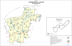 Map of Habbupur (#252478) in Akorhi Gola block | |
 Habbupur Location in Bihar, India | |
| Coordinates: 25.06103°N 84.21175°E[1] | |
| Country | India |
| State | Bihar |
| District | Rohtas |
| Area | |
| • Total | 1.417 km2 (0.547 sq mi) |
| Elevation | 101 m (331 ft) |
| Population (2011) | |
| • Total | 1,247[2] |
| Languages | |
| • Official | Hindi |
| Time zone | UTC+5:30 (IST) |
References
- "Geonames.org. Habbupur". Retrieved 29 October 2020.
- "Census of India 2011: Bihar District Census Handbook – Rohtas, Part A (Village and Town Directory)". Census 2011 India. pp. 1060–1083. Retrieved 29 October 2020.
This article is issued from Wikipedia. The text is licensed under Creative Commons - Attribution - Sharealike. Additional terms may apply for the media files.
