Hajdúdorog
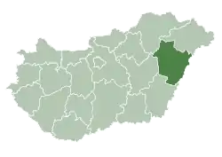
Hajdúdorog (Hungarian: [ˈhɒjduːdoroɡ] (![]() listen)) is a town in Hajdú-Bihar county, in the Northern Great Plain region of eastern Hungary. In 2001, 80.9% of the population of Hajdúdorog was Greek Catholic.
listen)) is a town in Hajdú-Bihar county, in the Northern Great Plain region of eastern Hungary. In 2001, 80.9% of the population of Hajdúdorog was Greek Catholic.
Hajdúdorog | |
|---|---|
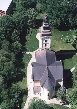 The Cathedral of Hajdúdorog from above | |
 Flag  Coat of arms | |
 Hajdúdorog | |
| Coordinates: 47°49′N 21°30′E | |
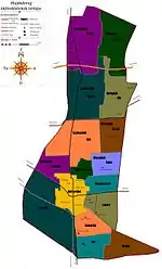
| Country | |
| County | Hajdú-Bihar |
| District | Hajdúböszörmény |
| Area | |
| • Total | 100.65 km2 (38.86 sq mi) |
| Population (2012) | |
| • Total | 8,888 |
| • Density | 89.97/km2 (233.0/sq mi) |
| Time zone | UTC+1 (CET) |
| • Summer (DST) | UTC+2 (CEST) |
| Postal code | 4087 |
| Area code | (+36) 52 |
| Website | www |
It is located at lat 47° 48 ' 59 21 and lon ° 29 ' 59 47.81647. Hajdúdorog had a population of 8797 in 2014[1] (down from 8888 in 2006), with a population density of 89,97 people per km². The city is 130 m above sea level and the district area is 100.65 km².
History
The city is one of the so-called "old haiduk towns" and appears to have been inhabited since Paleolithic times,[2] but the first written records come from 1301.[3] Archaeological remains of the so-called rézbalta culture from 1380–2200BC have been found in the area as have Iron Age Scythians settlements.[4][5] Roman era tombs were found in the area in 1938. The Sarmatian, Celtic, and Roman tombs were located near the church and the area appears to have been the frontier between Roman and Sarmation lands at the time.
Avars immigrated into the area in 567AD and Hungarian Magyars in 896AD. The Ottoman Empire took the town in 1566AD but by the 17th century it was in Habsburg hands.
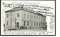
The City Hall was built around 1660, and remains today despite being damaged during World War II.
Cholera swept the city in the 19th century and in 1843 Hajdúdorog was divided into the seven municipalities. The town's history is presented in the Museum of Local History.
Religion
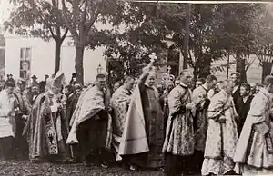
Traditionally the area was Catholic; however, since the beginning of the 20th century, the majority of the city has been from the Hungarian Greek Catholic Church, in contrast to the surrounding area. The differences in religion have created a distinct local culture.
Catholic
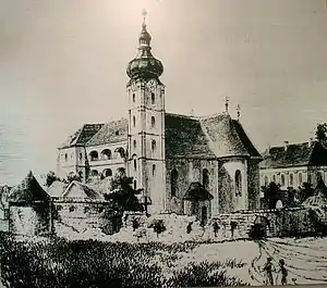
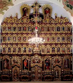
The city is the seat of the Hungarian Greek Catholic Archeparchy of Hajdúdorog. The Greek Catholic Cathedral is one of the city's main points of interest with its 200-year-old icons.
Jewish
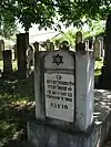
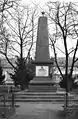
Before the Second World War, the city was home to a large Jewish population, located predominantly in three streets near the edge of town. A memorial to the community is located near the centre of the town.
There had been some anti-Semitism through the 1930s; however, when Nazi Germany invaded Hungary on 19 March 1944, Jewish businesses were closed and ghettoisation began.
On 16 October 1944 the Red Army started the so-called lowland armored battle and took the city on October 24.[6][7]
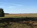
Geography
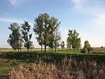
Geographically the town is located in the Northern Great Plains and three different geographical microregions dominate the area:
- Hortobágy
- Hajdúhát
- South-Nyírség
The area is also famous for its high-quality fürdővárosokhoz, Hajdúdorog medicinal and thermal water gushing to the surface.
The climate is moderately warm, and dry. The wettest month, July, averages 80 mm (3 in), while the driest, January, averages 25.5 mm (1.0 in).[8][9]
Northwest of Hajdúdorog is a floodplain ecological landscape and to the north is the Tisza River's catchment area, and also the Nagylapos River.[10]
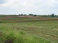
Economy
The region's main source of livelihood, is agriculture, mainly vineyards and agricultural activity related to them and cattle.[11][12][13][14]
Landmarks
- Cathedral of Hajdúdorog
- Iconostasis of the Cathedral of Hajdúdorog
- Central Church fortress
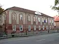
- General Ferenc Móra art school
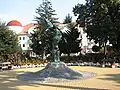
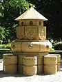
- the Town Fountain inaugurated in 1984
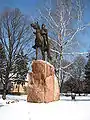
- The sculpture of István bocskai
- The old Town Hall
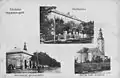
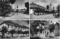
Gallery
References
- Hajdúdorog population statistics at Magyarország közigazgatási helynévkönyve.
- M. Nepper, Ibolya.szerk.: Komoróczy György: Hajdúdorog területe a hun korig, Hajdúdorog története. Hajdúdorog: Hajdúdorog Községi Tanácsának Végrehajtó Bizottsága, 15. o. Kiadói Főig. Eng. sz. 2188/1970 (1970)
- Gregorius Fejér. Codex Diplomaticus Hungariae ecclesiasticus ac civilis, 8. kötet/5 (Latin nyelven), 18. (1835)
- M. Nepper, Ibolya.szerk.: Komoróczy György: Hajdúdorog területe a hun korig, Hajdúdorog története. Hajdúdorog: Hajdúdorog Községi Tanácsának Végrehajtó Bizottsága, p17. (1970)
- M. Nepper, Ibolya.szerk.: Komoróczy György: Hajdúdorog területe a hun korig, Hajdúdorog története. (Hajdúdorog: Hajdúdorog Községi Tanácsának Végrehajtó Bizottsága, 21. o. Kiadói Főig., 1970).
- Számvéber, Norbert. Páncélosok a Tiszántúlon, Az alföldi páncéloscsata 1944 októberében. Budapest: Paktum Nyomdaipari Társaság. ISBN 963-204-493-2 (2002).
- Komoróczy, György. Hajdúdorog története. Hajdúdorog: Hajdúdorog Községi Tanácsának Végrehajtó Bizottsága, 198; 300-301. o. Kiadói Főig. Eng. sz. 2188/1970 (1970).
- Vadász, István. Hajdúböszörményi kistérség. Budapest: Száz magyar falu könyvesháza Kht., 54.
- Hajdúböszörményi Kistérség.
- Gönczy Sándor - Szalai Katalin. Geomorfológiai fogalomgyűjtemény (oktatási segédanyag a földrajz szakos főiskolai hallgatók számára). Beregszász: Kárpátaljai Magyar Pedagógusszövetség Tankönyv- és Taneszköztanácsa, p3. (2004).
- Hajdú-Bihar megyei Levéltár gyűjteménye; Határleírás 1852-1893 között. VI. 127.
- Vadász, István. Hajdúböszörményi kistérség. (Budapest: Száz magyar falu könyvesháza Kht), 53
- Vadász, István. Hajdúböszörményi kistérség. Budapest: Száz magyar falu könyvesháza Kht., 55. o. ISBN 963 8629851 (2004).
- Pannon Enciklopédia: Magyarország állatvilága. Budapest: Dunakanyar 2000, p14-15.
External links
| Wikimedia Commons has media related to Hajdúdorog. |
- Official website in Hungarian
| Towns (2) |
| |
|---|---|---|
| City with county rights |
|   |
|---|---|---|
| Towns | ||
| Large villages | ||
| Villages |
| |
| Other topics |
| |