Hancock Pass
Hancock Pass, elevation 12,208 ft (3,721 m), is a high mountain pass on the Continental Divide in western Colorado. The pass is on the border between Chaffee and Gunnison counties and between the Gunnison and San Isabel national forests.
| Hancock Pass | |
|---|---|
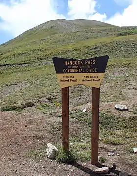 The sign at the top of the pass. | |
| Elevation | 12,208 ft (3,721 m)[1] |
| Location | Chaffee and Gunnison counties, Colorado. |
| Range | Rocky Mountains |
| Coordinates | 38°37′15″N 106°22′27″W |
| Topo map | Garfield |
The road over the pass is of moderate difficulty and is very rocky and slow going. [2]
References
- "Hancock Pass". Geographic Names Information System. United States Geological Survey. Retrieved 2014-08-24.
- Trip Advisor. Hancock Pass/ Alpine Tunnel 4x4 Road. Viewed 2014-08-24
This article is issued from Wikipedia. The text is licensed under Creative Commons - Attribution - Sharealike. Additional terms may apply for the media files.
