Hanging Houghton
Hanging Houghton is a small village in the Daventry district of the county of Northamptonshire in England. It is on the A508 road between Brixworth and Lamport, in the civil parish of Lamport .[1]
| Hanging Houghton | |
|---|---|
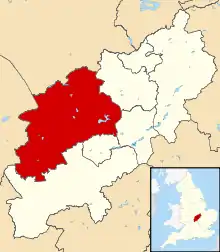
 Hanging Houghton Location within Northamptonshire | |
| OS grid reference | SP7573 |
| Civil parish | |
| District | |
| Shire county | |
| Region | |
| Country | England |
| Sovereign state | United Kingdom |
| Post town | Northampton |
| Postcode district | NN6 |
| Dialling code | 01604 |
| Police | Northamptonshire |
| Fire | Northamptonshire |
| Ambulance | East Midlands |
| UK Parliament | |
Great House and Gardens
Hanging Houghton was the location of a great house and gardens, that although no longer present is listed as a scheduled monument as part of the Ancient Monuments and Archaeological Areas Act 1979. This monument encompasses the now buried and the earthwork remains of the house and gardens, and is located in the south west area of the village.[2]
From 1471, until it was abandoned in 1665, the house was owned by the Montague family, and is shown on a map in 1655 as having highly elaborate formal gardens including a knot garden and several terraced walks. The ruins of the house survived into the late 18th Century, however all that now remains is a rectangular building platform measuring 40 metres by 30 metres in the north east corner of the land. Contemporary illustrations suggest the house was of typical late 16th Century design with three bays and a symmetrical south elevation with central porch.[2]
Nothing of the gardens remain other than a series of rectangular areas noticeable by shallow banks and earthworks measuring less than 1 metre in height.[2]
Listed Buildings
The village is home to five Grade II listed buildings,[3] they are:
- A K6 telephone box located on Manor Road
- The Hanging Houghton School House
- Clint Hill Farmhouse
- Manor Farmhouse
- Numbers 18 and 20 Manor Road
The Domesday Book
Hanging Houghton was referenced as a settlement in the Domesday Book of 1086.[4] It was recorded as having a population of 30 households. The book recorded the households, owners, resources and land value as follows:
| Owner | Number of Households | Land & Resources | Land Value in 1086 |
|---|---|---|---|
| The Abbey of Bury St. Edmunds | 3 freemen, 12 smallholders | 2 ploughlands. 2 men's plough teams | 12 shillings |
| Count Robert of Morton | 3 villagers, 2 smallholders | 4 ploughlands. 1.5 lord's plough teams. 1.5 men's plough teams | 1 pound |
| Walter of Flanders | - | - | 4 shillings |
| Countess Judith | 6 freeman, 4 smallholders | 2 ploughlands. 2 men's plough teams. | 13 shillings and 2 pence |
References
- Streetmap: 1:25,000 map. Retrieved 12 November 2009
- "Great house and gardens at Hanging Houghton". Historic England. Retrieved 7 October 2020.
- "Hanging Houghton". Historic England. Retrieved 8 October 2020.
- "Hanging Houghton". Open Domesday. Retrieved 7 October 2020.
External links
![]() Media related to Hanging Houghton at Wikimedia Commons
Media related to Hanging Houghton at Wikimedia Commons
- Map sources for Hanging Houghton