Harahan, Louisiana
Harahan is a city in Jefferson Parish, Louisiana, United States, and a suburb of New Orleans. The population was 9,277 at the 2010 census.
Harahan, Louisiana | |
|---|---|
City | |
| City of Harahan | |
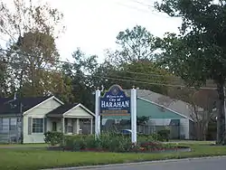 Welcome sign on Jefferson Highway | |
 Seal | |
 Location of Harahan in Jefferson Parish, Louisiana. | |
.svg.png.webp) Location of Louisiana in the United States | |
| Coordinates: 29°56′28″N 90°12′07″W[1] | |
| Country | |
| State | |
| Parish | Jefferson |
| Government | |
| • Mayor | Tim Baudier (R)[2] |
| Area | |
| • Total | 2.50 sq mi (6.46 km2) |
| • Land | 2.01 sq mi (5.21 km2) |
| • Water | 0.48 sq mi (1.25 km2) |
| Elevation | 7 ft (2 m) |
| Population (2010) | |
| • Total | 9,277 |
| • Estimate (2019)[4] | 9,250 |
| • Rank | JE: 3rd |
| • Density | 4,597.42/sq mi (1,775.34/km2) |
| Time zone | UTC-6 (CST) |
| • Summer (DST) | UTC-5 (CDT) |
| ZIP code | 70123 |
| Area code(s) | 504 |
| FIPS code | 22-32930 |
| Website | www |
Harahan was named in honor of James Theodore Harahan, president of the Illinois Central Railroad from 1906 to 1911. The Illinois Central track runs parallel to Airline Highway.
History
The city of Harahan occupies land which was once part of the Soniat Plantation.[5] The area was historically known for ideal conditions to use as farming and raising cattle. In the late 1800’s, part of the former plantation was used as an experimental farm operated by Southern University and A&M College (Southern).[6]
Non-agricultural development began in 1894, when the Illinois Central Railroad (now Canadian National) built a repair yard and roundhouse adjacent to the current City Hall. In 1914, the Harahan Land Company, composed of ICRR officials, bought the Southern University tract of land and subdivided it. Residents included railroad workers, river workers and truck farmers. The Village of Harahan was incorporated in 1920 – named after James Harahan, the ICRR President.[7]
Prior to the Huey P. Long Bridge being built, Harahan was one of few points on the entire Mississippi River where railcars could cross. The Illinois Central and Southern Pacific Railroads maintained a ferry crossing between Harahan and Avondale to carry their railroad cars across the Mississippi River. To reach this ferry, the rail cars traveled up an incline that brought them over the river levee. The three largest barges in the world, the Mastodon, the Mammoth and El Grande once called Harahan home.[7]
In 1908, the Colonial Country Club was built and occupied the old Soniat Plantation home. By 1910, Wedell-Williams – on the eastern edge of Harahan, had become the defacto New Orleans Airport,[8] and aviation pioneer John Moisant died there in a plane accident while preparing for a competition.[9] Shortly thereafter, Harahan dedicated Moisant Park on Hickory Avenue in his honor. This park was later re-named Zeringue Park shortly after World War II.[10] Wedell-Williams operated commercial and military flights through the 1940’s.
In 1930, the Huey P. Long Bridge was opened, increasing the importance of Harahan and by 1940, the population had risen to 1,082 citizens.[11]
During World War II, Camp Plauche was established on the current land occupied by Elmwood.[12] In addition to the camp, Freiburg Mahogany manufacturing began producing critical aircraft and boat components for the war effort. This activity spurred economic growth, particularly new homes; Harahan’s population tripled during this period. This growth continued after the war.
By 1960, the population had grown to over 9,000. Numerous improvements were undertaken, including modernizing the police and fire departments, paving more streets and building a water treatment facility. Commercial activity was limited to Jefferson Highway and the northern end of Hickory. The 1970’s and early 80’s so rapid development of apartment construction on Hickory and areas of Elmwood. Completion of Earhart Expressway, making access to New Orleans proper much easier, influence this growth as the appeal of Harahan as a “bedroom community”. Today, Harahan is directly influenced by its relationship with the larger surrounding area – including Jefferson Parish and the City of New Orleans.
Demographics
| Historical population | |||
|---|---|---|---|
| Census | Pop. | %± | |
| 1930 | 892 | — | |
| 1940 | 1,082 | 21.3% | |
| 1950 | 3,394 | 213.7% | |
| 1960 | 9,275 | 173.3% | |
| 1970 | 13,037 | 40.6% | |
| 1980 | 11,384 | −12.7% | |
| 1990 | 9,927 | −12.8% | |
| 2000 | 9,885 | −0.4% | |
| 2010 | 9,277 | −6.2% | |
| 2019 (est.) | 9,250 | [4] | −0.3% |
| U.S. Decennial Census[13] | |||
As of the census[14] of 2000, there were 9,885 people, 3,994 households, and 2,799 families residing in the city. The population density was 5,023.5 inhabitants per square mile (1,937.4/km2). There were 4,129 housing units at an average density of 2,098.3 per square mile (809.2/km2). The racial makeup of the city was 97.06% White, 0.62% African American, 0.45% Native American, 0.37% Asian, 0.03% Pacific Islander, 0.37% from other races, and 1.10% from two or more races. 2.46% of the population were Hispanic or Latino of any race.
There were 3,994 households, out of which 28.2% had children under the age of 18 living with them, 55.2% were married couples living together, 11.1% had a female householder with no husband present, and 29.9% were non-families. 25.3% of all households were made up of individuals, and 11.4% had someone living alone who was 65 years of age or older. The average household size was 2.42 and the average family size was 2.91.
In the city, the population was spread out, with 20.8% under the age of 18, 6.9% from 18 to 24, 28.5% from 25 to 44, 24.0% from 45 to 64, and 19.8% who were 65 years of age or older. The median age was 41 years. For every 100 females, there were 90.1 males. For every 100 females age 18 and over, there were 86.9 males.
The median income for a household in the city was $44,702, and the median income for a family was $55,319. Males had a median income of $37,995 versus $27,921 for females. The per capita income for the city was $23,448. 4.7% of the population and 3.1% of families were below the poverty line. 3.7% of those under the age of 18 and 8.2% of those 65 and older were living below the poverty line.
Arts and culture
Harahan was home to Colonial Golf and Country Club. It hosted the 1954 New Orleans Women's Open.[15] It closed in early 2012.[16]
Education
Harahan's public schools are operated by the Jefferson Parish Public School System (JPPSS).[17][18] The city is zoned to Harahan Elementary School (Harahan),[19] Riverdale Middle School (Jefferson),[20] and Riverdale High School (Jefferson).[21] In regards to the advanced studies academies, students are zoned to Airline Park Academy.[22]
In 2012, the Jefferson Parish campus of the International School of Louisiana (ISL) charter school opened in a leased JPPPS building on South Clearview Parkway in Elmwood. near Harahan.[23][24] The JPPPS board later arranged for the charter school to move from the Elmwood facility to the former Ralph J. Bunche Academy in Metairie.[24]
Private Schools in Harahan include St. Rita, a Catholic Elementary and Middle School, and Faith Lutheran, a K-12 Private Lutheran School.
Jefferson Parish Library operates the Harahan Library.[25]
Notable people
References
- "Harahan, Louisiana". Geographic Names Information System. United States Geological Survey. June 4, 1980. Retrieved 2007-12-12.
- "Election Returns: Jefferson Parish". Louisiana Secretary of State. November 6, 2018. Retrieved November 9, 2018.
- "2019 U.S. Gazetteer Files". United States Census Bureau. Retrieved July 25, 2020.
- "Population and Housing Unit Estimates". United States Census Bureau. May 24, 2020. Retrieved May 27, 2020.
- "1849 Kenner, Soniat, & Labarre". websitesneworleans.com. Retrieved 2021-01-27.
- "Southern University: From New Orleans to Scotlandville (1880-1914)". CreoleGen. 2016-03-29. Retrieved 2021-01-27.
- Deubler, Jeremy. "O-K Line: Harahan Barn & Ferry Crossing - Stop 3 of 4 in the O-K Rail Line, Kenner to New Orleans tour". New Orleans Historical. Retrieved 2021-01-27.
- "Abandoned & Little-Known Airfields: Louisiana: Western New Orleans area". www.airfields-freeman.com. Retrieved 2021-01-27.
- Times-Picayune, Doug MacCash, NOLA com |. "John Moisant, aviation pioneer, died a century ago in New Orleans". NOLA.com. Retrieved 2021-01-27.
- "City of Harahan". 2018-01-01.
- "Huey P. Long Bridge". www.asce.org. Retrieved 2021-01-27.
- "NO_Camp_Plauche". old-new-orleans.com. Retrieved 2021-01-27.
- "Census of Population and Housing". Census.gov. Retrieved June 4, 2015.
- "U.S. Census website". United States Census Bureau. Retrieved 2008-01-31.
- "LPGA Tournament Chronology 1950-1959" (PDF). lpga.com. Retrieved 2018-07-11.
- "On Colonial Country Club property in Harahan, owners seek six commercial lots". nola.com. Retrieved 2018-07-11.
- "Garbage Collection." City of Harahan. Retrieved on May 18, 2014.
- "2010 CENSUS - CENSUS BLOCK MAP (INDEX): Harahan city, LA" (Archive). U.S. Census Bureau. Retrieved on May 18, 2014.
- "Elementary School Districts 2012-2013 East Bank of Jefferson Parish Louisiana Archived 2013-09-05 at the Wayback Machine" (Archive). Jefferson Parish Public School System. Retrieved on May 18, 2014.
- "Middle School Districts 2012-2013 East Bank of Jefferson Parish Louisiana Archived 2013-09-05 at the Wayback Machine" (Archive) Jefferson Parish Public School System. Retrieved on May 18, 2014.
- "High School Districts 2012-2013 East Bank of Jefferson Parish Louisiana Archived 2014-05-18 at WebCite." (Archive) Jefferson Parish Public School System. Retrieved on May 18, 2014.
- "East Bank Advanced Studies Attendance Zones Archived 2013-09-05 at the Wayback Machine" (Archive). Jefferson Parish Public School System. Retrieved on May 18, 2014.
- Tan, Sarah. "The International School of Louisiana opens in Harahan." Times Picayune. November 23, 2012. Retrieved on May 18, 2014.
- "Jefferson Parish" (Archive) International School of Louisiana. December 18, 2012. Retrieved on May 18, 2014. "822 S. Clearview Parkway Harahan, LA 70123 (Located in Elmwood)"
- "Harahan Library." Jefferson Parish Library. Retrieved on September 29, 2010.
External links
| Wikimedia Commons has media related to Harahan, Louisiana. |
Municipalities and communities of Jefferson Parish, Louisiana, United States | ||
|---|---|---|
| Cities | 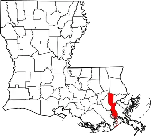 | |
| Towns | ||
| CDPs | ||
| Other unincorporated communities | ||
| ||
| Authority control |
|---|