Harrison Township, Harrison County, Indiana
Harrison Township is one of twelve townships in Harrison County, Indiana, United States. As of the 2010 census, its population was 12,484 and it contained 5,282 housing units.[1] Corydon, the county seat of Harrison County, is in Harrison Township.
Harrison Township | |
|---|---|
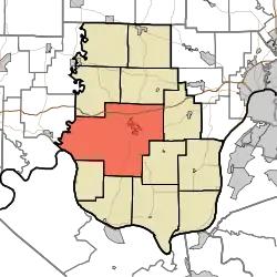 Location in Harrison County | |
| Coordinates: 38°11′02″N 86°10′33″W | |
| Country | United States |
| State | Indiana |
| County | Harrison |
| Named for | William Henry Harrison |
| Government | |
| • Type | Indiana township |
| Area | |
| • Total | 101.58 sq mi (263.1 km2) |
| • Land | 101.33 sq mi (262.4 km2) |
| • Water | 0.25 sq mi (0.6 km2) 0.25% |
| Elevation | 699 ft (213 m) |
| Population (2010) | |
| • Total | 12,484 |
| • Density | 123.2/sq mi (47.6/km2) |
| GNIS feature ID | 0453387 |
History
The township, like the county, is named for governor, general and ninth President William Henry Harrison. The majority of land in the township was in his possession in the first decade of the 19th century. He donated a parcel of land for the construction of Corydon and sold much of the rest of his land in the township by 1815 to the settlers who were rapidly occupying the countryside.
Corydon Battle Site was added to the National Register of Historic Places in 1979.[2]
Geography
According to the 2010 census, the township has a total area of 101.58 square miles (263.1 km2), of which 101.33 square miles (262.4 km2) (or 99.75%) is land and 0.25 square miles (0.65 km2) (or 0.25%) is water.[1] The streams of Blue River, Brush Heap Creek, Buck Creek, Hickman Branch, Little Indian Creek, Potato Run and Rock Creek run through this township.
Cities and towns
- Corydon (the county seat)
Unincorporated towns
- Dixie
- Harrison Grange
- Hillcrest
- Idlewild (historical)
- Kings Store
- White Cloud
(This list is based on USGS data and may include former settlements.)
Adjacent townships
- Jackson Township (northeast)
- Franklin Township (east)
- Boone Township (southeast)
- Webster Township (southeast)
- Heth Township (south)
- Washington Township (southwest)
- Jennings Township, Crawford County (west)
- Ohio Township, Crawford County (west)
- Spencer Township (northwest)
Cemeteries
The township contains seven cemeteries: Cedar Hill, Conrad, Hillgrove, Jackson, Jordan, Sharp,[3] Shuck and Trout.
References
- "Harrison Township, Harrison County, Indiana". Geographic Names Information System. United States Geological Survey. Retrieved 2009-09-24.
- United States Census Bureau cartographic boundary files
- "Population, Housing Units, Area, and Density: 2010 - County -- County Subdivision and Place -- 2010 Census Summary File 1". United States Census. Archived from the original on 2020-02-12. Retrieved 2013-05-10.
- "National Register Information System". National Register of Historic Places. National Park Service. July 9, 2010.
- Sharp Cemetery is located in the Harrison-Crawford State Forest on the east side of Old Forest Road about 0.4 miles east of its intersection with Ohio River Scenic Byway (Indiana State Highway 62).
External links
Municipalities and communities of Harrison County, Indiana, United States | ||
|---|---|---|
| Towns | Map of Indiana highlighting Harrison County | |
| Townships | ||
| CDP | ||
| Other unincorporated communities |
| |
| Ghost town | ||
| Footnotes | ‡This populated place also has portions in an adjacent county or counties | |
| ||
| Authority control |
|---|
