Hartford, Kansas
Hartford is a city in Lyon County, Kansas, United States. As of the 2010 census, the city population was 371.[7]
Hartford, Kansas | |
|---|---|
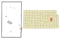 Location within Lyon County and Kansas | |
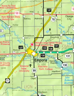 KDOT map of Lyon County (legend) | |
| Coordinates: 38°18′28″N 95°57′23″W | |
| Country | United States |
| State | Kansas |
| County | Lyon |
| Platted | 1858 |
| Incorporated | 1929 [1] |
| Government | |
| • Type | Mayor–Council |
| Area | |
| • Total | 0.40 sq mi (1.03 km2) |
| • Land | 0.40 sq mi (1.03 km2) |
| • Water | 0.00 sq mi (0.00 km2) |
| Elevation | 1,083 ft (330 m) |
| Population | |
| • Total | 371 |
| • Estimate (2019)[4] | 371 |
| • Density | 936.87/sq mi (361.82/km2) |
| Time zone | UTC-6 (CST) |
| • Summer (DST) | UTC-5 (CDT) |
| ZIP code | 66854 |
| Area code | 620 |
| FIPS code | 20-30475 [5] |
| GNIS ID | 0477441 [6] |
History
Hartford was laid out in 1858.[8] Some of its founders were original natives of Hartford, Connecticut, hence the name.[9][10]
Hartford was incorporated as a city in March 1884.[11]
Geography
Hartford is located at 38°18′28″N 95°57′23″W (38.307866, -95.956313).[12] According to the United States Census Bureau, the city has a total area of 0.38 square miles (0.98 km2), all land.[13]
Demographics
| Historical population | |||
|---|---|---|---|
| Census | Pop. | %± | |
| 1890 | 441 | — | |
| 1900 | 553 | 25.4% | |
| 1910 | 589 | 6.5% | |
| 1920 | 575 | −2.4% | |
| 1930 | 516 | −10.3% | |
| 1940 | 491 | −4.8% | |
| 1950 | 395 | −19.6% | |
| 1960 | 337 | −14.7% | |
| 1970 | 478 | 41.8% | |
| 1980 | 551 | 15.3% | |
| 1990 | 541 | −1.8% | |
| 2000 | 500 | −7.6% | |
| 2010 | 371 | −25.8% | |
| 2019 (est.) | 371 | [4] | 0.0% |
| U.S. Decennial Census | |||
Hartford is part of the Emporia Micropolitan Statistical Area.
2010 census
As of the census[3] of 2010, there were 371 people, 160 households, and 98 families residing in the city. The population density was 976.3 inhabitants per square mile (377.0/km2). There were 193 housing units at an average density of 507.9 per square mile (196.1/km2). The racial makeup of the city was 96.5% White, 0.3% African American, 1.1% Native American, 0.3% Asian, and 1.9% from two or more races. Hispanic or Latino of any race were 2.2% of the population.
There were 160 households, of which 30.6% had children under the age of 18 living with them, 41.3% were married couples living together, 12.5% had a female householder with no husband present, 7.5% had a male householder with no wife present, and 38.8% were non-families. 33.8% of all households were made up of individuals, and 14.4% had someone living alone who was 65 years of age or older. The average household size was 2.25 and the average family size was 2.87.
The median age in the city was 44.6 years. 23.5% of residents were under the age of 18; 8.9% were between the ages of 18 and 24; 18.3% were from 25 to 44; 32.3% were from 45 to 64; and 17% were 65 years of age or older. The gender makeup of the city was 52.3% male and 47.7% female.
2000 census
At the 2000 census,[5] there were 500 people, 200 households and 125 families residing in the city. The population density was 1,329.1 per square mile (508.0/km2). There were 220 housing units at an average density of 584.8 per square mile (223.5/km2). The racial makeup of the city was 98.20% White, 0.60% African American, 0.40% Native American, 0.60% from other races, and 0.20% from two or more races. Hispanic or Latino of any race were 0.40% of the population.
There were 200 households, of which 33.0% had children under the age of 18 living with them, 51.0% were married couples living together, 9.5% had a female householder with no husband present, and 37.5% were non-families. 33.5% of all households were made up of individuals, and 11.5% had someone living alone who was 65 years of age or older. The average household size was 2.35 and the average family size was 3.06.
26.0% of the population were under the age of 18, 5.8% from 18 to 24, 29.4% from 25 to 44, 24.0% from 45 to 64, and 14.8% who were 65 years of age or older. The median age was 39 years. For every 100 females, there were 104.1 males. For every 100 females age 18 and over, there were 103.3 males.
The median household income was $34,750 and the median family income was $37,212. Males had a median income of $27,212 versus $23,250 for females. The per capita income for the city was $16,014. About 4.6% of families and 9.3% of the population were below the poverty line, including 5.0% of those under age 18 and 7.8% of those age 65 or over.
Education
The community is served by Southern Lyon County USD 252 public school district.
See also
References
- "City of Hartford". The League of Kansas Municipalities. May 24, 2019.
- "2019 U.S. Gazetteer Files". United States Census Bureau. Retrieved July 24, 2020.
- "U.S. Census website". United States Census Bureau. Retrieved 2012-07-06.
- "Population and Housing Unit Estimates". United States Census Bureau. May 24, 2020. Retrieved May 27, 2020.
- "U.S. Census website". United States Census Bureau. Retrieved 2008-01-31.
- "US Board on Geographic Names". United States Geological Survey. 2007-10-25. Retrieved 2008-01-31.
- "2010 City Population and Housing Occupancy Status". U.S. Census Bureau. Retrieved November 27, 2011.
- Blackmar, Frank Wilson (1912). Kansas: A Cyclopedia of State History, Embracing Events, Institutions, Industries, Counties, Cities, Towns, Prominent Persons, Etc. Standard Publishing Company. pp. 812.
- Gannett, Henry (1905). The Origin of Certain Place Names in the United States. Govt. Print. Off. pp. 151.
- Heim, Michael (2007). Exploring Kansas Highways. p. 9. ISBN 9780974435886.
- French, Laura M. (1929). History of Emporia and Lyon County, Kansas. Heritage Books. p. 131. ISBN 9780788403460.
- "US Gazetteer files: 2010, 2000, and 1990". United States Census Bureau. 2011-02-12. Retrieved 2011-04-23.
- "US Gazetteer files 2010". United States Census Bureau. Retrieved 2012-07-06.
Further reading
External links
Municipalities and communities of Lyon County, Kansas, United States | ||
|---|---|---|
| Cities | 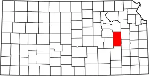 Map of Kansas highlighting Lyon County | |
| Unincorporated communities | ||
| Townships | ||
| ||
| Authority control |
|---|
