Olpe, Kansas
Olpe is a city in Lyon County, Kansas, United States. As of the 2010 census, the city population was 546.[7]
Olpe, Kansas | |
|---|---|
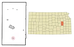 Location within Lyon County and Kansas | |
 KDOT map of Lyon County (legend) | |
| Coordinates: 38°15′43″N 96°10′10″W | |
| Country | United States |
| State | Kansas |
| County | Lyon |
| Founded | 1879 |
| Incorporated | 1905 [1] |
| Named for | Olpe, Germany |
| Government | |
| • Type | Mayor–Council |
| Area | |
| • Total | 0.83 sq mi (2.14 km2) |
| • Land | 0.70 sq mi (1.82 km2) |
| • Water | 0.13 sq mi (0.33 km2) |
| Elevation | 1,198 ft (365 m) |
| Population | |
| • Total | 546 |
| • Estimate (2019)[4] | 535 |
| • Density | 762.11/sq mi (294.33/km2) |
| Time zone | UTC-6 (CST) |
| • Summer (DST) | UTC-5 (CDT) |
| ZIP code | 66865 |
| Area code | 620 |
| FIPS code | 20-52800 [5] |
| GNIS ID | 0477418 [6] |
| Website | cityofolpe.com |
History
Olpe had its start in the year 1879 by the building of the railroad through that territory.[8] It had formerly been known as Eagle Creek Station before the name had been changed to Bitlertown for the owner of the townsite, Gilbert Bitler. A large share of the early settlers being natives of Olpe, Germany, caused the name to be selected.[9][10][11]
Olpe was incorporated as a city in 1905.[12]
Geography
Olpe is located at 38°15′43″N 96°10′10″W (38.262070, -96.169322).[13] According to the United States Census Bureau, the city has a total area of 0.80 square miles (2.07 km2), of which 0.67 square miles (1.74 km2) is land and 0.13 square miles (0.34 km2) is water.[14]
Climate
The climate in this area is characterized by hot, humid summers and generally mild to cool winters. According to the Köppen Climate Classification system, Olpe has a humid subtropical climate, abbreviated "Cfa" on climate maps.[15]
Demographics
| Historical population | |||
|---|---|---|---|
| Census | Pop. | %± | |
| 1910 | 215 | — | |
| 1920 | 235 | 9.3% | |
| 1930 | 317 | 34.9% | |
| 1940 | 331 | 4.4% | |
| 1950 | 293 | −11.5% | |
| 1960 | 722 | 146.4% | |
| 1970 | 453 | −37.3% | |
| 1980 | 477 | 5.3% | |
| 1990 | 431 | −9.6% | |
| 2000 | 504 | 16.9% | |
| 2010 | 546 | 8.3% | |
| 2019 (est.) | 535 | [4] | −2.0% |
| U.S. Decennial Census | |||
Olpe is part of the Emporia Micropolitan Statistical Area.
2010 census
As of the census[3] of 2010, there were 546 people, 220 households, and 151 families residing in the city. The population density was 814.9 inhabitants per square mile (314.6/km2). There were 239 housing units at an average density of 356.7 per square mile (137.7/km2). The racial makeup of the city was 98.7% White, 0.2% African American, 0.2% from other races, and 0.9% from two or more races. Hispanic or Latino of any race were 0.5% of the population.
There were 220 households, of which 34.5% had children under the age of 18 living with them, 58.6% were married couples living together, 5.0% had a female householder with no husband present, 5.0% had a male householder with no wife present, and 31.4% were non-families. 25.9% of all households were made up of individuals, and 13.6% had someone living alone who was 65 years of age or older. The average household size was 2.48 and the average family size was 3.00.
The median age in the city was 39 years. 27.3% of residents were under the age of 18; 4.8% were between the ages of 18 and 24; 26.2% were from 25 to 44; 24% were from 45 to 64; and 17.8% were 65 years of age or older. The gender makeup of the city was 49.8% male and 50.2% female.
2000 census
As of the census[5] of 2000, there were 504 people, 196 households, and 137 families residing in the city. The population density was 1,604.1 people per square mile (627.7/km2). There were 215 housing units at an average density of 684.3 per square mile (267.8/km2). The racial makeup of the city was 98.81% White, 0.40% African American, 0.60% Native American, and 0.20% from two or more races. Hispanic or Latino of any race were 2.58% of the population.
There were 196 households, out of which 39.3% had children under the age of 18 living with them, 56.1% were married couples living together, 10.7% had a female householder with no husband present, and 30.1% were non-families. 28.6% of all households were made up of individuals, and 16.3% had someone living alone who was 65 years of age or older. The average household size was 2.57 and the average family size was 3.20.
In the city, the population was spread out, with 31.7% under the age of 18, 7.9% from 18 to 24, 28.6% from 25 to 44, 17.7% from 45 to 64, and 14.1% who were 65 years of age or older. The median age was 33 years. For every 100 females, there were 96.9 males. For every 100 females age 18 and over, there were 90.1 males.
The median income for a household in the city was $34,643, and the median income for a family was $37,813. Males had a median income of $30,625 versus $18,542 for females. The per capita income for the city was $13,623. About 5.8% of families and 7.3% of the population were below the poverty line, including 10.8% of those under age 18 and 8.3% of those age 65 or over.
Attractions

The Chicken House is a restaurant that has been in operation since 1958 with roots to 1934.[16] The restaurant has acted as a town hall, playing host to governors and state representatives[17] and was named by USA Today as one of 50 Great Plates From 50 Great States in 2000.[18] The restaurant has raised notice as far away as New Jersey.[19]
Education
The community is served by Southern Lyon County USD 252 public school district.
Olpe High School
Olpe Elementary School
Before Olpe Elementary was a school, the school was called Harmony Hill, that started as a one-room school house and had later additions. It was located in the country about 3 miles north of Olpe. In December 1991, Olpe Elementary School was completed. The elementary wing of the building adjoins the cafeteria to the west of the high school. In 1997, two additional classrooms and a library were added to the elementary school.[20]
St. Joseph's Catholic School
Prior to the 1950s there was no public high school in Olpe. Area students attended St. Joseph's Catholic School. Olpe High School was built in the early 1950s. The first class graduated from Olpe Rural High School in 1952; however, the new building was then incomplete. That first year, the old St. Joseph's High School building was rented and classes were held there. Students began attending the newly constructed building the next year. Since then, it has housed kindergarten through sixth grade classes. After the 2012–2013 school year, Saint Joseph's Catholic School closed, due to the economy.[20]
References
- "City of Olpe". The League of Kansas Municipalities. May 24, 2019.
- "2019 U.S. Gazetteer Files". United States Census Bureau. Retrieved July 24, 2020.
- "U.S. Census website". United States Census Bureau. Retrieved 2012-07-06.
- "Population and Housing Unit Estimates". United States Census Bureau. May 24, 2020. Retrieved May 27, 2020.
- "U.S. Census website". United States Census Bureau. Retrieved 2008-01-31.
- "US Board on Geographic Names". United States Geological Survey. 2007-10-25. Retrieved 2008-01-31.
- "2010 City Population and Housing Occupancy Status". U.S. Census Bureau. Retrieved November 27, 2011.
- French, Laura M. (1929). History of Emporia and Lyon County, Kansas. Heritage Books. p. 137.
- Rydjord, John (1972). Kansas Place-Names. University of Oklahoma Press, Norman, Oklahoma. p. 178. ISBN 0-8061-0994-7.
- Heim, Michael (2007). Exploring Kansas Highways. p. 11.
- Capace, Nancy (1 June 2000). Encyclopedia of Kansas. North American Book Dist LLC. p. 246. ISBN 978-0-403-09312-0.
- Blackmar, Frank Wilson (1912). Kansas: A Cyclopedia of State History, Volume 2. Standard Publishing Company. p. 389.
- "US Gazetteer files: 2010, 2000, and 1990". United States Census Bureau. 2011-02-12. Retrieved 2011-04-23.
- "US Gazetteer files 2010". United States Census Bureau. Archived from the original on 2012-07-02. Retrieved 2012-07-06.
- Climate Summary for Olpe, Kansas
- "Olpe Chicken House". Kansas Travel. Retrieved February 20, 2016.
- Murphy, Jesse (July 31, 2014). "Brownback, Mast make Olpe visit". Emporia Gazette. Retrieved February 20, 2016.
- "USA Today Names 50 Great Plates From 50 Great States". PR Newswire. May 26, 2000. Retrieved February 20, 2016.
- "Editorial column: On fall weekends I went to Olpe, Kansas but my son celebrates Octoberfest in Munich". Hunterdon County Democrat. October 13, 2011. Retrieved February 20, 2016.
- Olpe High School history Archived 2014-08-12 at the Wayback Machine
- Corn, Mike "Prairie Dog Barrier Could Mend Fences", Hayes Daily News, 9/18/2009, accessed April 7, 2011.
- Corn, Mike "Good Fences Make Good Neighbors", Emporia Gazette, 9/18/2009, accessed April 7, 2011.
Further reading
External links
- City
- Maps
- Olpe City Map, KDOT
Municipalities and communities of Lyon County, Kansas, United States | ||
|---|---|---|
| Cities | 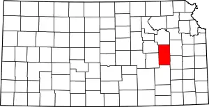 Map of Kansas highlighting Lyon County | |
| Unincorporated communities | ||
| Townships | ||
| ||