Hartford, South Dakota
Hartford is a city in Minnehaha County, South Dakota, United States. A suburb of Sioux Falls, Hartford lies a few miles northwest of the city. The population was estimated to be 3,364 in July 2018, up from 2,534 at the 2010 census.
Hartford, South Dakota | |
|---|---|
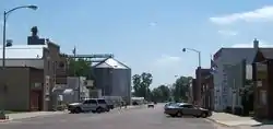 Main Street in Hatford, August 2010 | |
| Motto(s): "On The Edge Of Everything" | |
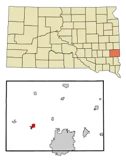 Location in Minnehaha County and the state of South Dakota | |
| Coordinates: 43°37′29″N 96°56′42″W | |
| Country | United States |
| State | South Dakota |
| County | Minnehaha |
| Settled | 1878[1] |
| Area | |
| • Total | 2.66 sq mi (6.88 km2) |
| • Land | 2.66 sq mi (6.88 km2) |
| • Water | 0.00 sq mi (0.00 km2) |
| Elevation | 1,572 ft (479 m) |
| Population | |
| • Total | 2,534 |
| • Estimate (2019)[4] | 3,354 |
| • Density | 1,262.80/sq mi (487.48/km2) |
| Time zone | UTC−6 (Central (CST)) |
| • Summer (DST) | UTC−5 (CDT) |
| ZIP code | 57033 |
| Area code(s) | 605 |
| FIPS code | 46-27540 |
| GNIS feature ID | 1265651[5] |
| Website | City of Hartford |
History
Hartford was named in 1880 after Hartford, Connecticut.[6] An early variant name was Oaksville.[7] A post office has been in operation in Hartford since 1880.[8] Hartford was incorporated in 1896.[9]
Geography
Hartford is located at 43°37′29″N 96°56′42″W.[10]
According to the United States Census Bureau, the city has a total area of 2.27 square miles (5.88 km2), all land.[11]
Hartford has been assigned the ZIP code 57033.
Demographics
| Historical population | |||
|---|---|---|---|
| Census | Pop. | %± | |
| 1900 | 423 | — | |
| 1910 | 648 | 53.2% | |
| 1920 | 677 | 4.5% | |
| 1930 | 628 | −7.2% | |
| 1940 | 647 | 3.0% | |
| 1950 | 592 | −8.5% | |
| 1960 | 688 | 16.2% | |
| 1970 | 800 | 16.3% | |
| 1980 | 1,207 | 50.9% | |
| 1990 | 1,262 | 4.6% | |
| 2000 | 1,844 | 46.1% | |
| 2010 | 2,534 | 37.4% | |
| 2019 (est.) | 3,354 | [4] | 32.4% |
| U.S. Decennial Census[12] | |||
2010 census
At the 2010 census there were 2,534 people, 913 households, and 684 families living in the city. The population density was 1,116.3 inhabitants per square mile (431.0/km2). There were 939 housing units at an average density of 413.7 per square mile (159.7/km2). The racial makeup of the city was 96.5% White, 0.6% African American, 1.2% Native American, 0.2% Asian, 0.1% from other races, and 1.4% from two or more races. Hispanic or Latino of any race were 0.6%.[3]
Of the 913 households 45.3% had children under the age of 18 living with them, 62.2% were married couples living together, 9.4% had a female householder with no husband present, 3.3% had a male householder with no wife present, and 25.1% were non-families. 20.0% of households were one person and 7.8% were one person aged 65 or older. The average household size was 2.78 and the average family size was 3.23.
The median age was 31.9 years. 32.7% of residents were under the age of 18; 6.2% were between the ages of 18 and 24; 30.3% were from 25 to 44; 22.7% were from 45 to 64; and 8.3% were 65 or older. The gender makeup of the city was 48.2% male and 51.8% female.
2000 census
At the 2000 census, there were 1,844 people, 661 households, and 534 families living in the city. The population density was 1,236.6 people per square mile (477.8/km2). There were 675 housing units at an average density of 452.7 per square mile (174.9/km2). The racial makeup of the city was 97.56% White, 0.11% African American, 1.14% Native American, 0.05% Asian, 0.22% from other races, and 0.92% from two or more races. Hispanic or Latino of any race were 0.33% of the population.
Of the 661 households 48.6% had children under the age of 18 living with them, 66.0% were married couples living together, 12.4% had a female householder with no husband present, and 19.1% were non-families. 15.9% of households were one person and 6.1% were one person aged 65 or older. The average household size was 2.77 and the average family size was 3.09.
The age distribution was 32.0% under the age of 18, 6.5% from 18 to 24, 34.7% from 25 to 44, 18.4% from 45 to 64, and 8.5% 65 or older. The median age was 32 years. For every 100 females, there were 95.3 males. For every 100 females age 18 and over, there were 92.3 males.
The median household income was $48,333, and the median family income was $53,942. Males had a median income of $34,792 versus $25,032 for females. The per capita income for the city was $20,726. About 2.8% of families and 3.8% of the population were below the poverty line, including 5.6% of those under age 18 and 7.5% of those age 65 or over.
Notable people
- Ruth Brinker, activist and founder of the nonprofit, Project Open Hand.
- Michael John Fitzmaurice, former United States Army soldier and recipient of the Medal of Honor for his actions in the Vietnam War
- Rhonda Milstead, member of the South Dakota House of Representatives
See also
References
- "SD Towns" (PDF). South Dakota State Historical Society. Retrieved 2010-02-13.
- "2019 U.S. Gazetteer Files". United States Census Bureau. Retrieved July 30, 2020.
- "U.S. Census website". United States Census Bureau. Retrieved 2012-06-21.
- "Population and Housing Unit Estimates". United States Census Bureau. May 24, 2020. Retrieved May 27, 2020.
- "US Board on Geographic Names". United States Geological Survey. 2007-10-25. Retrieved 2008-01-31.
- Chicago and North Western Railway Company (1908). A History of the Origin of the Place Names Connected with the Chicago & North Western and Chicago, St. Paul, Minneapolis & Omaha Railways. p. 177.
- Federal Writers' Project (1940). South Dakota place-names, v.1-3. University of South Dakota. p. 40.
- "Minnehaha County". Jim Forte Postal History. Retrieved 4 April 2015.
- "The beginning history". The Hartford Area News. Jun 1, 2006. p. 22. Retrieved 15 October 2015.
- "US Gazetteer files: 2010, 2000, and 1990". United States Census Bureau. 2011-02-12. Retrieved 2011-04-23.
- "US Gazetteer files 2010". United States Census Bureau. Retrieved 2012-06-21.
- United States Census Bureau. "Census of Population and Housing". Retrieved September 23, 2013.
External links
![]() Media related to Hartford, South Dakota at Wikimedia Commons
Media related to Hartford, South Dakota at Wikimedia Commons
Municipalities and communities of Minnehaha County, South Dakota, United States | ||
|---|---|---|
| Cities |  | |
| Towns | ||
| CDPs | ||
| Other unincorporated communities | ||
| Townships | ||
| Footnotes | ‡This populated place also has portions in an adjacent county or counties | |
| ||