Haspin
Haspin (Hebrew: חַסְפִּין), widely known as Hispin, is a religious Israeli settlement and a moshav located in the southern Golan Heights.
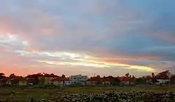
Haspin
חַסְפִּין | |
|---|---|
 | |
 Haspin | |
| Coordinates: 32°50′41.64″N 35°47′33.36″E | |
| District | Northern |
| Council | Golan |
| Founded | 1978 |
| Population (2019)[1] | 2,055 |
The international community considers Israeli settlements in the Golan Heights illegal under international law, but the Israeli government disputes this.[2]
History
The modern Haspin was established in 1978 at the site of the abandoned village Khisfin (Arabic: خسفين). During G. Schumacher's visit to the village in 1883, it was inhabited by about 270 souls, living in some 60 huts.[3] Three-fourths of the village already lay waste or deserted.[3]
Haspin now falls under the municipal jurisdiction of the Golan Regional Council. In 2019 the village had a population of 2,055.[1]
Haspin (Khisfin) is first mentioned in sources describing the military exploits of Judas Maccabeus (I Maccabbees 5:26), under the name Chaspho.[4] The town features prominently in the early rabbinic writings of the 3rd century CE (corresponding with the late Roman-early Byzantine period), under the name Hisfiyya.[5] It is also mentioned in the 3rd century-4th century Mosaic of Rehob.[5]
Geographical description
Haspin lies on the northern border of the most-productive agricultural region of the southern Golan Heights, which, in ages past, was part of the main road leading up from Hamat Gader and from the Yarmuk valley to the northern regions of the Golan (Jaulan) as far as Hauran.[4] An ancient Roman road criss-crossed the region.[4] The area is rich in natural springs.[4]
Archaeology
Many ancient artefacts from the Roman and Byzantine periods have been unearthed in Haspin.[4]
Sir Laurence Oliphant, who visited here on 15 March 1885, described the remains of a large fort, measuring 68 yards (62 m) x 54 yards (49 m) (the outer wall) and the thickness of the wall that surrounded it measuring 9 feet (2.7 m) in diameter, nestled between Haspin and Nâb.[6] This is probably the fortified caravanserai (khan) described by Gottlieb Schumacher in his book The Jaulân, situated west of the town of Haspin.[6][3] According to Oliphant, the fortress dates from the Early Arab period, and was used by the Crusaders in a later period.[6] Its location is currently unknown.
See also
References
- "Population in the Localities 2019" (XLS). Israel Central Bureau of Statistics. Retrieved 16 August 2020.
- "The Geneva Convention". BBC. 2009-12-10.
- Schumacher, G. (1888). The Jaulân: surveyed for the German Society for the Exploration of the Holy Land. London: R. Bentley. pp. 184–186. The actual figures of this structure posted in G. Schumacher's work, The Jaulân, are 160 feet (49 m) x 133 feet (41 m)
- Gal, Yitzhaki; Bar Lev, Shmuel, eds. (1978). "Khasfin (Hispiyeh)". Israel Guide - Hermon and Golan (A useful encyclopedia for the knowledge of the country) (in Hebrew). 1. Jerusalem: Keter Publishing House, in affiliation with the Israel Ministry of Defence. pp. 193–195. OCLC 745203905.
- The Holy Land - from the Persian to the Arab Conquests (536 B.C. to A.D. 640) A Historical Geography , Michael Avi-Yonah, Grand Rapids, 1979, p. 170; ISBN 0-8010-0010-6
- Gal, Yitzhaki; Bar Lev, Shmuel, eds. (1978). "Khasfin (Hispiyeh)". Israel Guide - Hermon and Golan (A useful encyclopedia for the knowledge of the country) (in Hebrew). 1. Jerusalem: Keter Publishing House, in affiliation with the Israel Ministry of Defence. p. 194. OCLC 745203905.
