Hato Rey Central
Hato Rey Central is one of the 18 barrios of the municipality of San Juan, Puerto Rico. With a population density of 16,155.3 per square mile. It has a land area of 1.03 sq mi and a 2010 Census population of 16,640.[3]
Hato Rey Central | |
|---|---|
Barrio | |
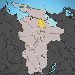 Location of Hato Rey Central shown in yellow. | |
| Coordinates: 18°25′19″N 66°03′02″W[1] | |
| Commonwealth | |
| Municipality | |
| Area | |
| • Total | 1.04 sq mi (2.7 km2) |
| • Land | 1.03 sq mi (2.7 km2) |
| • Water | 0.01 sq mi (0.03 km2) |
| Elevation | 23 ft (7 m) |
| Population (2010) | |
| • Total | 16,640 |
| • Density | 16,155.3/sq mi (6,237.6/km2) |
| 2010 census | |
Hato Rey Central was a barrio of the former municipality of Rio Piedras, before it was merged with San Juan in 1951.
It is bounded by Hato Rey Norte to the west, by barrio Universidad to the south, by Oriente to the east, and by Santurce to the north. The Caño Martín Peña separates Hato Rey Central from Santurce.
The Polytechnic University of Puerto Rico is located in Hato Rey Central.
Demographics
| Historical population | |||
|---|---|---|---|
| Census | Pop. | %± | |
| 1980 | 23,246 | — | |
| 1990 | 22,504 | −3.2% | |
| 2000 | 20,867 | −7.3% | |
| 2010 | 16,640 | −20.3% | |
| U.S. Decennial Census[4] 1899 (shown as 1900)[5] 1910-1930[6] 1930-1950[7] 1980-2000[8] 2010[9] | |||
Districts
The barrio of Hato Rey Central is further divided into 4 subbarrios,[10] from North to South:[11]
.png.webp) Las Monjas
Las Monjas.png.webp) Ciudad Nueva
Ciudad Nueva.png.webp)
 Quintana
Quintana
References
- "US Gazetteer 2019". US Census. US Government.
- U.S. Geological Survey Geographic Names Information System: Hato Rey Central barrio
- Puerto Rico: 2010:population and housing unit counts (PDF). U.S. Dept. of Commerce, Economics and Statistics Administration, U.S. Census Bureau. 2010.
- "U.S. Decennial Census". United States Census Bureau. Archived from the original on February 13, 2020. Retrieved September 21, 2017.
- "Report of the Census of Porto Rico 1899". War Department Office Director Census of Porto Rico. Archived from the original on July 16, 2017. Retrieved September 21, 2017.
- "Table 3-Population of Municipalities: 1930 1920 and 1910" (PDF). United States Census Bureau. Archived (PDF) from the original on August 17, 2017. Retrieved September 21, 2017.
- "Table 4-Area and Population of Municipalities Urban and Rural: 1930 to 1950" (PDF). United States Census Bureau. Archived (PDF) from the original on August 30, 2015. Retrieved September 21, 2014.
- "Table 2 Population and Housing Units: 1960 to 2000" (PDF). United States Census Bureau. Archived (PDF) from the original on July 24, 2017. Retrieved September 21, 2017.
- Puerto Rico:2010:population and housing unit counts.pdf (PDF). U.S. Dept. of Commerce Economics and Statistics Administration U.S. Census Bureau. 2010. Archived (PDF) from the original on 2017-02-20. Retrieved 2019-08-02.
- "US Census definition of "subbarrio"". factfinder.com. US Census. Archived from the original on 12 February 2019. Retrieved 5 January 2019.
- https://www.census.gov/prod/cen2000/phc-3-53-eng.pdf
| ||
| Barrios | ||
This article is issued from Wikipedia. The text is licensed under Creative Commons - Attribution - Sharealike. Additional terms may apply for the media files.