Haumoana
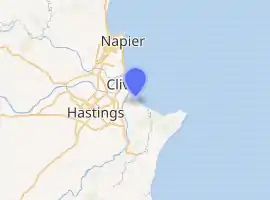
Haumoana is a coastal town just south of the Tukituki River outlet in Hawke Bay on the east coast of New Zealand's North Island. It is located 12 km south of Napier and ten kilometres east of Hastings. The village incorporates a school, a Presbyterian Church, a general store, a takeaway shop, a hall and a fire station. The village was developed as a holiday settlement with beaches, and the surrounding area has historically been used for sheep and cattle grazing and horticulture. However, lifestyle blocks and grape growing have become more prominent in recent times. Many inhabitants commute to the nearby cities to work. There are approximately 430 houses in Haumoana. The population at the 2013 census was 2256, an increase of 54 people since 2006.[2]
Haumoana | |
|---|---|
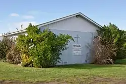 St Francis Church in Haumoana | |
| |
| Coordinates: 39°37′S 176°57′E | |
| Country | New Zealand |
| Region | Hawke's Bay |
| Territorial authority | Hastings District |
| Ward | Heretaunga |
| Population (2018)[1] | |
| • Total | 1,158 |
The New Zealand Ministry for Culture and Heritage gives a translation of "sea breeze" for Haumoana.[3]
The area is flat and low lying, with hills to the southwest. The underlying soil material has been laid down by rivers and the sea margin. Particle size ranges from gravel to clay. Nearer the beach the area is underlain by free draining sandy-gravels but further inland the gravels are overlain by poor draining silt and clay rich soils. Parts of the beach are experiencing coastal erosion of 0.7 metres per year, which resulted in the removal of several houses along the gravel beach crest, and other beach front properties being inundated during heavy swells and high tides.
Due to its location near the beach in an area prone to coastal erosion, parts of the beach at Haumoana is being eroded. The long term shoreline retreat at Haumoana is on average between 0.30 m and 0.70 m per year. This rate of erosion is the same as it is at Te Awanga further down the Bay coastline. The coastal erosion rate at Clifton south of Te Awanga is slightly higher.[4][5]
Haumoana has a reticulated water supply managed by the Hastings District Council. An estimated 3% gain their water independently through rain water collection or from individual water bores. Wastewater is disposed using individual septic tanks.
Demographics
The population of Haumoana was 1,158 in the 2018 census, a decrease of 36 from 2013. There were 579 males and 579 females. 86.0% of people identified as European/Pākehā, 20.5% as Māori, 1.8% as Pacific peoples and 2.9% as Asian. 19.4% were under 15 years old, 16.6% were 15–29, 50.8% were 30–64, and 13.0% were 65 or older.[1]
| Year | Pop. | ±% p.a. |
|---|---|---|
| 2006 | 1,926 | — |
| 2013 | 1,923 | −0.02% |
| 2018 | 1,926 | +0.03% |
| Source: [6] | ||
The statistical area of Haumoana-Te Awanga, which also includes Te Awanga, had a population of 1,926 at the 2018 New Zealand census, an increase of 3 people (0.2%) since the 2013 census, and unchanged since the 2006 census. There were 747 households. There were 966 males and 960 females, giving a sex ratio of 1.01 males per female. The median age was 44.5 years (compared with 37.4 years nationally), with 351 people (18.2%) aged under 15 years, 291 (15.1%) aged 15 to 29, 981 (50.9%) aged 30 to 64, and 300 (15.6%) aged 65 or older.
Ethnicities were 88.0% European/Pākehā, 18.8% Māori, 2.0% Pacific peoples, 2.3% Asian, and 2.2% other ethnicities (totals add to more than 100% since people could identify with multiple ethnicities).
The proportion of people born overseas was 16.4%, compared with 27.1% nationally.
Although some people objected to giving their religion, 59.5% had no religion, 27.1% were Christian, 0.2% were Hindu, 0.5% were Muslim, 0.9% were Buddhist and 4.7% had other religions.
Of those at least 15 years old, 369 (23.4%) people had a bachelor or higher degree, and 240 (15.2%) people had no formal qualifications. The median income was $34,900, compared with $31,800 nationally. The employment status of those at least 15 was that 846 (53.7%) people were employed full-time, 291 (18.5%) were part-time, and 45 (2.9%) were unemployed.[6]
Education
Haumoana School is a co-educational Year 1-6 state primary school,[7] with a roll of 171 as of March 2020.[8][9]
Notable people
- John Scott, architect
- Paul Holmes, media personality
References
- "Age and sex by ethnic group (grouped total response), for census usually resident population counts, 2006, 2013, and 2018 Censuses (urban rural areas)". Statistics New Zealand. Retrieved 22 January 2021.
- 2013 Census QuickStats about a place : Haumoana
- "1000 Māori place names". New Zealand Ministry for Culture and Heritage. 6 August 2019.
- Coastal Erosion and Inundation Archived 4 April 2012 at the Wayback Machine. www.hbemergency.govt.nz (3 April 2002). Retrieved on 8 August 2012.
- Coastal Erosion – Haumoana, Hawke's Bay, New Zealand. Haumoana.com. Retrieved on 8 August 2012.
- "Statistical area 1 dataset for 2018 Census". Statistics New Zealand. March 2020. Haumoana-Te Awanga (211300). 2018 Census place summary: Haumoana-Te Awanga
- "Haumoana School Ministry of Education School Profile". educationcounts.govt.nz. Ministry of Education.
- "New Zealand Schools Directory". New Zealand Ministry of Education. Retrieved 26 April 2020.
- "Haumoana School Education Review Office Report". ero.govt.nz. Education Review Office.
